Peanuts Walls
55 routes · sandstone (Fountain Formation) · 6,342 ft
What's here
5.5 to 5.13, mostly around 5.11.
Counted from the 55 climbs here that carry a grade. Shown only where there are at least 5 of them — below that the shape is noise.
How well located
Position on wall known 55
No route here has its own point yet. The map pin is the crag. At the wall? Survey it: 30 seconds per route.
The order of the climbs along this wall is known from the open catalogue, so a few surveys go a long way: standing at Easy Off, Blows Against the Empire, Faith, Hope, and Charity, Nova (aka Jawa?), Strolling (5 climbs, about 150 seconds on Lower Peanuts) would place up to 37 more climbs between them. Survey the wall →
“Up to” because the estimate between two surveyed routes is only used when they turn out to be close enough together on the ground.
The guidebook for this area
Eldorado Canyon: A Climbing Guide - Steve Levin - 4th ed. - 2024 every crag it covers
From the publisherBookshop.org
Bookshop.org links are affiliate links: if you buy through one we earn a commission, at no extra cost to you. Bookshop.org gives its profits to independent bookshops.
The book has the topos, the descriptions and the local knowledge this page can't. Buying it helps support the people who know the crag best.
Rock, from the geologic map
Colluvium. Holocene, younger than 12,000 years.
Generally unconsolidated material deposited on slopes by gravity and sheetwash. Thickness generally more than 1.5 m. Includes talus.
This is the map unit under this crag's map point, read from the 1:100,000 sheet (Trimble and others, 2003, U.S. Geological Survey Geologic Investigations Series I-856-H). The point can be a few hundred metres from the rock, a cliff often stands on the line between two units, and at that scale a line on the map is about 100 m wide on the ground, so the wall itself may be the neighbouring unit. The rock named at the top of this page comes from the public geology of this area; this card is the map's answer. Every crag on this unit: Colluvium. Geology data: Macrostrat (CC BY 4.0), serving USGS and Colorado Geological Survey maps.
On the map since 1899
The USGS has mapped this ground since 1899. 31 historical sheets cover this crag's map point; the oldest is below.
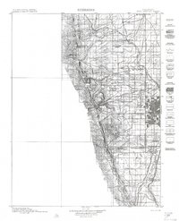
USGS Historical Topographic Map Collection · Public domain · the record · placed by its coordinates
Report this item
Hidden as soon as you tell us, everywhere it appears, before anyone reviews it.
Public domain, U.S. Geological Survey. The sheet shows the ground as the survey found it then, which is why a trail or road you know may be missing. Every sheet over this point, 1899 to 1983: USGS topoView.
In print since 1877
1877 Geologic Map of Colorado (Hayden), high-resolution scan · F. V. Hayden; scan by the Colorado Geological Survey · 1877
Geological and geographical atlas of Colorado and portions of adjacent territory · F. V. Hayden, U.S. Geological and Geographical Survey of the Territories · 1877
Trail and Timberline, volume 2 (1918) · Colorado Mountain Club · 1918
Free to read: public domain or government work. About Boulder as a whole, not this wall. More in the reading room.
From the archives
Photographs of this area held by the Library of Congress, oldest first. Every one carries the Library's own "no known restrictions on publication"; anything else is left out.


Library of Congress, Prints & Photographs Division · Public domain · the record · indexed to this place by the archive
Report this item
Hidden as soon as you tell us, everywhere it appears, before anyone reviews it.
Library of Congress, Prints & Photographs Division · Public domain · the record · indexed to this place by the archive
Report this item
Hidden as soon as you tell us, everywhere it appears, before anyone reviews it.
Library of Congress, Prints & Photographs Division · Public domain · the record · indexed to this place by the archive
Report this item
Hidden as soon as you tell us, everywhere it appears, before anyone reviews it.
Library of Congress, Prints & Photographs Division · Public domain · the record · indexed to this place by the archive
Report this item
Hidden as soon as you tell us, everywhere it appears, before anyone reviews it.
Library of Congress, Prints & Photographs Division · Public domain · the record · indexed to this place by the archive
Report this item
Hidden as soon as you tell us, everywhere it appears, before anyone reviews it.
Library of Congress, Prints & Photographs Division · Public domain · the record · indexed to this place by the archive
Report this item
Hidden as soon as you tell us, everywhere it appears, before anyone reviews it.
Library of Congress, Prints & Photographs Division · Public domain · the record · indexed to this place by the archive
Report this item
Hidden as soon as you tell us, everywhere it appears, before anyone reviews it.
Library of Congress, Prints & Photographs Division · Public domain · the record · found by place name, not yet checked
Report this item
Hidden as soon as you tell us, everywhere it appears, before anyone reviews it.
Library of Congress, Prints & Photographs Division · Public domain · the record · indexed to this place by the archive
Report this item
Hidden as soon as you tell us, everywhere it appears, before anyone reviews it.
Library of Congress, Prints & Photographs Division · Public domain · the record · indexed to this place by the archive
Report this item
Hidden as soon as you tell us, everywhere it appears, before anyone reviews it.
2 more at the Library of Congress.
Photographs near this crag
Taken within 1.5 km of this crag's map point and published under a licence that lets us show them, from Wikimedia Commons. The coordinates say where the camera was, not what it was pointed at, so some of these will be the creek or the trail rather than the rock.


Wikimedia Commons · CC BY · the record · placed by its coordinates
Report this item
Hidden as soon as you tell us, everywhere it appears, before anyone reviews it.
Wikimedia Commons · CC BY-SA · the record · placed by its coordinates
Report this item
Hidden as soon as you tell us, everywhere it appears, before anyone reviews it.
Wikimedia Commons · CC BY-SA · the record · placed by its coordinates
Report this item
Hidden as soon as you tell us, everywhere it appears, before anyone reviews it.
Wikimedia Commons · CC BY-SA · the record · placed by its coordinates
Report this item
Hidden as soon as you tell us, everywhere it appears, before anyone reviews it.
Wikimedia Commons · CC BY-SA · the record · placed by its coordinates
Report this item
Hidden as soon as you tell us, everywhere it appears, before anyone reviews it.
Wikimedia Commons · CC BY-SA · the record · placed by its coordinates
Report this item
Hidden as soon as you tell us, everywhere it appears, before anyone reviews it.
Wikimedia Commons · CC BY-SA · the record · placed by its coordinates
Report this item
Hidden as soon as you tell us, everywhere it appears, before anyone reviews it.
Wikimedia Commons · CC BY-SA · the record · placed by its coordinates
Report this item
Hidden as soon as you tell us, everywhere it appears, before anyone reviews it.
Wikimedia Commons · CC BY · the record · placed by its coordinates
Report this item
Hidden as soon as you tell us, everywhere it appears, before anyone reviews it.
Wikimedia Commons · CC BY · the record · placed by its coordinates
Report this item
Hidden as soon as you tell us, everywhere it appears, before anyone reviews it.
Wikimedia Commons · CC BY-SA · the record · placed by its coordinates
Report this item
Hidden as soon as you tell us, everywhere it appears, before anyone reviews it.
Wikimedia Commons · CC BY-SA · the record · placed by its coordinates
Report this item
Hidden as soon as you tell us, everywhere it appears, before anyone reviews it.
1 more on Commons.
Routes
Lower Peanuts
- 1 Easy Off 5.10
- 2 Let's Jet 5.10d
- 3 Jackson Browne (aka Fluid Power) 5.11c
- 4 The Pretender 5.11
- 5 No Visible Means of Support 5.10b
- 6 Criller 5.11d
- 7 Young, Blonde, and Easy 5.11b
- 8 The Shield 5.11
- 9 The Narrow Gate 5.10b
- 10 Evangelium Vitae (The Gospel of Life) 5.12b
- 11 Right Escape 5.10-
- 12 B.A.T.E. Direct 5.10d
- 13 Blows Against the Empire 5.11a
- 14 Peanuts 5.9+
- 15 Scorpions 5.11b
- 16 Air Guitar 5.11c
- 17 Black Pearl 5.13
- 18 The Sacred and the Profane 5.13-
- 19 Aspenleaf Dihedral 5.10c
- 20 Just Another Girl's Climb 5.12a
- 21 Wired 5.9+
- 22 Dihedral 5.8-
- 23 Cornered, straight up variation 5.9
- 24 Forbidden Planet 5.11b
- 25 Faith, Hope, and Charity 5.12b
- 26 Chaucer 5.7
- 27 Direct Start to Your Basic Layback 5.6
- 28 Your Basic Lieback 5.6
- 29 Trouble And Strife 5.10b/c
- 30 Tracer 5.8
- 31 Star Track 5.8+
- 32 Do or Do Not 5.11-
- 33 West Crack (aka Star Wars) 5.8
- 34 Double Cracks 5.5
- 35 Whiskey Gala 5.9
- 36 The Empire Strikes Back 5.11b
- 37 Nova (aka Jawa?) 5.7
- 38 Home Free 5.11b
- 39 Off The Cuff 5.6
- 40 Fickle Finger of Eight 5.7+
- 41 Sickle 5.8
- 42 Strolling 5.7
Upper Peanuts
- 1 Cardinal Richelieu 5.8+
- 2 Through and Through 5.8
- 3 Gravity's Angel 5.11b
- 4 Ace Of Spades 5.10c
- 5 Advanced Rockcraft 5.12b
- 6 Heavy Weather 5.9
- 7 Downstairs 5.6
- 8 Twilight 5.7
- 9 Twilight Variation 5.7
- 10 Martyr's Arena 5.12a
- 11 Sunrider 5.11c
- 12 Upstairs 5.8
- 13 The Cruise 5.9+
Also within 3 km
- Continental Crag105 m · 16 routes · 6,683 ft
- Eldorado Canyon Bouldering169 m · 134 boulder problems · 6,007 ft
- Hawk-Eagle Ridge305 m · 71 routes · 6,281 ft
- Kloof Alcove311 m · 12 routes · 6,344 ft
- Devil's Slide314 m · 2 routes · 5,860 ft · Old Stage Road
- Redgarden Wall346 m · 324 routes · 6,836 ft
Straight line between the two crags' map points, each of which can be some way from its rock. For when this wall is full, or the sun has found it.
Photos from climbers
No photos here yet. If you're at the crag, yours would be the first.
Taken at the crag by climbers and published as they sent them. Each one's own location had to be within 0.5 km of this crag before we accepted it. See something that shouldn't be here? Use Report this photo under it and it's hidden at once. Anything else, write to us.
Conditions reported
Nothing reported recently.
Report what you see
Reports are dated and fade on their own: wet rock after 3 days, a bad bolt after a year. No names, no text.
Access & safety
The map point for this crag is on land managed by Colorado Parks & Wildlife (state), in Eldorado Canyon State Park. It lies inside state park.
The boundary is close. Land managed by City of Boulder Open Space and Mountain Parks comes within 250 m of this point, and the point is not the rock — the wall itself may be on the other side of the line. Check which before you rely on either one's rules.
Land manager from USGS PAD-US (public domain), read 2026-09-29. It is the manager of the crag's map point, which can be a long way from the wall. What you may do on the rock is the manager's to say, not ours.
- Managed by
- Colorado Parks and Wildlife (Eldorado Canyon State Park)
- Fees
- $10-12/vehicle (CO plate), $15-17 (out of state), $4/person on foot or bike. Annual vehicle pass $80, family $120, Aspen Leaf (64+) $70.
- Reservations
- Timed-entry vehicle reservation required Saturdays, Sundays and summer holidays, May 1-Oct 1 (cpwshop.com, 30 days ahead, 2-hour windows). Not needed on foot, by bike or on the free Eldo Shuttle.
- Hours
- Park: sunrise-sunset daily. Visitor center 9am-4pm, closed Thursdays.
- Dogs
- Leashed dogs permitted.
- Parking
- No reliable cell signal at the gate to book on arrival; reserve before you drive.
- County
- Boulder County
Checked 2026-09-29 against source 1, source 2, source 3. Rules change: confirm with the land manager.
Rules for all Colorado Parks & Wildlife land
- Fees
- Every Colorado state park requires an entrance pass for motor vehicles. A daily vehicle pass is $4 to $17 depending on the park; an individual pass covers entry on foot or bike.
- Reservations
- Eldorado Canyon runs timed-entry vehicle reservations on summer weekends and holidays; see the park's own page. Other parks do not require one to enter.
- Permits
- A daily pass is valid until noon on the day after purchase. The annual Keep Colorado Wild pass is $29 and is bought with a vehicle registration.
Read on Colorado Parks & Wildlife's own pages, checked 2026-09-29 by John Crawford. What they require, in full, or their own climbing page. These apply to the manager's whole holding; anything specific to this crag is above.
Nearby, from OpenStreetMap
- Toilets
- 318 m away (map)
- Mapped parking
- 162 m away (map)
Distances are a straight line from this crag's map point, which can itself be hundreds of metres off; a road may be much longer. Mapped by OpenStreetMap contributors (ODbL), so a toilet missing here may simply be unmapped. Parking here is what OSM has drawn nearby, not a guidebook's directions.
Keep Deep Cut Guide free
No ads, no paywall, no account. You can chip in directly to help keep it running.