Eldorado Canyon Bouldering
134 boulder problems · sandstone (Fountain Formation) · 6,007 ft
What's here
VB to V13, mostly around V5.
Counted from the 134 climbs here that carry a grade. Shown only where there are at least 5 of them — below that the shape is noise.
How well located
Base placed (one source) 3 Position on wall known 85 Crag only 46
The order of the climbs along this wall is known from the open catalogue, so a few surveys go a long way: standing at South Face, The Grinch, Gill Face (3 climbs, about 90 seconds on Gill Boulder, The) would place up to 11 more climbs between them. Survey the wall →
“Up to” because the estimate between two surveyed routes is only used when they turn out to be close enough together on the ground.
The guidebook for this area
Eldorado Canyon: A Climbing Guide - Steve Levin - 4th ed. - 2024 every crag it covers
From the publisherBookshop.org
Bookshop.org links are affiliate links: if you buy through one we earn a commission, at no extra cost to you. Bookshop.org gives its profits to independent bookshops.
The book has the topos, the descriptions and the local knowledge this page can't. Buying it helps support the people who know the crag best.
Rock, from the geologic map
Post-Piney Creek and Piney Creek Alluvium. Holocene, younger than 12,000 years.
Gravel, sand, silt, and clay of modern stream flood plains and slightly older low terraces less than 6.1 m above stream level. Deposits of Bear Creek, Clear Creek, and Boulder Creek, and South Platte River are coarse, cobbly gravel near the Mountain front; decrease in grain size downstream. In streams east of the South Platte River, deposits are mainly sand. Sand, silt, and clay compose the deposits in small streams and tributaries. Thickness generally less than 6 m. Minor source of sound aggregate.
This is the map unit under this crag's map point, read from the 1:100,000 sheet (Trimble and others, 2003, U.S. Geological Survey Geologic Investigations Series I-856-H). The point can be a few hundred metres from the rock, a cliff often stands on the line between two units, and at that scale a line on the map is about 100 m wide on the ground, so the wall itself may be the neighbouring unit. The rock named at the top of this page comes from the public geology of this area; this card is the map's answer. Every crag on this unit: Post-Piney Creek and Piney Creek Alluvium. Geology data: Macrostrat (CC BY 4.0), serving USGS and Colorado Geological Survey maps.
On the map since 1899
The USGS has mapped this ground since 1899. 31 historical sheets cover this crag's map point; the oldest is below.
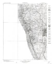
USGS Historical Topographic Map Collection · Public domain · the record · placed by its coordinates
Report this item
Hidden as soon as you tell us, everywhere it appears, before anyone reviews it.
Public domain, U.S. Geological Survey. The sheet shows the ground as the survey found it then, which is why a trail or road you know may be missing. Every sheet over this point, 1899 to 1983: USGS topoView.
In print since 1877
1877 Geologic Map of Colorado (Hayden), high-resolution scan · F. V. Hayden; scan by the Colorado Geological Survey · 1877
Geological and geographical atlas of Colorado and portions of adjacent territory · F. V. Hayden, U.S. Geological and Geographical Survey of the Territories · 1877
Trail and Timberline, volume 2 (1918) · Colorado Mountain Club · 1918
Free to read: public domain or government work. About Boulder as a whole, not this wall. More in the reading room.
From the archives
Photographs of this area held by the Library of Congress, oldest first. Every one carries the Library's own "no known restrictions on publication"; anything else is left out.


Library of Congress, Prints & Photographs Division · Public domain · the record · indexed to this place by the archive
Report this item
Hidden as soon as you tell us, everywhere it appears, before anyone reviews it.
Library of Congress, Prints & Photographs Division · Public domain · the record · indexed to this place by the archive
Report this item
Hidden as soon as you tell us, everywhere it appears, before anyone reviews it.
Library of Congress, Prints & Photographs Division · Public domain · the record · indexed to this place by the archive
Report this item
Hidden as soon as you tell us, everywhere it appears, before anyone reviews it.
Library of Congress, Prints & Photographs Division · Public domain · the record · indexed to this place by the archive
Report this item
Hidden as soon as you tell us, everywhere it appears, before anyone reviews it.
Library of Congress, Prints & Photographs Division · Public domain · the record · indexed to this place by the archive
Report this item
Hidden as soon as you tell us, everywhere it appears, before anyone reviews it.
Library of Congress, Prints & Photographs Division · Public domain · the record · indexed to this place by the archive
Report this item
Hidden as soon as you tell us, everywhere it appears, before anyone reviews it.
Library of Congress, Prints & Photographs Division · Public domain · the record · indexed to this place by the archive
Report this item
Hidden as soon as you tell us, everywhere it appears, before anyone reviews it.
Library of Congress, Prints & Photographs Division · Public domain · the record · found by place name, not yet checked
Report this item
Hidden as soon as you tell us, everywhere it appears, before anyone reviews it.
Library of Congress, Prints & Photographs Division · Public domain · the record · indexed to this place by the archive
Report this item
Hidden as soon as you tell us, everywhere it appears, before anyone reviews it.
Library of Congress, Prints & Photographs Division · Public domain · the record · indexed to this place by the archive
Report this item
Hidden as soon as you tell us, everywhere it appears, before anyone reviews it.
2 more at the Library of Congress.
Photographs near this crag
Taken within 1.5 km of this crag's map point and published under a licence that lets us show them, from Wikimedia Commons. The coordinates say where the camera was, not what it was pointed at, so some of these will be the creek or the trail rather than the rock.


Wikimedia Commons · CC BY · the record · placed by its coordinates
Report this item
Hidden as soon as you tell us, everywhere it appears, before anyone reviews it.
Wikimedia Commons · CC BY-SA · the record · placed by its coordinates
Report this item
Hidden as soon as you tell us, everywhere it appears, before anyone reviews it.
Wikimedia Commons · CC BY-SA · the record · placed by its coordinates
Report this item
Hidden as soon as you tell us, everywhere it appears, before anyone reviews it.
Wikimedia Commons · CC BY-SA · the record · placed by its coordinates
Report this item
Hidden as soon as you tell us, everywhere it appears, before anyone reviews it.
Wikimedia Commons · CC BY-SA · the record · placed by its coordinates
Report this item
Hidden as soon as you tell us, everywhere it appears, before anyone reviews it.
Wikimedia Commons · CC BY-SA · the record · placed by its coordinates
Report this item
Hidden as soon as you tell us, everywhere it appears, before anyone reviews it.
Wikimedia Commons · CC BY-SA · the record · placed by its coordinates
Report this item
Hidden as soon as you tell us, everywhere it appears, before anyone reviews it.
Wikimedia Commons · CC BY-SA · the record · placed by its coordinates
Report this item
Hidden as soon as you tell us, everywhere it appears, before anyone reviews it.
Wikimedia Commons · CC BY · the record · placed by its coordinates
Report this item
Hidden as soon as you tell us, everywhere it appears, before anyone reviews it.
Wikimedia Commons · CC BY · the record · placed by its coordinates
Report this item
Hidden as soon as you tell us, everywhere it appears, before anyone reviews it.
Wikimedia Commons · CC BY-SA · the record · placed by its coordinates
Report this item
Hidden as soon as you tell us, everywhere it appears, before anyone reviews it.
Wikimedia Commons · CC BY-SA · the record · placed by its coordinates
Report this item
Hidden as soon as you tell us, everywhere it appears, before anyone reviews it.
1 more on Commons.
Routes
Accordion Boulder
- 1 Paddle Foot V2
- 2 Pressure Drop V4-5
- 3 Hole In One V5
- 4 Noname V5+
Beach Boulders
- 1 No Name V3
- 2 Sandman V3
Block 1
- 1 SE Arete V2+
- 2 Crimpy Face V4-5
- 3 V2 V2-
Block 2
- 1 Left Side V1+
- 2 Black Dike V1-
- 3 Scoop Face V3
- 4 Right Arete V2
- 5 Overhanging Crack V1
Blocks Rocks
- 1 Spider Bite V5
Center Ring Wall
- 1 Left of Infinite V9
- 2 The Infinite V9
- 3 Pig Dog V6
- 4 Pig Ears V3+
- 5 Pig Nose V3
- 6 Slopers V3
Corridor Boulder
- 1 In Kneed V7
Crank Rock
- 1 Crank It V2-3
- 2 Crankakee V3+
- 3 Rock On V4-5
Creek Slab
- 1 Surge V5-6
- 2 Float V5-6
- 3 Bilge Pump V7-8
Diamond Head Bouldering
- 1 DH Boulder Left Arete V3-4
- 2 DH Center V4
- 3 DH Boulder Right Arete V0-
Edge Blocks
- 1 Sky Fall V7-8
Fringe Boulder
- 1 Lunatic Fringe V4-5
Gill Boulder, The
- 1 South Face V3-4
- 2 Southeast Slab V1-
- 3 East Face V3
- 4 Northeast Corner V0
- 5 North Face Mantel V2
- 6 North Face Dyno V3-4
- 7 North Dihedral V1
- 8 North Reach V1
- 9 SDS to Northeast Reach (submitted as The Blunt Arete) V3+
- 10 Horan Face V6-
- 11 606 V10
- 12 Baldwin Face V5-6
- 13 The Grinch V10-11
- 14 Gill Face V2
Hobo Boulder
- 1 Hobo V2
Horn Boulder
- 1 Slip Slide V4-5
Lost Boulder
- 1 Elegant Universe Stand V9
- 2 Elegant Universe SDS V10
- 3 Elegant Infinite V10
- 4 Lost V11
Low Traverse Boulder
- 1 Fist of Rage (submitted as Traverse) V6
- 2 Crack V2
- 3 Face V5
Mile Stone
- 1 Clairvoyant V7-8
- 2 Miles and Miles V4
Milton Boulder
- 1 Donna V5
- 2 Undercling Problem V3
- 3 Smeary Thing V7
- 4 Milton V4
- 5 Never Say Never V10
Mitten Boulder
- 1 Smitten V5-6
Musical Pinnacle
- 1 Huecos V0
- 2 West Crack V5
Nightmare Block
- 1 Nightmare Traverse V10
- 2 One Cigarette Makes It Murder V5+
Pony Keg
- 1 Fingertip Traverse V6
- 2 The Rail V2
Punk Rock
- 1 Mohawk Wind V4
Pyramid Boulder
- 1 Steppin' Stone V5
Qigong Boulder
- 1 Qigong AKA Schulte Arête V9
- 2 The Gong Show V8
Redgarden Boulders
- 1 The Wisdom Simulator Simulator V9
River Block
- 1 Eastern Priest Direct V5-6
- 2 Eastern Priest V4
- 3 Gautama V7
- 4 Kiss of Life V9-10
Ron's Keg
- 1 Ron's Keg Traverse V5
- 2 Easy Crack V0
- 3 Horn's Mudda V2
- 4 Horn's Mudda Right V1
- 5 Southwest Arete V2
- 6 South Face V3+
Roofus Rock
- 1 When The Chips Are Down V9
Smitten Boulder
- 1 The Hungover Cure V5+
- 2 Hangover-board V8-
Sound Wave Boulder
- 1 Sound Wave Traverse V5+
Splish Boulder
- 1 Splash V5-6
Water Rock
- 1 Low Brow V1
- 2 Resonated V8
- 3 Vibrant V5-6
- 4 Ice Breaker V6
- 5 Horan's Highball V4-5
- 6 Unknown V1
- 7 Obligated V9+
- 8 The 8th V10
Wave Boulder
- 1 Wavy Gravy V3-4
Elsewhere at this crag
- Arnoux's V5
- Barrel Rider V13
- Blue Whale V8
- Bryde's Whale V5
- Center Route V4-5
- Chubby Bunny V7
- Couch Potato V6
- Eggman V3
- Germ Free Adolescence V5
- Germ Free Adolescent SDS V7
- Get In My Belly! V2
- Here Comes Sickness aka Germ Free Adolescent Right Sit V8
- Highball/Mini-Cliff Standard V3-
- Hobo Mantle V3-4
- Left Side V1
- Medium Rare V1+
- Medium Well V1
- Over Water Traverse V1
- Prancing Cow Direct V3
- Prancing Cow Right V5+
- Prime Cut V3
- Right Side V2
- Riverside Traverse V5
- Sei V5
- Southern Prow V0
- Spam V0
- Terminator Traverse V5
- The Buddha Belly V3
- The Classic Warmup V1
- The Heist V12
- The Muckler V2
- The Walrus V5
- West Ridge Traverse V5
- Wet Shorts V0+
- [Redacted] V3-4
Also within 3 km
- Peanuts Walls169 m · 55 routes · 6,342 ft
- Hawk-Eagle Ridge177 m · 71 routes · 6,281 ft
- Quartzite Crag203 m · 1 route · 6,207 ft
- Kloof Alcove221 m · 12 routes · 6,344 ft
- Cartoon Crag233 m · 12 routes · 6,182 ft
- Continental Crag236 m · 16 routes · 6,683 ft
Straight line between the two crags' map points, each of which can be some way from its rock. For when this wall is full, or the sun has found it.
Photos from climbers
No photos here yet. If you're at the crag, yours would be the first.
Taken at the crag by climbers and published as they sent them. Each one's own location had to be within 0.5 km of this crag before we accepted it. See something that shouldn't be here? Use Report this photo under it and it's hidden at once. Anything else, write to us.
Conditions reported
Nothing reported recently.
Report what you see
Reports are dated and fade on their own: wet rock after 3 days, a bad bolt after a year. No names, no text.
Access & safety
The map point for this crag is on land managed by Colorado Parks & Wildlife (state), in Eldorado Canyon State Park. It lies inside state park.
The boundary is close. Land managed by City of Boulder Open Space and Mountain Parks comes within 250 m of this point, and the point is not the rock — the wall itself may be on the other side of the line. Check which before you rely on either one's rules.
Land manager from USGS PAD-US (public domain), read 2026-09-29. It is the manager of the crag's map point, which can be a long way from the wall. What you may do on the rock is the manager's to say, not ours.
- Managed by
- Colorado Parks and Wildlife (Eldorado Canyon State Park)
- Fees
- $10-12/vehicle (CO plate), $15-17 (out of state), $4/person on foot or bike. Annual vehicle pass $80, family $120, Aspen Leaf (64+) $70.
- Reservations
- Timed-entry vehicle reservation required Saturdays, Sundays and summer holidays, May 1-Oct 1 (cpwshop.com, 30 days ahead, 2-hour windows). Not needed on foot, by bike or on the free Eldo Shuttle.
- Hours
- Park: sunrise-sunset daily. Visitor center 9am-4pm, closed Thursdays.
- Dogs
- Leashed dogs permitted.
- Parking
- No reliable cell signal at the gate to book on arrival; reserve before you drive.
- County
- Boulder County
Checked 2026-09-29 against source 1, source 2, source 3. Rules change: confirm with the land manager.
Rules for all Colorado Parks & Wildlife land
- Fees
- Every Colorado state park requires an entrance pass for motor vehicles. A daily vehicle pass is $4 to $17 depending on the park; an individual pass covers entry on foot or bike.
- Reservations
- Eldorado Canyon runs timed-entry vehicle reservations on summer weekends and holidays; see the park's own page. Other parks do not require one to enter.
- Permits
- A daily pass is valid until noon on the day after purchase. The annual Keep Colorado Wild pass is $29 and is bought with a vehicle registration.
Read on Colorado Parks & Wildlife's own pages, checked 2026-09-29 by John Crawford. What they require, in full, or their own climbing page. These apply to the manager's whole holding; anything specific to this crag is above.
Nearby, from OpenStreetMap
- Toilets
- 183 m away (map)
- Mapped parking
- 24 m away (map)
Distances are a straight line from this crag's map point, which can itself be hundreds of metres off; a road may be much longer. Mapped by OpenStreetMap contributors (ODbL), so a toilet missing here may simply be unmapped. Parking here is what OSM has drawn nearby, not a guidebook's directions.
Keep Deep Cut Guide free
No ads, no paywall, no account. You can chip in directly to help keep it running.