Main Canyon: Unaweep Granite
445 routes and 2 boulder problems · granite and gneiss · 7,036 ft
What's here
5.2 to 5.13, mostly around 5.10.
Counted from the 445 climbs here that carry a grade. Shown only where there are at least 5 of them — below that the shape is noise.
How well located
Base placed (one source) 4 Position on wall known 408 Crag only 35
The order of the climbs along this wall is known from the open catalogue, so a few surveys go a long way: standing at Upper Deck 0.5, Don Juan, Porticullis, Harmony Dihedrals, Sweet Sunday Serenade, Right of Trash Can Alley (6 climbs, about 180 seconds on Sunday Wall) would place up to 53 more climbs between them. Survey the wall →
“Up to” because the estimate between two surveyed routes is only used when they turn out to be close enough together on the ground.
Rock, from the geologic map
Granitic rocks of 1400-m.y. age group (Silver Plume Granite, Sherman Granite, Cripple Creek Granite, St. Kevin Granite, Vernal Mesa Granite, Curecanti Granite, Eolus Granite, Trimble Granite) — alkali feldspar granite, granite, minor quartz monzonite. Mesoproterozoic, about 1,600 to 1,000 million years old.
Includes Silver Plume, Sherman, Cripple Creek, St. Kevin, Vernal Mesa, Curecanti, Eolus, and Trimble Granites or Quartz Monzonites; also, San Isabel Granite of Boyer (1962) and unnamed granitic rocks
This is the map unit under this crag's map point, read from the 1:500,000 sheet (Horton and others, 2017, U.S. Geological Survey Data Series 1052). The point can be a few hundred metres from the rock, a cliff often stands on the line between two units, and at that scale a line on the map is about 500 m wide on the ground, so the wall itself may be the neighbouring unit. The rock named at the top of this page comes from the public geology of this area; this card is the map's answer. Every crag on this unit: Granitic rocks of 1400-m.y. age group. Geology data: Macrostrat (CC BY 4.0), serving USGS and Colorado Geological Survey maps.
On the map since 1956
The USGS has mapped this ground since 1956. 15 historical sheets cover this crag's map point; the oldest is below.
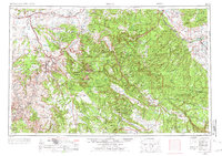
USGS Historical Topographic Map Collection · Public domain · the record · placed by its coordinates
Report this item
Hidden as soon as you tell us, everywhere it appears, before anyone reviews it.
Public domain, U.S. Geological Survey. The sheet shows the ground as the survey found it then, which is why a trail or road you know may be missing. Every sheet over this point, 1956 to 1980: USGS topoView.
In print since 1877
1877 Geologic Map of Colorado (Hayden), high-resolution scan · F. V. Hayden; scan by the Colorado Geological Survey · 1877
Geological and geographical atlas of Colorado and portions of adjacent territory · F. V. Hayden, U.S. Geological and Geographical Survey of the Territories · 1877
Free to read: public domain or government work. About Grand Junction Area as a whole, not this wall. More in the reading room.
Routes
Cave Buttress
- 1 The Main Vein 5.11
- 2 Pleasure Pillar Arete (AKA Facial Pleasure) 5.10b
- 3 The Pleasure Pillar 5.10-
- 4 Rowan's Arete 5.12b/c
- 5 The Unaweeper 5.13c
- 6 Cro-Magnons From Space 5.11+
- 7 Unknown 1 5.11+
- 8 Unknown 2 5.11
- 9 Unknown 3/ Unknown 3 Variation 5.11
Central Quarry Wall
- 1 Moon Shadow 5.10+
- 2 Sidewinder 5.11+
- 3 Chariots of Fire 5.11d
- 4 Mayachulla 5.11c
- 5 Ecylias 5.12a
- 6 Sunrise 5.11
- 7 Unknown 5.10
- 8 The Quarrel 5.10
- 9 Last Rites 5.11c
- 10 Rite of Passage 5.12a
- 11 The Chalk of Destiny 5.11+
Dental Block
- 1 Drunk on Lidocaine V2
Divide Wall
- 1 Jokers Wild 5.10
- 2 Cool Hand Luke 5.11-
- 3 Hummingbird 5.10
- 4 Cornucopia 5.11-
Fake News Wall
- 1 Kung Flue 5.9
- 2 Biden Your Time 5.11a
- 3 Fake News 5.11
Fortress Wall
- 1 Nimbasus 5.10-
- 2 The Emerald Orb 5.10c
- 3 Renaissance 5.10d
- 4 Dual Reality 5.10-
- 5 Pleiades 5.11b
- 6 Verachocha 5.10b/c
- 7 Luxor 5.10-
- 8 Kachina 5.10-
Get-away Wall
- 1 "That's All I'm Asking For!" 5.11
- 2 Snitches Get Stitches 5.11-
Hidden Valley Wall
- 1 Hacksaw Jim Duggan 5.7
- 2 Koko B. Ware 5.8+
- 3 Little Hulkster 5.9+
- 4 Mene Gene 5.8+
- 5 Lessons in Discipline 5.9+
- 6 Ted DiBiase, “The Million Dollar Man” 5.9+
- 7 Gardensmith Bypass Shears 5.8+
- 8 Made In the Shade 5.8+
- 9 The Brawl to End it ALL 5.9+
- 10 "Nature Boy" Ric Flair 5.9
- 11 Brutus 'The Barber' Beefcake 5.9
- 12 Cliff Break Fern 5.8-
- 13 Squeezed Opportunity 5.9
- 14 Slapping Heads 5.10
- 15 Hidden Valley Offwidth 5.9+
- 16 Don King Crack 5.10-
- 17 Gorilla in Manilla 5.10-
- 18 Float Like a Butterfly 5.10a
- 19 Padawan 5.8+
- 20 Obe Won Canobe 5.9+
- 21 Yoda 5.10
- 22 Summer Solstice 5.9
- 23 The Walking Wounded 5.10+
- 24 Quicksilver 5.10+
- 25 Black Beauty 5.10+
- 26 Anasazi 5.11
- 27 Illusions 5.10c
- 28 Never Ending Story 5.10b
- 29 So This is What Unclimbed Rock Looks Like? 5.10a
Lower Mighty Mouse Wall
- 1 Scrappy Mouse 5.10
- 2 Frankenstein's Cat 5.11
- 3 Cat Alarm 5.10d
- 4 Heckle & Jeckle 5.8
- 5 All Your Mite 5.10+
- 6 Y Crack 5.9+
- 7 Nice Surprises 5.9
- 8 Magna Mater Spire 5.10+
- 9 Sangria Headache 5.8+
- 10 Ginger the Oppressor 5.7
- 11 Mind the Gap 5.9
- 12 Elysium 5.10c
- 13 Gehenna 5.10c
- 14 Chimneying 101 5.8
- 15 Know Your Enemy 5.10c/d
- 16 Mouse of the Future 5.10
- 17 Pearl Pureheart 5.7
- 18 Oil Can Harry 5.9
- 19 Quacula 5.8
Lower Mother's Buttress
- 1 Alex's Tower 5.7
- 2 Slippery When Wet 5.11a
- 3 Another Unnamed Route 5.8
- 4 Cymbeline 5.10+
- 5 Cow-a-Bunga 5.8
- 6 Fine Line, A 5.8+
- 7 Mint Jam 5.8+
- 8 No Name Route 5.9+
- 9 Welcoming Party 5.7+
- 10 Thanks Mom 5.11-
- 11 Unknown Semi OW 5.10
- 12 The Lord of Wisdom 5.10+
Main Wall, The
- 1 Dumps Like a Truck 5.10
- 2 Beedoo 5.6
- 3 Kitty Rodeo 5.9
- 4 Go Slide 5.11
- 5 Neckgina 5.11-
- 6 Your Lipstick is Showing 5.10
- 7 Hanky and the Brain 5.8+
- 8 Farts of Unknown Origin 5.9+
Massey Wall
- 1 Lisenby-Zacher Especial 5.10+
- 2 Full Nelson 5.12+
- 3 Waking Life 5.11
- 4 The Space Between 5.9
- 5 Mindless Indulgence 5.11-
- 6 Modulation Crack 5.11
- 7 Frozen Will 5.11+
- 8 The Velvet Hammer 5.11+
- 9 Lost Vikings 5.10
- 10 Bachelor Party 5.11+
Middle Mother's
- 1 Centurion 5.11
- 2 Free Falling 5.11
- 3 The Ol' Hucklebuck 5.10
- 4 Flora Dora 5.11b
- 5 On Golden Pond 5.10a
- 6 Days of Wine and Roses 5.11-
- 7 Dirty Harry 5.11a
- 8 Iron Maiden 5.11
- 9 Jenny-Lynn's Special 5.8
- 10 The Double Reach Around 5.10+
- 11 Beyer's Rib 5.10-
- 12 White Lightning 5.12b
- 13 Drive-by Diking 5.11
- 14 Jagged Edge 5.11-
- 15 Rise of the Phoenix 5.10a/b
- 16 Wandering Charm 5.10
- 17 First Impressions 5.9-
- 18 No Name 4 5.11-
- 19 No Name 3 5.8-
- 20 No Name 2 5.10d
- 21 No Name 1 5.9+
- 22 Coxswain 5.10+
- 23 Definite Article 5.10+
- 24 Brevity 5.11+
- 25 Indirect Objects 5.10+
- 26 Under the Roof 5.9
- 27 Denouement 5.11-
- 28 Denotation 5.10
- 29 Connotation 5.11-
Music Mountain
- 1 Red, Red Wine 5.9
- 2 Cold and Ugly 5.10
- 3 Riders On The Storm 5.9
Other Mothers
- 1 With Teeth 5.10+
- 2 The Persistence of Loss 5.11
- 3 Furry Fruit Loop 5.6
- 4 Paw Prints 5.11
- 5 Alley Cat 5.9-
- 6 Dolphin Girl 5.8
- 7 Monk Sandals 5.9
- 8 Boodalicious Baby 5.10b/c
- 9 Newb Nation 5.5
- 10 84.1% Eclipse of the Heart (The Eclipse Route) 5.8
- 11 First First 5.7
- 12 Black Bunny Rabbit 5.8
- 13 RSG 5.10a
- 14 Soul Steeler 5.11c
- 15 Social Distancing 5.11
- 16 Rudimentary Extraction 5.6
Outback, The
- 1 The Maxx 5.12
- 2 Spirit Animal 5.7+
- 3 Artemis B. Gone 5.10
- 4 Great Northern Crabbit 5.8
- 5 The Isz 5.7
- 6 Large, Purple and Violent 5.10
- 7 Two Worlds 5.9+
- 8 Face My Face 5.9
- 9 Jungle Queen 5.8+
- 10 Red Orkan 5.10
Playground, The
- 1 Dewclaw Dexterity 5.10-
- 2 The Darkness 5.6
- 3 Head Waggle 5.8
- 4 Go Crazy 5.10
- 5 Black Beauty 5.11+
- 6 Popcorn Prostitute 5.9
- 7 Air Hump 5.10+
- 8 Just a Small Town Dog 5.9
Quarry Proper
- 1 Hotdog Charades 5.9
- 2 Kira, Get a Job! 5.10+
- 3 Hans Landa 5.11
- 4 Sauerkraut Sandwich 5.7
- 5 Ms. Kira Shakira 5.6
- 6 Two and a Half 5.8
- 7 Aldo the Apache 5.11-
- 8 Put It In Your Mouth 5.10+
- 9 Baby Dunk 5.9
- 10 Block-Eh 5.5
- 11 Burrito in My Speedo 5.9-
- 12 SGT Stiglitz 5.7
- 13 That's a Bingo! 5.10+
- 14 Bear J 5.9-
- 15 Slippery Trout 5.12-
- 16 Hazel Basil 5.11-
- 17 Gorlami 5.9
- 18 Decoco Crack 5.10+
- 19 Weinersnitzel Lickin' Fingers 5.10+
Raindrop Prow
- 1 Looking Down At The Rain 5.10+
Rectum Block
- 1 Old Man Patriarchy V2
SW Quarry Wall
- 1 Piece Snatcher 5.9+
- 2 Razor Ramon 5.10+
- 3 Jake "The Snake" Roberts 5.10
- 4 Dave's Elephant Trunk 5.10+
- 5 Rockin Robin 5.9
- 6 Unknown 5.11+
- 7 The Ultimate Warrior 5.12
- 8 Jimmy "Superfly" Snuka 5.10
- 9 "Rowdy Roddy" Piper 5.11+
- 10 Master Blaster 5.10+
- 11 Unknown .4s 5.10+
- 12 Junkyard Dog 5.9
- 13 Dusty Rhodes 5.6
- 14 Little, Big Man 5.12-
- 15 Honkey Tonk Man 5.8+
- 16 Jerry "The King" Lawler 5.9
- 17 King Kong Bundy 5.8+
- 18 "Ravishing" Rick Rude 5.10+
- 19 Paul Bearer 5.8
Slab Ramp
- 1 Dancing With a Mannequin 5.12c
- 2 Clipping Away 5.10
- 3 Split Hand 5.11-
- 4 Desk Pop 5.10+
- 5 Pelvis Pusher 5.10+
- 6 Brace Brace 5.10+
Space Balls Wall
- 1 Pizza the Hut 5.11+
- 2 Lonestar 5.11
- 3 Hail Screwed 5.11
- 4 Dink Dink 5.10+
- 5 Over My Helmet 5.11+
- 6 Comb the Desert! 5.11+
- 7 Hyperactive Speed 5.9+
- 8 Princess Vespa 5.11
- 9 Ludicrous Speed 5.11
- 10 The Bleeps, Sweeps, and the Creeps 5.10+
- 11 Dot Matrix 5.11-
- 12 Power Of the Schwartz 5.11-
- 13 Beam You Down 5.13
Sticks and Dicks Tower
- 1 Shake That Ass 5.9-
- 2 Sticks and Dicks and Finer Things 5.11-
- 3 Twerk 5.9
- 4 Whistles 5.10+
- 5 Puffy Cheeks 5.8
Sun Towers
- 1 Unknown offwidth 5.7
- 2 Sunup 5.8
- 3 Crack of Don 5.6
- 4 Dovercourt 5.7
- 5 Shady Character 5.9
- 6 Unknown 5.7+
- 7 Waitin' For Wane 5.7
- 8 Phaethon 5.8
- 9 Betty and Ray's Adventure 5.6
- 10 The Icarus Line aka The Thin White Line 5.9
- 11 Claret Cup Crack 5.7
Sunday Wall
- 1 Upper Deck 0.5 5.11
- 2 Upper Deck 1 5.11+
- 3 Upper Deck 2 5.11
- 4 Beginner's Luck 5.7
- 5 Fearless First 5.8
- 6 Red Hangers 5.11c/d
- 7 Tree It 5.11-
- 8 R-Tree It 5.10-
- 9 2-fer 5.10-
- 10 Napa Valley 5.11
- 11 Napa Arete 5.10
- 12 Unknown Arete 5.10
- 13 Don Juan 5.6
- 14 Undocumented (Left of Bandito) 5.9-
- 15 Bandito 5.8+
- 16 El Guapo 5.11+
- 17 The Steeple 5.12
- 18 Smear Campaign 5.13+
- 19 Dusty Bottoms 5.10-
- 20 Three's Company 5.8
- 21 Echoes 5.12d
- 22 Fart Gun 5.6
- 23 Tippy Toes 5.7
- 24 Bridge of Air 5.12-
- 25 Porticullis 5.12-
- 26 Simple Mind 5.11b
- 27 Optical Illusions 5.11
- 28 Monkey Gone to Heaven 5.13-
- 29 Burnt Beautician 5.12-
- 30 Unknown Reach 5.11
- 31 Antlers on a Sunday 5.10
- 32 Silently Indirect 5.10+
- 33 People are Poodles, Too 5.10-
- 34 Unhallowed 5.12+
- 35 Dark Winter 5.10
- 36 Unknown Pillar 5.10-
- 37 Harmony Dihedrals 5.10-
- 38 Cacophony Corners 5.9+
- 39 Dike Arch 5.9+
- 40 Arch Traverse 5.10+
- 41 Dike Pinch 5.10b
- 42 Smooth Reach 5.11b
- 43 Standard Route 5.7
- 44 Dreams of Far Away Places 5.10a
- 45 Black Dynamite 5.10+
- 46 The Wave 5.10
- 47 Sundae Driver 5.11c
- 48 Single Bolt Seam 5.10-
- 49 Sweet Sunday Serenade 5.9
- 50 High Exposure 5.8+
- 51 Sun Dancer 5.8
- 52 Gargoyle 5.10a/b
- 53 Catch a Wave 5.11a
- 54 Overlap 5.11
- 55 Pillar 1 5.10+
- 56 Motion Fascination 5.11b/c
- 57 Pillar 2a 5.11+
- 58 Second Pillar 5.10-
- 59 Right of Trash Can Alley 5.9
Television Wall
- 1 Dog Day Afternoon 5.10
- 2 Big Mo 5.11+
- 3 [Redacted] 5.8+
- 4 Crystal Vision 5.10
- 5 Rubarama 5.11+
- 6 Mode I Failure 5.11-
- 7 TV1 5.10-
- 8 TV2 5.11+
- 9 Corridor 1 5.10
- 10 Corridor2 5.11
- 11 Corridor 3 5.11+
Upper Mother's Buttress
- 1 Sugi 5.8
- 2 [Redacted] 5.8+
- 3 Unknown 5.9+ 5.9+
- 4 Throbbing Gristle Project 5.12b
- 5 Crab Head Poseidon God 5.11b/c
- 6 In Search of Don Juan 5.9
- 7 Super Dike 5.11
- 8 Squeeze to Please 5.9
- 9 Rat Trap 5.10
- 10 Flight Without Wings 5.12
- 11 3-D 5.11-
- 12 White Cross aka Titus Groan 5.10
- 13 Doppelgänger 5.11
- 14 Questions and Answers 5.10+
- 15 Sophie's Revenge 5.11
Washout, The
- 1 Scanners 5.8
- 2 Dreamscape 5.7
- 3 Exultant 5.3
- 4 Grasshopper 5.4
- 5 Caveman Tools 5.3
- 6 Menta 5.4
- 7 Vitamins 5.8
- 8 Dusk 5.10-
- 9 Dawn 5.8
- 10 500 lbs 5.9
- 11 ThisisRCity 5.9
- 12 Alpine X 5.8
Wildcat One Northwest Face
- 1 It’s the Mittens 5.8
- 2 Catwalk 5.11
- 3 Cougar Tracks 5.9
- 4 Mr. Muderbritches 5.10
- 5 Jane of the Jungle 5.10
Wildcat One South Face
- 1 Eye of the Liger 5.8
- 2 Highland Tiger 5.10
- 3 Cat In Heat 5.9
- 4 Truly Untamed 5.10
- 5 Divine Debris 5.6
- 6 Snake Jazz 5.7
- 7 Snaggletooth 5.9
- 8 Jungle Cat 5.10
- 9 Mo’ai 5.9
- 10 Canadian Lynx 5.8
- 11 Walking the Giant 5.7
- 12 Straight Down to Nothing 5.11
- 13 M-12 LRV Warthog 5.8
- 14 Looks like a Puma 5.9
- 15 Room with a View 5.3
- 16 Calm Between Storms 5.2
- 17 90 Day Construction Bod 5.9
- 18 Ocelot 5.9+
- 19 Wind and Rodents 5.11
- 20 Glorious 5.11
- 21 Express Hang Over 5.11
- 22 Throw Me a Bone 5.8
- 23 Trumaine 5.9
- 24 Finch 5.9
- 25 Kitty Litter 5.7
- 26 Krushinski 5.9
- 27 Coach McGrath 5.10
Zone 1
- 1 4_P_Beyer 5.10+
- 2 Beyer 5 5.8-
- 3 Colonel Rhombus 5.11
- 4 Beyer 4 5.11-
- 5 Beyer 3 5.11
- 6 Beyer 2 5.11+
- 7 Beyer 1 5.10-
- 8 Beyer 0.5 5.10+
- 9 Beyer 0.25 5.10
Zone 2
- 1 Orange 5.11
- 2 Light Green 5.11+
- 3 Green 5.10
- 4 Turquoise 5.10+
- 5 Light Blue 5.11-
- 6 Dark Blue 5.10+
- 7 Fuchsia 5.9+
- 8 Red 5.11+
- 9 Upper 1 5.11-
- 10 Upper 2 5.10-
Zone 3
- 1 TV3 5.9+
- 2 TV4 5.10
- 3 TV5 5.9
- 4 Unknown 2 5.11-
- 5 Unknown 5.8
- 6 Wanderer 5.11-
Elsewhere at this crag
- Guide's Route 5.9-
- Hand Jive 5.9+
- 1. Private Idaho 5.11a
- 2. High Noon 5.12a/b
- 3. Evergreen 5.11a
- Daffy Duck Pinnacle 5.9+
- Hand to Hand Combat 5.10c
- Crimson Behelit 5.11-
- Diagonal Crack 5.11
- Elementary, My Dear Watson 5.11
- Fear of Flying 5.11
- Hudak Attack 5.9+
- Salem 5.10+
- Stair Step Traverse 5.8+
- 4. Raindance 5.11a
- 5. 1000 Headed Dragon 5.11-
- 6. Squirmin German Roof 5.11c/d
- Addiction 5.8
- All the Right Moves 5.10c
- Amelie 5.12a
- Angelica 5.9+
- Crown Jewel 5.10-
- Deception Crack 5.11+
- Fight Club 5.12b
- Frontal Assault 5.9-
- In and Out the Back Door 5.6
- Mary's Tower 5.10+
- Project 5.12-
- Quercus Circus 5.10
- Smack My Bishop 5.11
- The Constant Gardener 5.12-
- The Sewer 5.9-
- Therapy 5.9+
- Twin Owls Center Route 5.9
- Unknown OW to Fingers 5.10+
- Unknown Roof 5.10+
Photos from climbers
No photos here yet. If you're at the crag, yours would be the first.
Taken at the crag by climbers and published as they sent them. Each one's own location had to be within 0.5 km of this crag before we accepted it. See something that shouldn't be here? Use Report this photo under it and it's hidden at once. Anything else, write to us.
Conditions reported
Nothing reported recently.
Report what you see
Reports are dated and fade on their own: wet rock after 3 days, a bad bolt after a year. No names, no text.
Access & safety
The map point for this crag is on land managed by Access Fund (non-governmental organization), in Unaweep Canyon. It lies inside recreation or education easement.
Land manager from USGS PAD-US (public domain), read 2026-09-29. It is the manager of the crag's map point, which can be a long way from the wall. What you may do on the rock is the manager's to say, not ours.
Nobody has yet read Access Fund's own rules for this crag and written them down here, so treat the above as where you are, not as what you may do.
Keep Deep Cut Guide free
No ads, no paywall, no account. You can chip in directly to help keep it running.