Taylor Canyon Bouldering
70 boulder problems · granite (Granite of Taylor River, Middle Proterozoic) · 8,467 ft
What's here
VB to V11, mostly around V3.
Counted from the 70 climbs here that carry a grade. Shown only where there are at least 5 of them — below that the shape is noise.
How well located
Base placed (one source) 3 Position on wall known 26 Crag only 41
The order of the climbs along this wall is known from the open catalogue, so a few surveys go a long way: standing at Left Arete, Get to Crackin' (2 climbs, about 60 seconds on Esty Lane Boulders) would place up to 4 more climbs between them. Survey the wall →
“Up to” because the estimate between two surveyed routes is only used when they turn out to be close enough together on the ground.
Rock, from the geologic map
Granitic rocks of 1400- and 1700-m.y. age groups, undivided, or, in Taylor River region, rocks with characteristics of Xg but U-Th-Pb zircon ages of Yg — granite. Mesoproterozoic, about 1,600 to 1,000 million years old.
This is the map unit under this crag's map point, read from the 1:500,000 sheet (Horton and others, 2017, U.S. Geological Survey Data Series 1052). The point can be a few hundred metres from the rock, a cliff often stands on the line between two units, and at that scale a line on the map is about 500 m wide on the ground, so the wall itself may be the neighbouring unit. The rock named at the top of this page comes from the public geology of this area; this card is the map's answer. Every crag on this unit: Granitic rocks of 1400- and 1700-m.y. age groups, undivided, or, in Taylor River region, rocks with characteristics of Xg but U-Th-Pb zircon ages of Yg. Geology data: Macrostrat (CC BY 4.0), serving USGS and Colorado Geological Survey maps.
On the map since 1941
The USGS has mapped this ground since 1941. 20 historical sheets cover this crag's map point; the oldest is below.
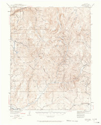
USGS Historical Topographic Map Collection · Public domain · the record · placed by its coordinates
Report this item
Hidden as soon as you tell us, everywhere it appears, before anyone reviews it.
Public domain, U.S. Geological Survey. The sheet shows the ground as the survey found it then, which is why a trail or road you know may be missing. Every sheet over this point, 1941 to 2001: USGS topoView.
In print since 1877
1877 Geologic Map of Colorado (Hayden), high-resolution scan · F. V. Hayden; scan by the Colorado Geological Survey · 1877
Geological and geographical atlas of Colorado and portions of adjacent territory · F. V. Hayden, U.S. Geological and Geographical Survey of the Territories · 1877
Free to read: public domain or government work. About Gunnison as a whole, not this wall. More in the reading room.
From the archives
Photographs of this area held by the Library of Congress, oldest first. Every one carries the Library's own "no known restrictions on publication"; anything else is left out.


Library of Congress, Prints & Photographs Division · Public domain · the record · indexed to this place by the archive
Report this item
Hidden as soon as you tell us, everywhere it appears, before anyone reviews it.
Library of Congress, Prints & Photographs Division · Public domain · the record · indexed to this place by the archive
Report this item
Hidden as soon as you tell us, everywhere it appears, before anyone reviews it.
Library of Congress, Prints & Photographs Division · Public domain · the record · indexed to this place by the archive
Report this item
Hidden as soon as you tell us, everywhere it appears, before anyone reviews it.
Routes
Black Boulder, The
- 1 Nevermore V10
Bottle Nose
- 1 Bottle Nose V5
Brotherhood Boulder
- 1 Homeland V11-12
- 2 Brotherhood V10-11
Campsite 5
- 1 All Time Arete V6
Cave, The
- 1 Dead Weather V3+
Dirty Boulder
- 1 Dirty V5-
Esty Lane Boulders
- 1 Left Arete V3
- 2 The Graduate V9
- 3 Right Arete V0
- 4 Pistachio V4
- 5 Uncrackable V7
- 6 Get to Crackin' V7
Fuzzy Bottom Boulder
- 1 Boss Arete V2
- 2 Flatline V8
- 3 Murderball V5
- 4 Dog Killer V4
- 5 Canine Levitation V3+
Hunter's Moon
- 1 Hunter's Moon V4
Ill Vibrations Boulder
- 1 Momentum Dimension V10
- 2 Ill Vibrations V8
- 3 Polling Place V5
- 4 Blunt V1
Nameless Boulder
- 1 Flightless Bird V5
- 2 Bury Them Bones V11
- 3 Homeless Slab V1
- 4 Brainless V1+
Shark's Tooth, The
- 1 ? V4
Sponge Ruiner Boulder
- 1 Sponge Ruiner V3-4
Tooth, The
- 1 Braces V0
- 2 Head Gear V6
Umbrella Boulder
- 1 Uno V7
- 2 Smack V4-5
- 3 Mary Poppins V4
Elsewhere at this crag
- All Time Low V9
- Anarchy V9+
- Average Arete V0-
- Charlie Don't Surf V7
- Compression 101 V3-4
- Cool Beans V0
- Corn Off The Cob V1
- Dark Entries V3
- Death In Tall Grass V9-
- Double Clutch V2
- El Hermano V0-1
- Fer-De-Lance V11
- Flight of the Navigator V8
- Hooked V8
- Light Entries V2-
- Mangos V4
- No Lifeguard On Duty V2
- One Arm Dan V0
- Plaid V3
- Plumb Fall V5+
- Poquito V5
- Practice Makes Perfect V3+
- Sense of Place V6
- Slabs Rule V2+
- Snug Slot V4-5
- Snug Slot - Sit Start V6-7
- Stan The Man V0
- Stigmata V11
- Superfly SnukA V-easy
- The Butter Hole V3
- The Final Frontier V4
- The Pioneer V3-4
- The Pioneer (Sit Start) V7
- Tiny Dancer V3-4
- Warm Up V2
- What's My Motivation V1+
Also within 3 km
- Throttle Wall2,343 m · 1 route · 8,559 ft
- Baby Buttress (aka the Baby Butt)2,413 m · 1 route · 8,410 ft
- Coffin Crack Crag2,449 m · 2 routes · 8,502 ft
- Gold Wall2,449 m · 2 routes · 8,493 ft
- North Bank2,449 m · 16 routes · 8,502 ft
- PCP Pinnacle2,449 m · 4 routes · 8,502 ft
Straight line between the two crags' map points, each of which can be some way from its rock. For when this wall is full, or the sun has found it.
Photos from climbers
No photos here yet. If you're at the crag, yours would be the first.
Taken at the crag by climbers and published as they sent them. Each one's own location had to be within 0.5 km of this crag before we accepted it. See something that shouldn't be here? Use Report this photo under it and it's hidden at once. Anything else, write to us.
Conditions reported
Nothing reported recently.
Report what you see
Reports are dated and fade on their own: wet rock after 3 days, a bad bolt after a year. No names, no text.
Access & safety
The map point for this crag is on land managed by Gunnison National Forest (federal). It lies inside national forest.
Land manager from USGS PAD-US (public domain), read 2026-09-29. It is the manager of the crag's map point, which can be a long way from the wall. What you may do on the rock is the manager's to say, not ours.
Nobody has yet read Gunnison National Forest's own rules for this crag and written them down here, so treat the above as where you are, not as what you may do.
Nearby, from OpenStreetMap
- Toilets
- 1,189 m away (map)
- Mapped parking
- 134 m away (map)
- Campsite
- Rosy Lane Campground, 482 m away (map)
Distances are a straight line from this crag's map point, which can itself be hundreds of metres off; a road may be much longer. Mapped by OpenStreetMap contributors (ODbL), so a toilet missing here may simply be unmapped. Parking here is what OSM has drawn nearby, not a guidebook's directions.
Keep Deep Cut Guide free
No ads, no paywall, no account. You can chip in directly to help keep it running.