South Fork of St. Vrain Canyon
453 routes and 25 boulder problems · granite (Silver Plume Granite) · 5,905 ft
What's here
5.2 to 5.13, mostly around 5.10.
VB to V12, with no single grade dominating.
Counted from the 478 climbs here that carry a grade. Shown only where there are at least 5 of them — below that the shape is noise.
How well located
Base placed (one source) 4 Position on wall known 413 Crag only 61
The order of the climbs along this wall is known from the open catalogue, so a few surveys go a long way: standing at Scout Route, In a Pinch aka Genie, Tonto, Little Bear (4 climbs, about 120 seconds on Scout Rock) would place up to 23 more climbs between them. Survey the wall →
“Up to” because the estimate between two surveyed routes is only used when they turn out to be close enough together on the ground.
The guidebook for this area
Rock Climbing St. Vrain Canyons - Bernard Gillett every crag it covers
The book has the topos, the descriptions and the local knowledge this page can't. Buying it helps support the people who know the crag best.
Rock, from the geologic map
Silver Plume Quartz Monzonite. about 4,000 to 541 million years old.
Pale yellowish- orange to pale reddish-gray, equigranular, fine- to medium-grained, biotite- muscovite quartz monzonite; some outcrops are gray to tan, medium- to coarse-grained porphyritic quartz monzonite that contains tabular microcline phenocrysts; c
This is the map unit under this crag's map point, read from the 1:100,000 sheet (Colton, Roger B., 1976, U.S. Geological Survey Geologic Investigations Series I-855-G). The point can be a few hundred metres from the rock, a cliff often stands on the line between two units, and at that scale a line on the map is about 100 m wide on the ground, so the wall itself may be the neighbouring unit. The rock named at the top of this page comes from the public geology of this area; this card is the map's answer. Every crag on this unit: Silver Plume Quartz Monzonite. Geology data: Macrostrat (CC BY 4.0), serving USGS and Colorado Geological Survey maps.
On the map since 1902
The USGS has mapped this ground since 1902. 29 historical sheets cover this crag's map point; the oldest is below.
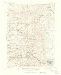
USGS Historical Topographic Map Collection · Public domain · the record · placed by its coordinates
Report this item
Hidden as soon as you tell us, everywhere it appears, before anyone reviews it.
Public domain, U.S. Geological Survey. The sheet shows the ground as the survey found it then, which is why a trail or road you know may be missing. Every sheet over this point, 1902 to 1984: USGS topoView.
Routes
Acrophile, The
- 1 Slab in the Face 5.10
- 2 Shitty Surprise 5.11b
- 3 Claustrophobia 5.11a
- 4 Acrophobia 5.11a
- 5 Acrophilia 5.11b
- 6 Lithophyte 5.10a
- 7 South Slabs 5.9-
- 8 Southern Comfort 5.9
- 9 Yawning Flake 5.9+
- 10 Badger Crack 5.10
- 11 Yellow Jersey 5.10d
- 12 Stiff Lipped 5.11c
- 13 Black Powder 5.9+
- 14 That '70s Route 5.10
- 15 Binary Cracks 5.9
- 16 Slabolishous 5.8-
- 17 Twin Pillar 5.8+
- 18 Groovy 5.4
- 19 Dead Deer Cracks 5.9
- 20 Iced Tea 5.8+
- 21 Pine Straw 5.9-
Arch of Titus
- 1 C'est La Vrie 5.8+
- 2 The Arch of Titus 5.8
- 3 Roman Architecture 5.10c/d
- 4 Triple Bypass 5.11b
- 5 North Central 5.10b
- 6 Pre-Op 5.8
- 7 Post-Op 5.10
Area 51
- 1 North By Northeast 5.9+
- 2 UFO 5.10a
- 3 Red Scare 5.11d
- 4 Government Conspiracy 5.9
- 5 Alien Hot Rod 5.11b
- 6 Little Blue Doctors 5.12a
Atoll, The
- 1 Enola 5.9+
- 2 Ol' St. Joe 5.10a
- 3 Smokers 5.9
- 4 Smeat 5.5
Bullshit Rock
- 1 Unknown 5.10a/b
- 2 North Arete 5.10a/b
- 3 Central West Face 5.10b
- 4 Bullshit Detector 5.10a/b
Cache Dome
- 1 Cache Crack 5.8
- 2 Cache Memory 5.8+
Cedar Rock
- 1 Fancy Tail 5.9
- 2 Out of a Triangle 5.10a
- 3 The Broken Vessel 5.11a
Cliffs of Insanity, The
- 1 The Princess Tried 5.11b
- 2 Prepare to Die 5.10d
- 3 Six Fingered Man 5.10b
- 4 Iocane Powder 5.10
Coliseum, The
- 1 Unleash The Lions 5.7
- 2 The Lion's Face 5.7
- 3 Ionic Column 5.10b/c
- 4 Gladiator 5.11b
- 5 Hollow Man 5.8
- 6 Planetary Pull 5.7
- 7 Vrainavore 5.10a
- 8 Handcrack-a-rete 5.7
- 9 Lost in Time 5.10b
- 10 Wrinkle in Time 5.9-
Dance Hall of the Dead
- 1 Cryptic 5.10c
- 2 Brutal Planet 5.10-
- 3 Grateful Head 5.9+
- 4 Great Full Body 5.8
- 5 Servant of the Bones 5.9
- 6 Unnamed thin hands through bulge 5.10
- 7 Unnamed corner to dirty crack 5.8
- 8 Watusi Afterworld 5.10a
- 9 Expropigation 5.9
- 10 Lean Into It 5.9+
- 11 The Smiling Mortician 5.9+
- 12 Cold Nipples and Busch 5.7
December Wall
- 1 Moonstruck 5.8
- 2 Seams Alright 5.10+
- 3 Mnemonic Plague 5.9+
- 4 I Promise Not To Cam In Your Mouth 5.9+
- 5 Red Tag 5.11d
- 6 Arborvitae 5.10c
- 7 Great Tree Route 5.9+
- 8 Short Takes 5.10
- 9 Nocturne 5.10c
- 10 Caesar's 5.10b
- 11 A Long December 5.11a
- 12 Ranklands of Perfidy 5.10a
- 13 Life After James 5.11b
- 14 The Road Goes Ever On 5.11+
- 15 Climb of the Anonymous Coward (Var) 5.11-
- 16 Telegraph Road 5.11b
- 17 The Telegraph Road Goes Ever On (Variation) 5.11
- 18 Winter Dreams / Gene and George's Excellent Adventure 5.10c
- 19 Brackets 5.10
Defibrillator Dome
- 1 deCeeved 5.9+
- 2 Wake-Up Toys 5.9
Desdemona
- 1 North Face 5.11a
- 2 Northwest Arete 5.9+
- 3 Oasis Red 5.9
- 4 Elanor 5.10b
- 5 The Tortoise And The Hare 5.6
Fang, The
- 1 Stiletto 5.13d
- 2 Gold Stiletto aka Stiletto/Gold 5.13c
- 3 Goldfinger 5.13b
- 4 Crack Therapy 5.11d
- 5 Perfect Stemetry 5.12c/d
- 6 Belligerent Buttress 5.12b
- 7 October Light 5.8
Field of Dreams
- 1 Pepper 5.10b
- 2 Change Up 5.11c
Fin, The
- 1 Feeding Frenzy 5.10d
Fourth Band
- 1 Little Bighorn 5.6
- 2 Sitting Bull 5.7
- 3 The Big Nasty 5.8
- 4 Spaghetti Westerns 5.5
- 5 Gunsmoke 5.8-
- 6 Shelob's Lair 5.6
- 7 Deliverance 5.9+
- 8 Stupid Human Trick 5.11+
Gopher, The
- 1 Baby Ruth 5.10a
- 2 Free Drop 5.11d
- 3 Be the Ball 5.10a
- 4 Dangerfield 5.10c
Graveyard, The
- 1 If the Shoe Fits 5.9+
- 2 Lost Sole 5.8
Guard House
- 1 Martial Law 5.10b
- 2 Auld Lang Syne 5.8
- 3 Cheech and Choss 5.7
- 4 Eric Couldn't Come 5.7
Guardian Rock
- 1 Rhino Rocket 5.8
Hideaway Dome
- 1 Gumbi Parade 5.10
- 2 Parade of Fools 5.10a
- 3 Hidden Pleasures 5.8
- 4 Riding the Tongue, variation on One No-Trump 5.9+
- 5 One No-Trump 5.9
Hobo Car, The
- 1 Meat in a Wine Glass 5.9
Journeyman
- 1 Apprentice 5.8+
- 2 Box Chimney 5.9-
- 3 Journeyman 5.11+
- 4 Tree Crack 5.10a
Kids' Wall
- 1 Central Slab 5.2
Log Boulder
- 1 Sculpted By Nature V2-3
- 2 Polishing a Turd V6
- 3 Logarithm V12
- 4 Outside Logs V10-
- 5 Log Cabins V12
- 6 Wake of the Flood V9+
Lower Infirmary Slabs
- 1 Short But Sweet 5.9
- 2 Acts of Contrition 5.10b
- 3 Mentally Infirm 5.10b
- 4 Plague Boys 5.8
- 5 Morning Oyster 5.7
- 6 Owner Beware 5.8
Lower Tier
- 1 Red Eye 5.9
- 2 Red Eye Dihedral 5.9-
- 3 Cockpit 5.5
- 4 Flight Simulator 5.8-
- 5 Autopilot 5.10a
- 6 Admiral's Club 5.9
- 7 Crop Duster 5.7
Mental Crux Boulder
- 1 Epilithic Wave V1
Monkey Skull, The
- 1 Amy, Good Gorilla 5.10b
- 2 Fringe Dweller 5.10b/c
- 3 Casual Corner 5.8+
- 4 Hollow Be Thy Name 5.10c
- 5 Monkey Trial 5.10c
- 6 Skull and Bones 5.10c
- 7 Sunshine Dihedral 5.10b
- 8 Ripple 5.11a
- 9 Upside The Cranium 5.10c
- 10 Fever Dance 5.10c/d
- 11 Looking for Trouble 5.9-
Mortuary, The
- 1 The Crypt 5.8
- 2 The Coroner 5.11b
- 3 Hatchet Job 5.9+
- 4 Dirt Nap 5.10c
- 5 Under the Knife 5.11c
- 6 Plant Food 5.6
Mushroom Massif
- 1 Mongoose 5.8+
- 2 Granitude 5.11+
- 3 Raven's Nest 5.8-
- 4 Body Snatcher 5.9
- 5 Cold Water Drama 5.9-
- 6 Pollemor 5.8
- 7 Grip 5.10a
- 8 Lichen Psilocybin 5.11c
- 9 Unknown 5.8-
- 10 The Mushroom 5.8
- 11 Unknown 5.10+
- 12 Freewheelin' 5.8+
- 13 Locked and Loaded 5.9+
- 14 Godspeed 5.11d
- 15 Easy Street 5.8
- 16 Quartz Dancer 5.11a/b
Mystery Rock
- 1 Whoazzur Arete 5.9
- 2 Alliteration Arete 5.8
- 3 Show Me Where It Says I Can't Do This 5.8
- 4 Finger Crack 5.8
North Narrows Slabs
- 1 Alley Cat Street 5.10a
- 2 Gas Huffer 5.10b
- 3 White Line Fever 5.10b
- 4 Climb to Safety 5.9
- 5 Death Tongue Variation 5.11d
- 6 Narrows Crack 5.10d
- 7 The Hitcher 5.12a/b
Observatory Rock
- 1 The River 5.10d
- 2 Flop, The 5.10b
- 3 Punch Line 5.10-
- 4 Panic in the Gray Womb 5.10c
- 5 Jonah 5.10a
- 6 Skin Mechanic 5.10
- 7 The Glass Bead Game 5.11-
- 8 Stargazing 5.9+
- 9 Mineral Secretion 5.10c
- 10 99% Pure 5.9
- 11 Original Route 5.8
- 12 Will Chevy Slab 5.11
- 13 Telescoping Sum 5.9
- 14 Double Vision 5.11c
Owl, The
- 1 Hashtag Vapelife 5.12a
- 2 Unknown (AKA Explorers' Route) 5.11a
- 3 Lily Biscuits 5.12a
- 4 Hail Satan (AKA Screech) 5.13a/b
- 5 Dakotas On The Run (Out) 5.11
P. Mosh Wall
- 1 Disco Solitaire 5.7+
- 2 Dixie Electric Company 5.6
- 3 Human Disco Ball 5.8
- 4 Gypsy Switch 5.8
- 5 Boom Box Baby 5.10a
Pantheon, The
- 1 Bury the Hatchet 5.10
- 2 The Oculus 5.8
- 3 The Portico 5.10
- 4 Stem Cell Research 5.10
- 5 Do as the Romans 5.10
- 6 Maximus 5.9
- 7 When in Rome 5.11b/c
Pile, The
- 1 The Naugahide Stool (originally submitted as Slab Arete) 5.9+
Platitudes, The
- 1 Stone Hill 5.7+
- 2 Element 101 5.7
- 3 Dig Those Moves 5.8
- 4 Knee Jerk Reaction 5.10
- 5 Quicker Picker Upper 5.8+
Rapids Rock
- 1 The Enthusiast aka Guided by Voices 5.9+
- 2 Guided [Missile] 5.9-
Rebel Boulder, The
- 1 Erosion V10
- 2 Rebel Forces V4
Rhesus Monkey
- 1 Rheomorphism 5.8-
- 2 Too Big To Fail 5.8
- 3 Monkey Business 5.8+
River Block
- 1 Prophets V9-10
- 2 Prospectors V10-11
- 3 Prospectors (stand) V8
- 4 A River Runs Through It V3
Roadeo
- 1 Roadeo 5.9-
Rodent Rock
- 1 Red Robin 5.10c
Sandbox Wall
- 1 Awkward Traverse V1-2
- 2 Crocs with Socks V0
- 3 American Soccer V2
- 4 Sandy Pants V1
Scout Rock
- 1 Scout Route 5.5
- 2 The Triple Mantel 5.10
- 3 Route 166 5.7
- 4 Sneak Attack 5.11c/d
- 5 Rawhide 5.10c
- 6 Funhouse Chimney 5.5
- 7 General Cluster's Last Stance 5.9
- 8 But for a Silver Bullet ... 5.6
- 9 The Lone Ranger 5.6
- 10 Tom Thumb 5.8+
- 11 Broken Arrow 5.11c
- 12 Exit Stage Left 5.9
- 13 In a Pinch aka Genie 5.11c
- 14 Comanche Warrior 5.11
- 15 War Path 5.12a
- 16 Hunting Party 5.11b
- 17 Dead Raccoon Crack 5.4
- 18 Ambush 5.12a
- 19 Leaning Aid Crack 5.4
- 20 Blood Brothers 5.7
- 21 Cornered to Blood Brothers 5.5
- 22 Cornered 5.9
- 23 Living the Dream 5.9+
- 24 Love, Honor, and Belay 5.9+
- 25 Tonto 5.9+
- 26 KeeMoSabe 5.9
- 27 Little Bear 5.11b
Second Tier
- 1 Ejector Seat 5.9+
- 2 Chem Trail 5.7
- 3 Stress Fracture 5.7
- 4 Touch and Go 5.7
- 5 Scoop Up a Little Sky 5.9+
- 6 Little Black Box 5.7
- 7 Stand By 5.7
- 8 Drunken Pilot 5.7
Sentinel, The
- 1 Eye Sockets Look Down on Chess Board Metals 5.10c
- 2 Spy Story 5.7
- 3 Koon's Corner 5.9
- 4 Fogline 5.10a
- 5 I Spy 5.8
- 6 Roundabout 5.8
- 7 Crooked Cross 5.9+
- 8 Southern Cross 5.9
Shadows, The
- 1 When Darkness Falls 5.7+
- 2 Twilight 5.7+
- 3 Steel Gray 5.10d
- 4 Solar Eclipse 5.10d
- 5 Gray Pilgrim 5.9+
- 6 Shadowfax 5.9-
Shangri-La Slab
- 1 Slablander Var. 5.10+
- 2 Slablander 5.11b/c
- 3 High Noon (submitted as Shangri-La Slab) 5.10a/b
Shortcrack Lump
- 1 Mouse Poop Finger Lock 5.6
Shrine of Vanity, The
- 1 Apathetic Womb 5.6
- 2 Reap What You Sew 5.10a
- 3 All We Like Sheep 5.6
- 4 Gluttonous Ego 5.8-
- 5 Raise Your Fist 5.7
- 6 [Redacted] 5.6
- 7 Here We Go Again 5.6
- 8 High Friends in Crawl Spaces 5.7
- 9 Simply Complicated 5.9-
Stewardess Convention Crag
- 1 Aviatrix 5.9+
- 2 Oxygen Masks and Float Cushions 5.8
- 3 Flight Attendant 5.7
Stray Dog
- 1 Stray Dog 5.8
Sundrop, The
- 1 Sideshow Bob 5.12a
- 2 A.O.D. 5.11b
- 3 Bada Boom 5.10b
Sweat Loaf aka Big Dogs
- 1 Walking on Paper 5.9+
- 2 Sweatin' to the Oldies 5.10b
- 3 Independent Worm Saloon 5.10c
- 4 Deodorant 5.10b
- 5 Big Dogs on the Prowl 5.12a
- 6 Big Dogs Variation 5.10c
- 7 Ain't No Puppy 5.9
- 8 Revocation 5.9
- 9 Black Ramp 5.9+
- 10 Rat Crack Direct 5.11a
- 11 Rat Crack 5.10b
- 12 Gravity's Rainbow 5.11a
- 13 White Shores 5.10b
Swift Rock
- 1 Spanky Goes to Hollywood 5.8
- 2 Drowning in a River of Disturbance 5.10
- 3 Blue Swift 5.9+
Terraphile
- 1 Ophidiophobe 5.9
- 2 Hibernaculum 5.8
Thinker, The
- 1 Dierection 5.10c
Third Band
- 1 Yegg 5.9+
- 2 Hacky Sack 5.9+
- 3 Fish Out Of Water 5.10-
- 4 If You Don't Leave Me, I'll Find Someone Who Will 5.9
- 5 If You Can’t Live Without Me, Why Aren’t You Dead Yet? 5.8
- 6 How Can I Miss You If You Won't Go Away? 5.8
- 7 Gnashville 5.9
Throne, The
- 1 Thunderstruck 5.10a
- 2 Petticoat 5.10a
- 3 Magnum P.I. 5.9+
- 4 Forgotten Passage 5.9
Ticket Booth, The
- 1 Foul Line 5.7
- 2 Step Right Up 5.8+
Tomahawk Buttress
- 1 Kitty Hawk 5.8
- 2 Chicken Hawk 5.9+
- 3 I'm Your Huckleberry 5.9+
Trojan Bunny Buttress
- 1 Botany of Desire 5.13a
- 2 Half Cracked 5.11b
- 3 Bun in the Oven 5.12d
- 4 Temptation Arete 5.12a
- 5 Thy Holy Hand Grenade 5.11
- 6 Lick My Plate 5.8+
- 7 Streatch 5.9+
- 8 Dog Will Hunt 5.10b
- 9 The Bruise Collector 5.12a
- 10 The Bucket List 5.11
- 11 Europithacus 5.11+
- 12 Delivering Dynos 5.12a
- 13 Sloping Surprise 5.11d
- 14 Crawfish 5.12b/c
- 15 Evolution 5.12+
- 16 Only A Flesh Wound 5.12b
- 17 Cuervo Gold 5.12a
- 18 Unicorn Tower 5.13+
- 19 Goldshut Arete 5.11c
- 20 Fire On The Mountain 5.11c
- 21 Sonata 5.9+
- 22 Pondemonium 5.10d
Turd World Country
- 1 Howdy Ho! (The Turd) 5.10d
- 2 Master Peace and Monkey Meat 5.10
- 3 Psychovino's Spaghetti Hell 5.9-
- 4 Sodom and America 5.10c
- 5 Cactus Crack 5.6
Upper Infirmary Slabs
- 1 Community Service (formerly Little Flatiron Left aka West Buttress) 5.6
- 2 Merit Based Pay 5.7
- 3 Submission 5.6
- 4 Nocturnal Emissions 5.9
- 5 Remission 5.8
- 6 Admission Crack 5.6
- 7 IV League 5.7
- 8 Cyberchondrial Paranoia 5.10d
- 9 Panic in the Gray Room 5.10b/c
- 10 Emergency Entrance 5.6
- 11 Cracked Lens 5.7
- 12 Air Apparent 5.9
- 13 Mûmakil 5.10
- 14 Haradrim 5.11+
Vrain Dead
- 1 Red Fox 5.9
- 2 vrAin't No Big Thing 5.9-
- 3 Vrain Child 5.11+
- 4 Vrain Dead 5.8+
Vrain Trust, The
- 1 No Vrainer 5.10c
- 2 Vrain Teaser 5.7
- 3 Fully Gratified 5.10a
Wailing Wall
- 1 Sabra 5.10a
- 2 North Arete 5.11
- 3 Cry Baby 5.10d
- 4 Intermezzo 5.9-
- 5 North Corner 5.10b
- 6 The Problem of Pain 5.9
- 7 Burning Down the House 5.11a
- 8 Three Stigmata 5.10+
- 9 Martyr 5.8+
Wave Twister, The
- 1 Wave Twister 5.10a/b
- 2 Inner Space Dental Commander 5.10c
Whistler's Mother
- 1 Northwest Arete 5.8
- 2 West Face 5.8
- 3 West Face Variation 5.10+
- 4 Southeast Face 5.7+
Elsewhere at this crag
- Center Slab 5.8+
- Crown Molding 5.9
- Spire-A-Jyra 5.10a
- Butter Cup 5.8+
- Git 'em Up Scout 5.9
- R.O.U.S. 5.10a
- The Sword-That-Was-Broken 5.3
- Hire Spire 5.7
- Ring of Power 5.4
- Dire Spire 5.9-
- Highway Robbery 5.12b
- Summit Block 5.10
- Barnacle 5.10c
- Blow Chow 5.8
- Door Jam 5.9-
- Hammerhead 5.9
- Knuckle Sandwich 5.9+
- The Watchtower Corner 5.8
- Tiburon (submitted as Tiberone) 5.10c
- Drop Your Cool, Tom Foolery 5.10c
- Full Nelson Reilly II 5.10c
- Left Side 5.8
- Wax 'n Wane 5.8
- Antifreeze 5.10a
- Business Loop 5.11b
- Finish Carpenter 5.9-
- Little Narrows 5.10
- Mr. Goodwrench 5.10
- Auto Repair 5.7+
- Cove Trim 5.5
- Fluid Mechanics 5.10a
- Hamburger 5.10d
- Handy Man 5.9-
- The Tooth 5.10+
- Unknown Brown Arete 5.9+
- Unknown Roof Route 5.11
- West Face AKA Cold Feelings 5.7
- Bending Nails 5.7+
- Best Boy 5.9+
- Corner Bead 5.6
- El Corazon Del Loco 5.10-
- Emissions Testing 5.9-
- Gaffer 5.10b
- Piolet 5.10
- The Ant 5.10a
- - V-easy
- Crack Saves V0
- Dihedral V0
- Hog Slapper V3+
- Super Mario Brothers V2
- The Pandemic V4
- The Rabbit Hole 5.11a
- The Skin Tollbooth V8+
- Turd Burglar V6
Photos from climbers
No photos here yet. If you're at the crag, yours would be the first.
Taken at the crag by climbers and published as they sent them. Each one's own location had to be within 0.5 km of this crag before we accepted it. See something that shouldn't be here? Use Report this photo under it and it's hidden at once. Anything else, write to us.
Conditions reported
Nothing reported recently.
Report what you see
Reports are dated and fade on their own: wet rock after 3 days, a bad bolt after a year. No names, no text.
Access & safety
The map point for this crag is on land managed by Roosevelt National Forest (federal). It lies inside national forest.
Land manager from USGS PAD-US (public domain), read 2026-09-29. It is the manager of the crag's map point, which can be a long way from the wall. What you may do on the rock is the manager's to say, not ours.
Rules for all Arapaho and Roosevelt National Forests land
- Fees
- No entrance fee for the forest. Some locations require a reservation, pass, permit or day-use fee.
- Overnight
- Camping more than 14 days in a 30-day period, or more than 30 days in a 365-day period, is prohibited across the forests and the Pawnee National Grassland. Dispersed camping is within 300 feet of most Forest Service roads, on National Forest land; the MVUM shows which.
Read on Arapaho and Roosevelt National Forests's own pages, checked 2026-09-29 by John Crawford. What they require, in full, or their own climbing page. These apply to the manager's whole holding; anything specific to this crag is above.
Nearby, from OpenStreetMap
- Mapped parking
- 270 m away (map)
Distances are a straight line from this crag's map point, which can itself be hundreds of metres off; a road may be much longer. Mapped by OpenStreetMap contributors (ODbL), so a toilet missing here may simply be unmapped. Parking here is what OSM has drawn nearby, not a guidebook's directions.
Keep Deep Cut Guide free
No ads, no paywall, no account. You can chip in directly to help keep it running.