North Fork of the St. Vrain River
82 routes and 47 boulder problems · granite (Silver Plume Granite) · 6,020 ft
What's here
5.3 to 5.14, mostly around 5.10.
V0 to V13, mostly around V1.
Counted from the 129 climbs here that carry a grade. Shown only where there are at least 5 of them — below that the shape is noise.
How well located
Base placed (one source) 5 Position on wall known 80 Crag only 44
The order of the climbs along this wall is known from the open catalogue, so a few surveys go a long way: standing at Technicolor Nightmare, Livewire, Dihedral [River Wall] aka Shades of Murky Depths (3 climbs, about 90 seconds on River Wall II) would place up to 16 more climbs between them. Survey the wall →
“Up to” because the estimate between two surveyed routes is only used when they turn out to be close enough together on the ground.
The guidebook for this area
Rock Climbing St. Vrain Canyons - Bernard Gillett every crag it covers
The book has the topos, the descriptions and the local knowledge this page can't. Buying it helps support the people who know the crag best.
Rock, from the geologic map
Brecciated Rock. .
breccia
This is the map unit under this crag's map point, read from the 1:100,000 sheet (Colton, Roger B., 1976, U.S. Geological Survey Geologic Investigations Series I-855-G). The point can be a few hundred metres from the rock, a cliff often stands on the line between two units, and at that scale a line on the map is about 100 m wide on the ground, so the wall itself may be the neighbouring unit. The rock named at the top of this page comes from the public geology of this area; this card is the map's answer. Every crag on this unit: Brecciated Rock. Geology data: Macrostrat (CC BY 4.0), serving USGS and Colorado Geological Survey maps.
On the map since 1902
The USGS has mapped this ground since 1902. 29 historical sheets cover this crag's map point; the oldest is below.
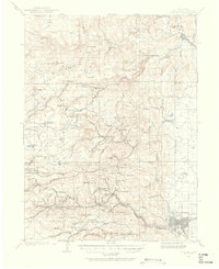
USGS Historical Topographic Map Collection · Public domain · the record · placed by its coordinates
Report this item
Hidden as soon as you tell us, everywhere it appears, before anyone reviews it.
Public domain, U.S. Geological Survey. The sheet shows the ground as the survey found it then, which is why a trail or road you know may be missing. Every sheet over this point, 1902 to 1984: USGS topoView.
Routes
Blue Rose
- 1 Upper Traverse V2
- 2 Blue Rose V5
Broken Bridge Dome
- 1 A Casual Cruise 5.8
- 2 Just Another 5.6 Dihedral 5.6
Buick Rocks and Hitler's Sex Life
- 1 Yo Mama, Osama 5.7
- 2 Green Slab 5.9+
- 3 The Buick 5.10a
- 4 Pontiac 5.11a
- 5 Civic Minded 5.8
- 6 Energon Cube 5.9-
- 7 Beamer Up Scotty 5.9+
- 8 Pooh Belly 5.7
- 9 Unknown Face 5.10c
- 10 Initial Route 5.7
Bullet, The
- 1 Finger Tattoo 5.12b
- 2 Pretty Blue Gun 5.12a
- 3 Where Eagles Die 5.10d
- 4 Moonraker 5.12c
- 5 Sharps 50 5.12b
- 6 Spy Dust 5.10c
Choss Roof Boulder
- 1 Buckets V1
- 2 Crossing The Divide V3
Disappointment Dome
- 1 Rattlesnake Rodeo 5.6
Entryway Slabs
- 1 Rock Biter 5.3
- 2 First Door 5.6
- 3 Joy 5.7
- 4 Shark Fin 5.8+
Northwest Formation
- 1 Hot Heels 5.9
- 2 Poker Night 5.10d
- 3 Water Streak 5.11c
- 4 Temperature Inversion 5.10b/c
- 5 Career Day 5.11d
Old Yellar Dome
- 1 Old Yellar 5.13a
- 2 Old Scoundrel 5.13b
- 3 Yellar Belly 5.12d
- 4 The Scoundrel 5.13b
Palace, The
- 1 Swat Team 5.10c
- 2 Middle Earth 5.10b
Raven's Roost
- 1 Already Died Once 5.10-
RiffRaff Dome
- 1 Casual Corner 5.7
- 2 Mississippi High-Step 5.10a
River Wall II
- 1 Technicolor Nightmare 5.11+
- 2 New Horizon 5.13a
- 3 Lost Horizons 5.14a
- 4 Brother From Another Planet 5.13b
- 5 Surround Sound 5.11c
- 6 Big, Big Gunky Man 5.12
- 7 Pocket Hercules 5.11+
- 8 Big, Big, Monkey Man 5.12b
- 9 Aquadarius 5.13d
- 10 Redneck Hero 5.12a
- 11 Social Dispensing 5.11d
- 12 Escape from Alcatraz 5.11b
- 13 Livewire 5.10c/d
- 14 Introducing Meteor Dad 5.10d
- 15 The Box 5.7
- 16 Le Diamant E'ternal 5.13b/c
- 17 Neurosurgeon 5.12a
- 18 Arresting Arete 5.10d
- 19 Dihedral [River Wall] aka Shades of Murky Depths 5.8
South Formation
- 1 Payback 5.11d
- 2 Electric Sky 5.11d
- 3 ELO 5.9
- 4 Arch Dihedral 5.7
- 5 Origami 5.9
- 6 Southwest Direct 5.12a
- 7 Dreaming in Color 5.10b
- 8 Lima Bean 5.10b
- 9 Granite Beach 5.12a
- 10 True Grit 5.13a
- 11 Granite Beach Headwall 5.13b
- 12 Cross Stitch 5.10b
- 13 Stonebridge 5.11c
- 14 Hibernation 5.12c
- 15 Button Hole 5.7+
Summit Boulder Problems
- 1 Tomato Traverse V4
Thirty Minute Boulder, The
- 1 Classic Crack V0
Tigers in Lipstick
- 1 Tigers in Lipstick 5.9
Warm-Up Blocks
- 1 Left Arete V3
- 2 Squidward V7
- 3 The Gem V5
- 4 Right Arete V3
- 5 Short Overhang V1
- 6 Left Arete - East Boulder V3-4
- 7 Bulge V2-
Elsewhere at this crag
- New Moon 5.10c
- PWS Corner 5.6
- Pilots 3 Mayday! 5.10
- Unknown 5.6
- Unknown 2 5.9
- Amelia Bean V1
- Backyard Boulder 5.8
- Campus Problem V5
- Devil's Face V5
- Dihedral Crack V0
- Double Trouble V6
- Dysfunctional Family V0
- Eiger V9
- Eleanor "Snuggs" V1
- Face Problem V3-4
- Feel The Wetness V4
- Get Around To It V13
- Get Over It V10
- Get Over It Super SDS V11
- Go Feed the Dogs V1-2
- Honor 5.10
- Layback Crack V0
- Layback Problem V2
- Lip Traverse V4
- Mambo # V4 V4
- Matterhorn V11
- North Crack Left 5.9-
- North Crack Right 5.8-
- Oliver Clark's Great Chewbacca Warrior Spirit Traverse V3
- Rosebud V2-3
- Route 1 V2
- Route 2 V1
- Route 3 V2
- Shake It Up V2
- Shape Shifter AKA Crime & Punishment V8
- Sinister Minister V3
- The Arete V1-2
- The Arete V2
- The Traverse V4
- The Vision V2-3
- Threat Condition Delta V6
- Tomato Traverse V1-2
- Truth 5.8
- unknown [The Sanctuary] V8
Also within 3 km
Straight line between the two crags' map points, each of which can be some way from its rock. For when this wall is full, or the sun has found it.
Photos from climbers
No photos here yet. If you're at the crag, yours would be the first.
Taken at the crag by climbers and published as they sent them. Each one's own location had to be within 0.5 km of this crag before we accepted it. See something that shouldn't be here? Use Report this photo under it and it's hidden at once. Anything else, write to us.
Conditions reported
Nothing reported recently.
Report what you see
Reports are dated and fade on their own: wet rock after 3 days, a bad bolt after a year. No names, no text.
Access & safety
The map point for this crag is on land managed by Boulder County Parks & Open Space (local government), in Billings.
The boundary is close. Land managed by Boulder County, CO comes within 250 m of this point, and the point is not the rock — the wall itself may be on the other side of the line. Check which before you rely on either one's rules.
Worth checking first. PAD-US records public access to this unit as “closed” (according to CNHP COMaP, 2016). That is about getting onto the unit at all, not about climbing, and we have not checked it against Boulder County Parks & Open Space's own page.
Land manager from USGS PAD-US (public domain), read 2026-09-29. It is the manager of the crag's map point, which can be a long way from the wall. What you may do on the rock is the manager's to say, not ours.
Nobody has yet read Boulder County Parks & Open Space's own rules for this crag and written them down here, so treat the above as where you are, not as what you may do.
Keep Deep Cut Guide free
No ads, no paywall, no account. You can chip in directly to help keep it running.