Sand Gulch
123 routes and 5 boulder problems · limestone · 6,712 ft
What's here
5.7 to 5.12, mostly around 5.11.
VB to V6, with no single grade dominating.
Counted from the 128 climbs here that carry a grade. Shown only where there are at least 5 of them — below that the shape is noise.
How well located
Position on wall known 119 Crag only 9
No route here has its own point yet. The map pin is the crag. At the wall? Survey it: 30 seconds per route.
The order of the climbs along this wall is known from the open catalogue, so a few surveys go a long way: standing at Cumulocrimpus, Not So Killer Bees, Energizer, It's Miller Time, Jump for Cholla, Silverado, Wee Man, Sticks And Stones, Cholla My Valentine (9 climbs, about 270 seconds on Contest Wall) would place up to 80 more climbs between them. Survey the wall →
“Up to” because the estimate between two surveyed routes is only used when they turn out to be close enough together on the ground.
The guidebook for this area
Shelf Road Rock - Rick Thompson - 3rd ed. every crag it covers
The book has the topos, the descriptions and the local knowledge this page can't. Buying it helps support the people who know the crag best.
Rock, from the geologic map
One or more Ordovician fms (Fremont Limestone, Harding Sandstone, Manitou Limestone) — limestone, minor sandstone. Ordovician, about 483 to 451 million years old.
Fremont Limestone, Harding Sandstone, and Manitou Limestone
This is the map unit under this crag's map point, read from the 1:500,000 sheet (Horton and others, 2017, U.S. Geological Survey Data Series 1052). The point can be a few hundred metres from the rock, a cliff often stands on the line between two units, and at that scale a line on the map is about 500 m wide on the ground, so the wall itself may be the neighbouring unit. The rock named at the top of this page comes from the public geology of this area; this card is the map's answer. Every crag on this unit: One or more Ordovician fms. Geology data: Macrostrat (CC BY 4.0), serving USGS and Colorado Geological Survey maps.
On the map since 1894
The USGS has mapped this ground since 1894. 20 historical sheets cover this crag's map point; the oldest is below.
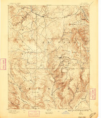
USGS Historical Topographic Map Collection · Public domain · the record · placed by its coordinates
Report this item
Hidden as soon as you tell us, everywhere it appears, before anyone reviews it.
Public domain, U.S. Geological Survey. The sheet shows the ground as the survey found it then, which is why a trail or road you know may be missing. Every sheet over this point, 1894 to 1989: USGS topoView.
From the archives
Photographs of this area held by the Library of Congress, oldest first. Every one carries the Library's own "no known restrictions on publication"; anything else is left out.


Library of Congress, Prints & Photographs Division · Public domain · the record · indexed to this place by the archive
Report this item
Hidden as soon as you tell us, everywhere it appears, before anyone reviews it.
Library of Congress, Prints & Photographs Division · Public domain · the record · indexed to this place by the archive
Report this item
Hidden as soon as you tell us, everywhere it appears, before anyone reviews it.
Library of Congress, Prints & Photographs Division · Public domain · the record · indexed to this place by the archive
Report this item
Hidden as soon as you tell us, everywhere it appears, before anyone reviews it.
Routes
Contest Wall
- 1 Cumulocrimpus 5.11d
- 2 Vail Athletic Club 5.11c
- 3 Dead Tree Crack 5.10
- 4 Limestone Lady 5.11c
- 5 Scruples 5.11c/d
- 6 Slipper Queen 5.11d
- 7 Porkus Non Grata 5.11a
- 8 Liquid Pork 5.11b
- 9 Dr. Howard's Digital Exam 5.10b
- 10 Dough Boys 5.10b
- 11 Single Gun Theory 5.11c
- 12 Jelly Bellies 5.10c
- 13 Not So Killer Bees 5.10d
- 14 The Apple Bites Back 5.11c
- 15 Apple Jam 5.11a
- 16 The Opportunist 5.9
- 17 Knot Head 5.9
- 18 Enterprise 5.9+
- 19 Phase Dance 5.12-
- 20 The Dune 5.10a
- 21 Armistice (AKA The Armisist) 5.10b
- 22 The List 5.10b/c
- 23 Hide n' Seek 5.11a/b
- 24 Bitten by a Manpris 5.11a
- 25 Energizer 5.10c
- 26 Gotham City 5.10a
- 27 Awakenings 5.9
- 28 Strangeways 5.9+
- 29 Cave Troll 5.7
- 30 Time Square 5.8
- 31 It Takes a Village 5.9+
- 32 Slamdance Cosmopolis (aka It Takes a Village) 5.10a
- 33 Suburbia 5.10b/c
- 34 Utopia 5.9
- 35 Unknown 5.10a/b
- 36 Metropolis 5.11d
- 37 It's Miller Time 5.11a/b
- 38 Scary Carrie 5.10a/b
- 39 Spike aka BR 1 5.9
- 40 Tinsel Town aka BR 2? 5.9
- 41 Cactus Carrie 5.11
- 42 Spinney Dan 5.10c
- 43 Black Rib 5.10a
- 44 Tortuga 5.11b
- 45 Pesko Sour 5.11a
- 46 Turbo Road 5.11+
- 47 Taos Hum 5.10b
- 48 Cattle Prod 5.11a
- 49 Jump for Cholla 5.10d
- 50 Trick-or-Treat 5.11a/b
- 51 Curious George 5.11a
- 52 Little Mecca 5.12b
- 53 Cactus Drop 5.10d
- 54 Regroovable 5.11b
- 55 Lime and Punishment 5.11b/c
- 56 Little Red Badge of Courage 5.11c
- 57 Big Froggy 5.10b
- 58 Holy Sheath 5.10b
- 59 River of Rabbits 5.11a
- 60 Renaissance 5.11a
- 61 Silverado 5.11b
- 62 Limestone Politician 5.11b
- 63 9 to 5 5.10d
- 64 Short Slaughter 5.11a
- 65 Aretissima 5.11b
- 66 Rodao 5.11c
- 67 Agent Orange 5.12a
- 68 Farts of Horsemen 5.12a/b
- 69 No Tomorrow 5.12b
- 70 Grand Cru 5.11a/b
- 71 Fossil Fueled 5.11b
- 72 Pocket Laureate 5.11d
- 73 Wee Man 5.11a/b
- 74 Zia 5.10a
- 75 Monster Man 5.11b
- 76 You Snooze, You Lose 5.11c/d
- 77 Spice is Nice 5.11d
- 78 Top Fun 5.11b
- 79 Truancy 5.11b/c
- 80 High Pockets 5.11a
- 81 Perilous 5.11d
- 82 Here Comes Midnight With The Dead Moon In Its Jaws 5.10a
- 83 Sprayburn 5.12a
- 84 Primal Urge 5.11c/d
- 85 Sticks And Stones 5.11a
- 86 Little Wolfie 5.12a
- 87 No Place for a Gentleman 5.11d
- 88 No Place For a Lady 5.12a
- 89 Cholla My Valentine 5.12b
Free Form Wall
- 1 New World 5.10
- 2 Habitually Human 5.11b
- 3 Castrator 5.10b
- 4 Freeform 5.12a
- 5 Barney 5.9+
- 6 Bad Brains 5.12a
- 7 Helter Skelter 5.12a
- 8 Unknown 5.10c/d
- 9 No Vacancy (submitted as No Math Required) 5.11-
- 10 Partners in Crime 5.11c
- 11 Pedestrian Gene Pool 5.11-
- 12 Cyborg 5.11b
- 13 Village Idiot 5.11b
- 14 Karma Mechanic 5.10b
- 15 Bourgeois Belay Dogs 5.10b
- 16 Helium Boys 5.11b
- 17 Guilty By Association 5.9+
- 18 Berlin Wall 5.11a
- 19 The Sharp, The Bad, and The Thugly 5.12+
- 20 Take 5.12
- 21 Swinging Chimps 5.11-
- 22 Onomatopoeia 5.12a
- 23 UFO 5.11a
- 24 GOBs 5.10a
- 25 Supermax 5.11d
- 26 Solitary Confinement 5.12a
- 27 Minimum Security 5.11c
- 28 Maximum Security 5.10a
- 29 Red Rocket 5.12a
- 30 Laughing Lab 5.11a
Elsewhere at this crag
- Don't Think Twice 5.11b
- Matilda 5.11a
- End of all Porpoises 5.12c
- Porpoise Path 5.12a
- Cougar V3
- Dirty Eye V1
- Lucy's Butt Hole V3-
- Shithouse Traverse V0-
- Twisted Existence V6
Also within 3 km
- The Gallery571 m · 198 routes · 6,704 ft
- The Dark Side1,028 m · 67 routes · 6,769 ft
- The Bach Block1,204 m · 12 routes · 6,542 ft
- The Vault1,421 m · 37 routes · 6,848 ft
- Cactus Cliff1,457 m · 157 routes · 6,939 ft
- Cash Wall1,507 m · 15 routes · 6,986 ft
Straight line between the two crags' map points, each of which can be some way from its rock. For when this wall is full, or the sun has found it.
Photos from climbers
No photos here yet. If you're at the crag, yours would be the first.
Taken at the crag by climbers and published as they sent them. Each one's own location had to be within 0.5 km of this crag before we accepted it. See something that shouldn't be here? Use Report this photo under it and it's hidden at once. Anything else, write to us.
Conditions reported
Nothing reported recently.
Report what you see
Reports are dated and fade on their own: wet rock after 3 days, a bad bolt after a year. No names, no text.
Access & safety
The map point for this crag is on land managed by Bureau of Land Management (federal), in Royal Gorge Field Office.
Land manager from USGS PAD-US (public domain), read 2026-09-29. It is the manager of the crag's map point, which can be a long way from the wall. What you may do on the rock is the manager's to say, not ours.
Rules for all Bureau of Land Management land
- Fees
- Developed campgrounds are fee sites: at Shelf Road, Sand Gulch is $20 a night for an individual site and $40 for a group site, with no drinking water, hook-ups or trash service. Where a fee area is posted, you must register and pay within 30 minutes of entering it.
- Overnight
- Camping more than 14 days in any 30-day period at any one location is prohibited, including in a campground, and afterwards you must move at least 30 air miles. Personal property may not be left unattended anywhere on public land for more than 48 hours.
Read on Bureau of Land Management's own pages, checked 2026-09-29 by John Crawford. What they require, in full, or their own climbing page. These apply to the manager's whole holding; anything specific to this crag is above.
Nearby, from OpenStreetMap
- Toilets
- 479 m away (map)
- Mapped parking
- 468 m away (map)
- Campsite
- Sand Gulch Campground, 583 m away (map)
Distances are a straight line from this crag's map point, which can itself be hundreds of metres off; a road may be much longer. Mapped by OpenStreetMap contributors (ODbL), so a toilet missing here may simply be unmapped. Parking here is what OSM has drawn nearby, not a guidebook's directions.
Keep Deep Cut Guide free
No ads, no paywall, no account. You can chip in directly to help keep it running.