Rampart Range Bouldering
102 boulder problems · granite (Pikes Peak Granite) · 9,005 ft
What's here
VB to V8, mostly around V2.
Counted from the 102 climbs here that carry a grade. Shown only where there are at least 5 of them — below that the shape is noise.
How well located
Base placed (one source) 3 Position on wall known 88 Crag only 11
The order of the climbs along this wall is known from the open catalogue, so a few surveys go a long way: standing at Dead Ringer, Split Decision (2 climbs, about 60 seconds on Shadowboxing Boulder) would place up to 10 more climbs between them. Survey the wall →
“Up to” because the estimate between two surveyed routes is only used when they turn out to be close enough together on the ground.
Rock, from the geologic map
Rocks of Pikes Peak Batholith (1000-m.y. age group) (Pikes Peak Granite, Mount Rosa Granite, Windy Point Granite, Redskin Granite) — granite, alkali feldspar granite, minor quartz monzonite. Mesoproterozoic, about 1,600 to 1,000 million years old.
Includes Pikes Peak, Mount Rosa, Windy Point, and Redskin Granites and unnamed rocks
This is the map unit under this crag's map point, read from the 1:500,000 sheet (Horton and others, 2017, U.S. Geological Survey Data Series 1052). The point can be a few hundred metres from the rock, a cliff often stands on the line between two units, and at that scale a line on the map is about 500 m wide on the ground, so the wall itself may be the neighbouring unit. The rock named at the top of this page comes from the public geology of this area; this card is the map's answer. Every crag on this unit: Rocks of Pikes Peak Batholith (1000-m.y. age group). Geology data: Macrostrat (CC BY 4.0), serving USGS and Colorado Geological Survey maps.
On the map since 1893
The USGS has mapped this ground since 1893. 27 historical sheets cover this crag's map point; the oldest is below.
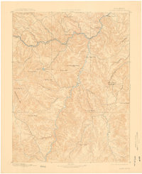
USGS Historical Topographic Map Collection · Public domain · the record · placed by its coordinates
Report this item
Hidden as soon as you tell us, everywhere it appears, before anyone reviews it.
Public domain, U.S. Geological Survey. The sheet shows the ground as the survey found it then, which is why a trail or road you know may be missing. Every sheet over this point, 1893 to 1994: USGS topoView.
In print since 1877
1877 Geologic Map of Colorado (Hayden), high-resolution scan · F. V. Hayden; scan by the Colorado Geological Survey · 1877
Geological and geographical atlas of Colorado and portions of adjacent territory · F. V. Hayden, U.S. Geological and Geographical Survey of the Territories · 1877
Free to read: public domain or government work. About South Platte as a whole, not this wall. More in the reading room.
From the archives
Photographs of this area held by the Library of Congress, oldest first. Every one carries the Library's own "no known restrictions on publication"; anything else is left out.


Library of Congress, Prints & Photographs Division · Public domain · the record · indexed to this place by the archive
Report this item
Hidden as soon as you tell us, everywhere it appears, before anyone reviews it.
Library of Congress, Prints & Photographs Division · Public domain · the record · found by place name, not yet checked
Report this item
Hidden as soon as you tell us, everywhere it appears, before anyone reviews it.
Photographs near this crag
Taken within 1.5 km of this crag's map point and published under a licence that lets us show them, from Wikimedia Commons. The coordinates say where the camera was, not what it was pointed at, so some of these will be the creek or the trail rather than the rock.


Wikimedia Commons · CC BY-SA · the record · placed by its coordinates
Report this item
Hidden as soon as you tell us, everywhere it appears, before anyone reviews it.
Wikimedia Commons · CC BY-SA · the record · placed by its coordinates
Report this item
Hidden as soon as you tell us, everywhere it appears, before anyone reviews it.
Wikimedia Commons · CC BY-SA · the record · placed by its coordinates
Report this item
Hidden as soon as you tell us, everywhere it appears, before anyone reviews it.
Wikimedia Commons · CC BY-SA · the record · placed by its coordinates
Report this item
Hidden as soon as you tell us, everywhere it appears, before anyone reviews it.
Wikimedia Commons · CC BY-SA · the record · placed by its coordinates
Report this item
Hidden as soon as you tell us, everywhere it appears, before anyone reviews it.
Routes
Antiflag Boulder
- 1 Drink V0
- 2 Drank V0
- 3 Punk V1
Blockhead Boulder
- 1 Shake the Tree! V0
- 2 Spider V0
- 3 Notintennies V-easy
- 4 Mission: Immossible V3
- 5 As God Intended V4
- 6 Nonsensical V2
- 7 Frog V1
Boulbous Boulder
- 1 Arete V2
- 2 Crimps V3-4
- 3 Corner Bulge V1-2
- 4 Upclimb the Downclimb V-easy
- 5 Smear'n Mantel V2
- 6 Bacon! V2
- 7 Moderate Face Problem V3-4
- 8 Undercling Problem V4-5
- 9 Crack Project V6+
- 10 Highball Slab V3
- 11 Easier Highball Slab V2
FAP ROP Boulder
- 1 MSB Crack V4
- 2 The Clipper (Stand) V2+
- 3 Unnamed V4
- 4 The Morning After V3
- 5 Fa-Fa-Face V6
Gumbi Boulder
- 1 Diggin' Potatoes V4
- 2 Ants on a Log V0
- 3 Hop-Scotch V0
- 4 Stretch Armstrong V0
- 5 Lincoln Logs V-easy
- 6 Chutes and Ladders V0
- 7 Sandbag V-easy
Main Area
- 1 Pyro Project V4+
- 2 Arsonist V2
Militant Whale Boulder
- 1 The Downside of Being Up V1
- 2 Fish Story V3
- 3 If I Were a Fish V1-2
- 4 Whale of a Fish V2-3
- 5 Girikin V2
- 6 Minnow V0
- 7 STP 2 V-easy
- 8 Bovine Feces V-easy
Missing Eitemiller
- 1 Carry These Dumbbells V3-
- 2 Mess of Wind Chimes V2
- 3 Green Tea Ice Cream V2
- 4 Green Tea Smoothie V2+
- 5 The Muffin Maiden V1+
- 6 The Girl Who Bailed V1
- 7 Dirty Defecation V1
- 8 The Tree Hugger V1+
Outlaw Wall
- 1 Reach for the Sky V4+
Punk's Not Dead Slab
- 1 Underclass Hero V0
- 2 Working Class Punk V0
- 3 The Bum V0
- 4 Ska Lives! V0
Renegade Boulder
- 1 Flashbang V2
- 2 Guerilla Warfare Project V6+
- 3 Double Barrel V1
- 4 Rampart Rebel V4
- 5 Tripwire V0
- 6 Bouncing Betty V2-3
- 7 Grenade V3
- 8 Machete V7+
Roadside Attractions
- 1 Adirondack Slap V4-
- 2 Adirondack Crack V7
Send Block
- 1 Frosted Flakes V3
- 2 Matt Damon Arete V5
Shadowboxing Boulder
- 1 Dead Ringer V0
- 2 Below the Belt V0
- 3 Haymaker V2
- 4 Underdog V1
- 5 Comeback Kid V4-5
- 6 Reigning Champ V2
- 7 Ramparty! V3
- 8 Uppercut V7+
- 9 Rope-a-dope Traverse V3
- 10 Backed in a Corner V2-3
- 11 TKO V1
- 12 Split Decision V5
Simpleton Slab
- 1 Asswagon V1
- 2 Lagwagon V0
Zoo, The
- 1 Giraffe V3
- 2 Longneck V4
- 3 Squirrel V3-4
- 4 Sidewinder V2
- 5 Rocklobster V2
- 6 Leapfrog V-easy
- 7 Slippery Salamander V3
Elsewhere at this crag
- Beaver Creek Buttcrack V0-1
- Defiance Project V4
- First Encounter V2
- Gastoner V4
- Jabba Ate a Mushroom V3
- Palindrome Traverse V1-2
- Pet the Parapet V0-1
- Project A V5+
- Sober Slab V1
- Take-a-Penny Traverse V6+
- Trix are for Kids V4
- Vindication Project V8
- When I Go Out V1
Photos from climbers
No photos here yet. If you're at the crag, yours would be the first.
Taken at the crag by climbers and published as they sent them. Each one's own location had to be within 0.5 km of this crag before we accepted it. See something that shouldn't be here? Use Report this photo under it and it's hidden at once. Anything else, write to us.
Conditions reported
Nothing reported recently.
Report what you see
Reports are dated and fade on their own: wet rock after 3 days, a bad bolt after a year. No names, no text.
Access & safety
The map point for this crag is on land managed by Pike National Forest (federal). It lies inside national forest.
Land manager from USGS PAD-US (public domain), read 2026-09-29. It is the manager of the crag's map point, which can be a long way from the wall. What you may do on the rock is the manager's to say, not ours.
Rules for all Pike-San Isabel National Forests land
- Fees
- No entrance fee for the Pike-San Isabel National Forests or the Cimarron and Comanche National Grasslands. Fees apply at campgrounds and day-use areas operated by the forest's concessionaire, paid on site.
- Overnight
- On the Leadville, Salida and San Carlos districts of the San Isabel, camping at any location within the same 20-mile radius for more than 14 days in a continuous 30-day period is prohibited. No camping within 100 feet of water outside a developed or designated site.
Read on Pike-San Isabel National Forests's own pages, checked 2026-09-29 by John Crawford. What they require, in full, or their own climbing page. These apply to the manager's whole holding; anything specific to this crag is above.
Keep Deep Cut Guide free
No ads, no paywall, no account. You can chip in directly to help keep it running.