The Bigfoots
39 routes and 70 boulder problems · granite (Pikes Peak Granite) · 9,482 ft
What's here
5.0 to 5.12, mostly around 5.9.
VB to V7, mostly around V1.
Counted from the 109 climbs here that carry a grade. Shown only where there are at least 5 of them — below that the shape is noise.
How well located
Base placed (one source) 2 Position on wall known 107
The order of the climbs along this wall is known from the open catalogue, so a few surveys go a long way: standing at Craftmatic, Special Olympian, Holy Moley (3 climbs, about 90 seconds on Saddle, The) would place up to 22 more climbs between them. Survey the wall →
“Up to” because the estimate between two surveyed routes is only used when they turn out to be close enough together on the ground.
Rock, from the geologic map
Rocks of Pikes Peak Batholith (1000-m.y. age group) (Pikes Peak Granite, Mount Rosa Granite, Windy Point Granite, Redskin Granite) — granite, alkali feldspar granite, minor quartz monzonite. Mesoproterozoic, about 1,600 to 1,000 million years old.
Includes Pikes Peak, Mount Rosa, Windy Point, and Redskin Granites and unnamed rocks
This is the map unit under this crag's map point, read from the 1:500,000 sheet (Horton and others, 2017, U.S. Geological Survey Data Series 1052). The point can be a few hundred metres from the rock, a cliff often stands on the line between two units, and at that scale a line on the map is about 500 m wide on the ground, so the wall itself may be the neighbouring unit. The rock named at the top of this page comes from the public geology of this area; this card is the map's answer. Every crag on this unit: Rocks of Pikes Peak Batholith (1000-m.y. age group). Geology data: Macrostrat (CC BY 4.0), serving USGS and Colorado Geological Survey maps.
On the map since 1893
The USGS has mapped this ground since 1893. 34 historical sheets cover this crag's map point; the oldest is below.
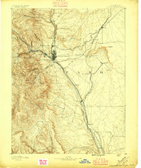
USGS Historical Topographic Map Collection · Public domain · the record · placed by its coordinates
Report this item
Hidden as soon as you tell us, everywhere it appears, before anyone reviews it.
Public domain, U.S. Geological Survey. The sheet shows the ground as the survey found it then, which is why a trail or road you know may be missing. Every sheet over this point, 1893 to 1994: USGS topoView.
In print since 1877
1877 Geologic Map of Colorado (Hayden), high-resolution scan · F. V. Hayden; scan by the Colorado Geological Survey · 1877
Geological and geographical atlas of Colorado and portions of adjacent territory · F. V. Hayden, U.S. Geological and Geographical Survey of the Territories · 1877
Free to read: public domain or government work. About South Platte as a whole, not this wall. More in the reading room.
From the archives
Photographs of this area held by the Library of Congress, oldest first. Every one carries the Library's own "no known restrictions on publication"; anything else is left out.


Library of Congress, Prints & Photographs Division · Public domain · the record · indexed to this place by the archive
Report this item
Hidden as soon as you tell us, everywhere it appears, before anyone reviews it.
Library of Congress, Prints & Photographs Division · Public domain · the record · found by place name, not yet checked
Report this item
Hidden as soon as you tell us, everywhere it appears, before anyone reviews it.
Routes
Animal Kingdom
- 1 Animal Hole V0
- 2 Nature's Rarities V2+
- 3 SeaWorld V1+
- 4 Burly Crack V1
- 5 Any Way You Slice It V2+
- 6 Padfoot V0
- 7 Storm The Castle V1+
Bear Den Boulder
- 1 Warm-up V0
- 2 Traverse V2
- 3 Reach for the Stars V4
- 4 Greasy Whale V0
Big Split Boulder
- 1 Dirty Jackson 5.9
Boat Boulder, The
- 1 Bow Crack V3+
- 2 Crow's Nest V1
Drug Boulder, The
- 1 Snicklefritz Slab V-easy
- 2 Corner Thug V2
- 3 Angel Dust V7
- 4 J's Arete V2
- 5 Crackhouse V4
- 6 Slugworth V1
Eastern Talus Field
- 1 Bear Shit V2
Magic Kingdom
- 1 It's A Small World 5.5
- 2 Dumbo Left 5.9
- 3 Dumbo Direct 5.10
- 4 Dumbo Right 5.9
- 5 Mouseketeer 5.0
- 6 Space Mountain 5.7
- 7 Flounder 5.6
- 8 Mowgli 5.7
- 9 Chiminey Cricket 5.8+
- 10 Pinnochi-Hole 5.11b
- 11 Simba Slab 5.9
- 12 Exit Through The Giftshop V1
Old Trad Tower
- 1 Dice Game 5.8
- 2 Crawling on All 4s 5.7+
- 3 Missed Exit 5.9
Saddle, The
- 1 Craftmatic V1+
- 2 Doozy V2
- 3 Smells Like Coffee V2+
- 4 Mossy The Snowman V3
- 5 Daydreamer V6
- 6 Funk 2 Funk V2+
- 7 Spiderman Crack V3-4
- 8 The Book Traverse V1
- 9 Hold Fire V4
- 10 Mighty Bite V2+
- 11 Tumbler V2
- 12 Go Dumb V2+
- 13 Special Olympian V4+
- 14 Happy Birthday V2
- 15 The Incisor V1
- 16 The Alex-izer V1+
- 17 Punkture V5
- 18 Ace's Arete V1+
- 19 Backscratcher V1+
- 20 Andrew's Crack V3
- 21 Pretend There's Rope V2
- 22 Warm-up Dihedral V1
- 23 Warm-up Slab V0+
- 24 Squatch V0
- 25 Holy Moley V2
Stacks, The
- 1 Horizontals 5.10a
- 2 Sneakfoot V1
- 3 Locals Only 5.12+
- 4 Cryptid V1+
- 5 La Fleur V1+
- 6 Littlefoot 5.4
- 7 Harry 5.9+
- 8 Happy Little Trees 5.4
- 9 Cow Punch 5.6
- 10 The Hendersons 5.7+
- 11 Sighting (Hendersons Right Var.) 5.10+
- 12 Elephant Shoulder 5.10b
- 13 Elephantiasis 5.10a
- 14 Butterface 5.10
- 15 The Fridge 5.9+
- 16 Chutes V0
- 17 Ladders V1
- 18 Lip Traverse V3
- 19 Easy Corner V-easy
- 20 Yheti V1
Talus Field
- 1 The Nose V1
- 2 Poppin' Tags V1
- 3 Kitana V1
- 4 Tractor Beam V0-1
- 5 Moonboots V1+
- 6 Bleed Green V4
- 7 The Campus Problem V4
- 8 Who Needs Crack? V3
- 9 The Monolith 5.10+
- 10 Old Greg V5
- 11 Curly Jefferson V2-
- 12 Neature Feature V3
- 13 Aspen V1+
- 14 Aspen Low V4+
- 15 Warmup Cracks V1
- 16 Pointework V5+
Toy Gun Buttress
- 1 Short Barrel 5.9+
- 2 T-Shirt Cannon 5.5
- 3 Cody's Scramble 5.4
- 4 Woody 5.8
- 5 There's A Snake In My Boot 5.8
- 6 Pop Cap 5.4
- 7 T.R. Burner 5.8
- 8 Chambered V0
- 9 Super Soaker Slab 5.2
- 10 Trigger 5.10
- 11 Small Game 5.9+
- 12 N.E.R.F. 5.4
Photos from climbers
No photos here yet. If you're at the crag, yours would be the first.
Taken at the crag by climbers and published as they sent them. Each one's own location had to be within 0.5 km of this crag before we accepted it. See something that shouldn't be here? Use Report this photo under it and it's hidden at once. Anything else, write to us.
Conditions reported
Nothing reported recently.
Report what you see
Reports are dated and fade on their own: wet rock after 3 days, a bad bolt after a year. No names, no text.
Access & safety
The map point for this crag is on land managed by Pike National Forest (federal). It lies inside national forest.
Land manager from USGS PAD-US (public domain), read 2026-09-29. It is the manager of the crag's map point, which can be a long way from the wall. What you may do on the rock is the manager's to say, not ours.
Rules for all Pike-San Isabel National Forests land
- Fees
- No entrance fee for the Pike-San Isabel National Forests or the Cimarron and Comanche National Grasslands. Fees apply at campgrounds and day-use areas operated by the forest's concessionaire, paid on site.
- Overnight
- On the Leadville, Salida and San Carlos districts of the San Isabel, camping at any location within the same 20-mile radius for more than 14 days in a continuous 30-day period is prohibited. No camping within 100 feet of water outside a developed or designated site.
Read on Pike-San Isabel National Forests's own pages, checked 2026-09-29 by John Crawford. What they require, in full, or their own climbing page. These apply to the manager's whole holding; anything specific to this crag is above.
Nearby, from OpenStreetMap
- Mapped parking
- 882 m away (map)
- Campsite
- Lone Duck Family Campground, 2,787 m away (map)
Distances are a straight line from this crag's map point, which can itself be hundreds of metres off; a road may be much longer. Mapped by OpenStreetMap contributors (ODbL), so a toilet missing here may simply be unmapped. Parking here is what OSM has drawn nearby, not a guidebook's directions.
Keep Deep Cut Guide free
No ads, no paywall, no account. You can chip in directly to help keep it running.