Pyramid Boulder
3 boulder problems · Quartz-feldspar gneiss · 7,054 ft
How well located
Position on wall known 2 Crag only 1
No route here has its own point yet. The map pin is the crag. At the wall? Survey it: 30 seconds per route.
Rock, from the geologic map
Quartz-feldspar gneiss. Paleoproterozoic, about 2,500 to 1,600 million years old.
Gray, dark-gray, white, pinkish-gray, and tan, moderately foliated to well-foliated, layered, fine- to coarse-grained (mostly medium grained) quartz-plagioclase-microcline-biotite gneiss. Proportion of minerals varies widely. Layers typically 10 cm to several tens of meters thick and commonly wavy. Locally contains layers of foliated monzogranite and granodiorite. May contain minor, thin layers of hornblende gneiss and amphibolite. Commonly migmatitic. U-Pb date on weakly foliated rock of monzogranitic composition in northwestern part of Indian Hills 7.5-minute quadrangle is 1,776±4 Ma. Weathers tan to pinkish tan in rounded outcrops. Crops out widely throughout map area
This is the map unit under this crag's map point, read from the 1:100,000 sheet (Kellogg and others, 2008, USGS Geologic Investigations Series 3000). The point can be a few hundred metres from the rock, a cliff often stands on the line between two units, and at that scale a line on the map is about 100 m wide on the ground, so the wall itself may be the neighbouring unit. Every crag on this unit: Quartz-feldspar gneiss. Geology data: Macrostrat (CC BY 4.0), serving USGS and Colorado Geological Survey maps.
On the map since 1899
The USGS has mapped this ground since 1899. 23 historical sheets cover this crag's map point; the oldest is below.
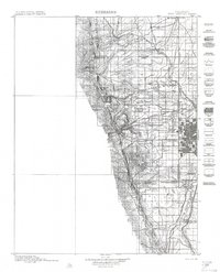
USGS Historical Topographic Map Collection · Public domain · the record · placed by its coordinates
Report this item
Hidden as soon as you tell us, everywhere it appears, before anyone reviews it.
Public domain, U.S. Geological Survey. The sheet shows the ground as the survey found it then, which is why a trail or road you know may be missing. Every sheet over this point, 1899 to 1983: USGS topoView.
Photographs near this crag
Taken within 1.5 km of this crag's map point and published under a licence that lets us show them, from Wikimedia Commons. The coordinates say where the camera was, not what it was pointed at, so some of these will be the creek or the trail rather than the rock.


Wikimedia Commons · CC BY-SA · the record · placed by its coordinates
Report this item
Hidden as soon as you tell us, everywhere it appears, before anyone reviews it.
Wikimedia Commons · CC BY-SA · the record · placed by its coordinates
Report this item
Hidden as soon as you tell us, everywhere it appears, before anyone reviews it.
Wikimedia Commons · CC BY-SA · the record · placed by its coordinates
Report this item
Hidden as soon as you tell us, everywhere it appears, before anyone reviews it.
Wikimedia Commons · CC BY-SA · the record · placed by its coordinates
Report this item
Hidden as soon as you tell us, everywhere it appears, before anyone reviews it.
Wikimedia Commons · CC BY-SA · the record · placed by its coordinates
Report this item
Hidden as soon as you tell us, everywhere it appears, before anyone reviews it.
Wikimedia Commons · CC BY-SA · the record · placed by its coordinates
Report this item
Hidden as soon as you tell us, everywhere it appears, before anyone reviews it.
Wikimedia Commons · CC BY-SA · the record · placed by its coordinates
Report this item
Hidden as soon as you tell us, everywhere it appears, before anyone reviews it.
Wikimedia Commons · CC BY-SA · the record · placed by its coordinates
Report this item
Hidden as soon as you tell us, everywhere it appears, before anyone reviews it.
Wikimedia Commons · CC BY-SA · the record · placed by its coordinates
Report this item
Hidden as soon as you tell us, everywhere it appears, before anyone reviews it.
Wikimedia Commons · CC BY-SA · the record · placed by its coordinates
Report this item
Hidden as soon as you tell us, everywhere it appears, before anyone reviews it.
Wikimedia Commons · CC BY-SA · the record · placed by its coordinates
Report this item
Hidden as soon as you tell us, everywhere it appears, before anyone reviews it.
Wikimedia Commons · CC BY-SA · the record · placed by its coordinates
Report this item
Hidden as soon as you tell us, everywhere it appears, before anyone reviews it.
Routes
Also within 3 km
- Fireblack Boulder313 m · 12 boulder problems · 6,731 ft · Fireblack Boulder
- What's With all These Tiny Trees? (WWATTT)572 m · 3 boulder problems · 6,506 ft · What's With all These Tiny Trees? (WWATTT)
- The Urban Alpine Crag793 m · 6 routes · 6,342 ft · Urban Alpine Crag, The
- Birds and the Bees918 m · 9 routes · 6,639 ft · Birds and the Bees
- Deer Creek Canyon Cave1,065 m · 1 boulder problem · 6,412 ft · Deer Creek Canyon Cave
- Deer Creek Crag1,249 m · 6 routes and 6 boulder problems · 6,416 ft · Deer Creek Crag
Straight line between the two crags' map points, each of which can be some way from its rock. For when this wall is full, or the sun has found it.
Photos from climbers
No photos here yet. If you're at the crag, yours would be the first.
Taken at the crag by climbers and published as they sent them. Each one's own location had to be within 0.5 km of this crag before we accepted it. See something that shouldn't be here? Use Report this photo under it and it's hidden at once. Anything else, write to us.
Conditions reported
Nothing reported recently.
Report what you see
Reports are dated and fade on their own: wet rock after 3 days, a bad bolt after a year. No names, no text.
Access & safety
The map point for this crag is on land managed by Jefferson County Open Space (local government), in Deer Creek Canyon Park. It lies inside local park.
Land manager from USGS PAD-US (public domain), read 2026-09-29. It is the manager of the crag's map point, which can be a long way from the wall. What you may do on the rock is the manager's to say, not ours.
Rules for all Jefferson County Parks & Open Space land
- Climbing permit
- Installing fixed hardware on a new route requires a permit: a Fixed Hardware Application, vetted by the Fixed Hardware Review Committee before the Climbing Committee decides.
- Hours
- Unlawful to be on Open Space land from one hour after sunset to one hour before sunrise, unless posted otherwise.
- Rules
- JCPOS does not install, maintain or inspect hardware related to rock climbing. Climbing ethics differ by park -- Clear Creek Canyon, the Cathedral Spires and the South Platte each have their own published guidelines.
- Overnight
- Camping by advance permit only, obtained online at least 24 hours ahead -- not at the park, headquarters or by phone. Only White Ranch and Reynolds Parks, tent-only.
- Dogs
- Dogs must be on a leash ten feet or less in length and under physical control.
Read on Jefferson County Parks & Open Space's own pages, checked 2026-09-29 by John Crawford. What they require, in full, or their own climbing page. These apply to the manager's whole holding; anything specific to this crag is above.
Nearby, from OpenStreetMap
- Toilets
- 1,506 m away (map)
Distances are a straight line from this crag's map point, which can itself be hundreds of metres off; a road may be much longer. Mapped by OpenStreetMap contributors (ODbL), so a toilet missing here may simply be unmapped. Parking here is what OSM has drawn nearby, not a guidebook's directions.
Keep Deep Cut Guide free
No ads, no paywall, no account. You can chip in directly to help keep it running.