West of Rustic
105 routes and 352 boulder problems · granite and gneiss · 8,107 ft
What's here
5.8 to 5.14, with no single grade dominating.
VB to V14, with no single grade dominating.
Counted from the 457 climbs here that carry a grade. Shown only where there are at least 5 of them — below that the shape is noise.
How well located
Base placed (one source) 42 Position on wall known 293 Crag only 122
The order of the climbs along this wall is known from the open catalogue, so a few surveys go a long way: standing at Poison Swoop, Wicked Pissah (2 climbs, about 60 seconds on Orange Wall) would place up to 11 more climbs between them. Survey the wall →
“Up to” because the estimate between two surveyed routes is only used when they turn out to be close enough together on the ground.
The guidebook for this area
Colorado Bouldering: Front Range - Phillip Benningfield, Matt Samet - 2020 every crag it covers
From the publisherBookshop.org
Bookshop.org links are affiliate links: if you buy through one we earn a commission, at no extra cost to you. Bookshop.org gives its profits to independent bookshops.
Poudre Canyon Rock Climbing Guide - Bennett Scott - 3rd ed. every crag it covers
From the publisherBookshop.org
Bookshop.org links are affiliate links: if you buy through one we earn a commission, at no extra cost to you. Bookshop.org gives its profits to independent bookshops.
The book has the topos, the descriptions and the local knowledge this page can't. Buying it helps support the people who know the crag best.
Rock, from the geologic map
Talus deposits — colluvium. Quaternary, younger than 781,000 years.
Large angular boulders and smaller rock fragments deposited chiefly by rock and snow avalanche, rock fall, rock slide, and debris flow at the base of cliffs and steep slopes where debris forms aprons, cones, and fan-shaped deposits. Unit locally includes rubbly scree deposits and probably tills of Holocene age near cirque headwalls (for example, Benedict, 1973a; Benson and others, 2007). Much of the talus in glaciated valleys and cirques postdates the retreat of Pinedale ice. Unit Qta is mapped chiefly in alpine and subalpine areas along the crest of the Medicine Bow Mountains and Never Summer Mountains, and in the upper part of the Cache la Poudre River valley upstream of Kinikinik. Small talus deposits adjacent or surrounded by colluvium (Qc) are mapped as colluvium. Estimated thickness is 3–15 m
This is the map unit under this crag's map point, read from the 1:100,000 sheet (Workman and others, 2018, U.S. Geological Survey Scientific Investigations Map 3399). The point can be a few hundred metres from the rock, a cliff often stands on the line between two units, and at that scale a line on the map is about 100 m wide on the ground, so the wall itself may be the neighbouring unit. The rock named at the top of this page comes from the public geology of this area; this card is the map's answer. Every crag on this unit: Talus deposits. Geology data: Macrostrat (CC BY 4.0), serving USGS and Colorado Geological Survey maps.
On the map since 1916
The USGS has mapped this ground since 1916. 19 historical sheets cover this crag's map point; the oldest is below.
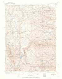
USGS Historical Topographic Map Collection · Public domain · the record · placed by its coordinates
Report this item
Hidden as soon as you tell us, everywhere it appears, before anyone reviews it.
Public domain, U.S. Geological Survey. The sheet shows the ground as the survey found it then, which is why a trail or road you know may be missing. Every sheet over this point, 1916 to 1980: USGS topoView.
In print since 1877
1877 Geologic Map of Colorado (Hayden), high-resolution scan · F. V. Hayden; scan by the Colorado Geological Survey · 1877
Geological and geographical atlas of Colorado and portions of adjacent territory · F. V. Hayden, U.S. Geological and Geographical Survey of the Territories · 1877
Free to read: public domain or government work. About Fort Collins as a whole, not this wall. More in the reading room.
From the archives
Photographs of this area held by the Library of Congress, oldest first. Every one carries the Library's own "no known restrictions on publication"; anything else is left out.


Library of Congress, Prints & Photographs Division · Public domain · the record · found by place name, not yet checked
Report this item
Hidden as soon as you tell us, everywhere it appears, before anyone reviews it.
Library of Congress, Prints & Photographs Division · Public domain · the record · found by place name, not yet checked
Report this item
Hidden as soon as you tell us, everywhere it appears, before anyone reviews it.
Library of Congress, Prints & Photographs Division · Public domain · the record · found by place name, not yet checked
Report this item
Hidden as soon as you tell us, everywhere it appears, before anyone reviews it.
Library of Congress, Prints & Photographs Division · Public domain · the record · found by place name, not yet checked
Report this item
Hidden as soon as you tell us, everywhere it appears, before anyone reviews it.
Library of Congress, Prints & Photographs Division · Public domain · the record · indexed to this place by the archive
Report this item
Hidden as soon as you tell us, everywhere it appears, before anyone reviews it.
Library of Congress, Prints & Photographs Division · Public domain · the record · indexed to this place by the archive
Report this item
Hidden as soon as you tell us, everywhere it appears, before anyone reviews it.
Library of Congress, Prints & Photographs Division · Public domain · the record · indexed to this place by the archive
Report this item
Hidden as soon as you tell us, everywhere it appears, before anyone reviews it.
Library of Congress, Prints & Photographs Division · Public domain · the record · indexed to this place by the archive
Report this item
Hidden as soon as you tell us, everywhere it appears, before anyone reviews it.
Library of Congress, Prints & Photographs Division · Public domain · the record · indexed to this place by the archive
Report this item
Hidden as soon as you tell us, everywhere it appears, before anyone reviews it.
Library of Congress, Prints & Photographs Division · Public domain · the record · indexed to this place by the archive
Report this item
Hidden as soon as you tell us, everywhere it appears, before anyone reviews it.
3 more at the Library of Congress.
Routes
Against Humanity
- 1 Crime V9
- 2 Against Humanity V6
- 3 Against Humanity Right V8-9
- 4 Dump Truck V10
Andromeda Bloc
- 1 Andromeda V14
Arete Boulder
- 1 Lance's Arete V3
- 2 Warm-up Arete V0+
Astronomy Wall
- 1 Meteor Mining 5.10c
- 2 Black Hole 5.11d
- 3 Wormhole 5.11a
- 4 Nova 5.11b
- 5 Oh' Ryan 5.11b
- 6 The Big Bang 5.11c
- 7 Andromeda Galaxy 5.10c
- 8 Farthest Planet 5.11b
- 9 Intergalactic 5.12b/c
- 10 Journey to Pluto 5.13b
- 11 Milky Way 5.10a
Attacking Hawk Crag
- 1 Attacking Hawk 5.12d
- 2 Grey Havens 5.11+
- 3 Cacophony Project - closed 5.13+
Balance Boulder
- 1 Nadeau's Got a Gun V3
- 2 Incredibly Impossible Possibly Possible Arete V10
Bat Boulder
- 1 Bat Outta Hell V5
- 2 Dracula V4
Big Bend
- 1 Rainmaker V7
- 2 Eye For An Eye V5
- 3 Blank Stare V8-9
- 4 Rain Shadow V3-4
- 5 Force of Habit V8
- 6 Creature of Habit V10
- 7 Day 1 V4
- 8 Hollow Heart Low V9+
- 9 Hollow Heart Stand V8-9
Blobulus Prime Bloc
- 1 Blobulus Prime V3
- 2 Meatball V2
Bonsai Boulder
- 1 Bonsai Blaster V8
Bop It Bloc
- 1 Bop It V3
- 2 Twist It V2
Bristlecone Castle
- 1 Path of Least Resistance 5.8
- 2 Golden Arete 5.10b/c
- 3 Red Dragon 5.13b
- 4 Guillotine 5.12a
- 5 Unnamed 5.10
- 6 Keyhole Cousins 5.10a/b
- 7 Unnamed 2 5.10
- 8 Green Dragon 5.11c
- 9 Iron Maiden 5.11c
- 10 Short Stack 5.12b
- 11 The Golden Shower 5.8+
- 12 Tech Savvy 5.11b
Cabin Fever Bloc
- 1 Cabin Fever V10
Calypso Bloc
- 1 Calypso V13
- 2 Medusa V10
Camelot Bloc
- 1 Camelot V6
Cavalry Boulder, The
- 1 All the King's Horses V6
- 2 All the King's Men V5
- 3 Cavalry V3
Classified
- 1 Classified V11
Clementine Bloc
- 1 Clementine V10
- 2 Bergamot V6
- 3 Kumquat Low V9
- 4 Kumquat V4
Cold Turkey Bloc
- 1 Purple Instagram Project V7
- 2 Cold Turkey V1
Cosmic Dawn Boulder
- 1 Cosmic Dawn V6
Couch Boulder, The
- 1 The Couch V4
- 2 Enigma V7
- 3 Couch Crack V0
- 4 Sweet Potato V7
Cove Wall
- 1 First in Appropriation 5.10b/c
- 2 First in Time 5.11b
- 3 First in Right 5.11b/c
Critical Mass
- 1 Escape Artist V8-9
Devil's Buddy Boulder
- 1 Devil's Advocate V5
Diamond Boulder
- 1 Diamonds Last Forever V10
- 2 Engagement V4
- 3 Lovers Quarrel V3
- 4 Bubbles V1
- 5 Lost Stone V1
Dippin' Dot Bloc
- 1 Dippin' Dot V10
- 2 Stinger V7
Drawbridge Boulder
- 1 Cut With A Sword V4
- 2 Drawbridge V5
- 3 Coat of Arms V7
Eiffel Tower Boulder
- 1 Eiffel Tower V1
Fish Food Boulder
- 1 Fish Food V8
Flapjack Bloc
- 1 Flapjack V5
Flowers Bloc
- 1 Flexecution V7
Fruit Loops Bloc
- 1 Fruit Loops V7
- 2 Toucan Sam V7
Gecko Boulder
- 1 FTP Arete V1
- 2 Executive Disorder V5
- 3 Gecko Grip V6
- 4 Green Gambini PROJECT V9+
Groblin Bloc
- 1 Left Groblin V5+
- 2 Groblin V5
Grotto Bloc
- 1 Sinkhole V7
- 2 Garden Feature V4
- 3 Root Canal V10
- 4 The Grotto V8
- 5 Toothless V8
- 6 Incisor V6
- 7 Unloaded V8
- 8 Reloaded V9
- 9 Kaleidoscope V9
- 10 Roygbiv V3
- 11 Limelight V3
- 12 Weenie Hut Jr. V5
Hall of Fame
- 1 Jamaica Plains 5.10d
- 2 Boston Commons 5.10c
- 3 84 Beacon Street 5.10a
- 4 Heartbreaker 5.12
- 5 Foreplay/Longtime 5.13-
- 6 Bunker Hill 5.12b
- 7 Southie Boyz 5.13b
- 8 Sidewalk Sam 5.8
- 9 Pratt's Arete 5.10d
Hatchery Rock
- 1 Unnamed V5 V4-5
- 2 North Face V3 V3
Horizon Wall
- 1 Chainsaw Massacre 5.12b
- 2 Porter Slab 5.8
- 3 Crazy Will 5.10b
- 4 Horizon Arete 5.11a
- 5 Puzzlebook 5.10c
Hornet's Nest Boulder
- 1 Touch of Death V9
- 2 Venom V8
- 3 The Usurper V2-3
Huggy Bear Bloc
- 1 Huggy Bear V7+
Isosceles Bloc
- 1 Isoceles V6
- 2 Tiger Shark V7
Jester Boulder, The
- 1 Jester V8
Jungle Booty Boulder
- 1 Wave Goodbye V7
King Fin
- 1 Gastoner V7-
- 2 King Fin V4
King's Boulder, The
- 1 Duchess V4
- 2 Squire V4+
- 3 The Last King V8
- 4 We Three Kings V8
- 5 Charlemagne Arete V9
- 6 Charlemagne V9
- 7 Chivalry V8
- 8 Start Something V0
Kingfin Crag
- 1 Prince Mushroom 5.8
- 2 Duke 5.11c
- 3 Dutchess 5.11b
- 4 Knight 5.11b
- 5 Esquire 5.10d
- 6 Queen's Gambit 5.12c
- 7 Baron 5.11c
- 8 Jughead 5.12a
- 9 Gentleman 5.11a
- 10 Lady 5.11a
Knight Boulder
- 1 When Angels Dance V4
Layer Cake Bloc
- 1 Layer Cake V10-
- 2 Creme Brulee V9
- 3 Sweet Tooth V2
Lead Belly
- 1 Lead Belly V11
- 2 Minnesota Sidekick V4
- 3 Lonely Luke V2
Lighthouse Bloc
- 1 The Lighthouse V5+
- 2 Lighthouse Sit V7+
- 3 Maritime V2
Magpie Boulder
- 1 Walk the Plank V6
- 2 Spear of Destiny V6
- 3 The Black Freighter V5
- 4 Magpie V8
Mars Boulder
- 1 Apollo 13 V4
- 2 Russian Space Monkey V4
- 3 The Martian V6+
Meadow Boulder
- 1 Breakaway V3
- 2 Hide and Seek V5
- 3 Finders Keepers V7
- 4 The Ramp V-easy
- 5 Beginner's Luck V0
Medallion Roof
- 1 Medallion V8
Mega-Bloks Wall
- 1 Whiskey Dickin 5.10c
- 2 Mega Bloks 5.8
- 3 Green Monster 5.9
Microverse Bloc
- 1 Miniverse V5
- 2 Microverse V8
Midnight Limousine Boulder
- 1 Paper Doll V5
- 2 Midnight Limousine V4
- 3 DemoBabe V7-
Moose Crag
- 1 Smoke Trail 5.12d
- 2 Bullwinkle 5.12c
- 3 Tonka 5.12b
- 4 Big, Black Moose 5.12b
- 5 Miguel 5.13b
Nectarine Bloc
- 1 Peachy Keen V4
- 2 Nectarine V9
Odyssey Bloc
- 1 The Iliad V3
- 2 The Odyssey V4
- 3 Homer V4
- 4 Queen Arete V4
- 5 Polyphemus V3
Omicron Roof
- 1 Omicronic V11
- 2 Old Stumpy V9
- 3 Stump Arete V8
- 4 Mudslide V4
Orange Wall
- 1 Poison Swoop 5.13b
- 2 Bean Town Beat Down 5.13a
- 3 Callan's Crack 5.12a
- 4 Callan's Ride 5.12b
- 5 Midnight Ride 5.13c/d
- 6 Tea Party 5.13a
- 7 Paul Revere 5.13d
- 8 Hayden House 5.10b
- 9 Cradle of Liberty 5.13c
- 10 J. F. K. 5.12a/b
- 11 Departed 5.12a
- 12 Staircase to Nowhere 5.12b
- 13 Wicked Pissah 5.13b
Panoramic Bloc
- 1 Panoramic V5
- 2 Dyno project V9
- 3 Screenshot V6
Paper Mache Bloc
- 1 Paper Mache Arete V3
- 2 Paper Mache V5
- 3 Elephant Man V5
Pyramid Boulder
- 1 Greens Keeper V5
Rain Clock Boulder
- 1 Rain Clock V6
- 2 Rain Clock Right V5
- 3 Sunspot V3
Rasta Boulder
- 1 Thigh Gap V4
Roaring Creek Boulder
- 1 Panty Line V8
- 2 Eyes of the World 5.13c
Robin Hood Boulder
- 1 Friar Tuck V7
- 2 Sir Hiss V6
- 3 Little John V7
- 4 Robin Hood V8
Rude Beauty
- 1 Rude Beauty V8
- 2 Quilling Me Rudely V10-
- 3 Quilling Me Softly V5
- 4 Warm Up V2-3
- 5 Doggy Style V9
- 6 Unnamed Arete V4
- 7 Soggy Doggy V2
Sleeping Elephant Campground
- 1 Commitment Issues V1
- 2 Fancy Feet V1-2
Snake Boulder
- 1 Undulator V1
- 2 Horridor V8
- 3 Snake in the Grass V3
Sorcerer's Boulder
- 1 Sorcerer's Stone V3
- 2 Foot Magic V0
- 3 Sorting Hat V1
South Ridge
- 1 Freedom Trail 5.10b
- 2 Marky Mark 5.12c/d
- 3 How Bout Dem Apples? 5.12b
- 4 Jolly Jane 5.13a
- 5 Donnie Loves Jenny 5.10d
- 6 Pura Aventura 5.11
- 7 Scorsese 5.14c
South Wall
- 1 Red Dawn 5.12c
- 2 Mellow Yellow 5.11b
- 3 Silver Salute 5.11c
- 4 Mirror Mirror 5.12-
Space Cadaver
- 1 Space Cadaver V4
Stand Up Boulder
- 1 Arête V3
- 2 Stand Up, Stay Classy V7
- 3 Walking Tall V8
Stematron Boulder
- 1 Enigma V9
- 2 Crystal Layback V4
- 3 Stematron V8
- 4 Obelisk SDS V7
- 5 Megatron V12
Stowaway Boulder
- 1 Wigwam V4
- 2 Stowaway V2
Sundial Boulder, The
- 1 Hourglass V3
- 2 Clockwork V0
- 3 Sundial V2
- 4 Rules of Engagement V5
Sunny Boulder
- 1 Speed of Light V12
- 2 Sunny V10-11
Sushi Boulder, The
- 1 Bluefin V5
- 2 Yellowtail V8
Swan Boulder, The
- 1 Cygnus V7
- 2 Branch Action V3
- 3 Treedigger V6+
- 4 Ugly Duck V1
- 5 Ducks in a Row V3
- 6 Swan V6
- 7 Grey Goose V10
- 8 Duckling V7
Telegraph Boulder
- 1 Tomahawk Chop V3-4
Thick Cuts Boulder
- 1 Thick Cuts V5
Thundercat Bloc
- 1 The Hoff V8
- 2 Thundercat V4
- 3 Bristlebeans V7
Turtle Crag
- 1 Golden Arete 5.12b
- 2 Tan Panel 5.11b
- 3 Consolation Prize 5.10b
- 4 Blue Streak 5.12a
- 5 Black Beast 5.13a
Turtlehead Boulder
- 1 Turtlehead V9
Tuxedo Boulder
- 1 Canadian Tuxedo V3
Underworld Bloc, The
- 1 Persephone V8
- 2 Telemachus V7
- 3 Hades V5
- 4 Sisyphus V6
Vista Crag
- 1 Streaky (OPEN PROJECT) 5.13+
- 2 Big Bad Beav 5.11c
- 3 Vista Cruiser 5.11b
- 4 Vista Cruiser Extension 5.12c
- 5 Straw Into Gold 5.13d
- 6 Easy Eukie 5.12a
- 7 Eukie Extension 5.13a
- 8 Eukie Arete 5.13a
- 9 Creme de la Poudre 5.14b
- 10 Slippery Slope 5.13c
- 11 Schwagn Wagon 5.11c
- 12 Three Ring Circus 5.12
- 13 Pocket Talk 5.12c
Void Bloc, The
- 1 Empty of Thought, Full of Mind V7
- 2 The Void Bop V3
Wang Jangler Boulder
- 1 Wang Jangler V4
Warm Up Boulder
- 1 Starcruiser V2-3
- 2 DaiseyStripper V2
- 3 Ryan's Rippling Calves V4
White Wall
- 1 Dihedron 5.11a
Elsewhere at this crag
- Acid House V9
- Acid House Direct V9
- Auldridge Jump Problem V2
- Backstop V3
- Bisher Traverse V7
- Bob on a Knob V1
- Bob on a Knob Dyno V2
- Braveheart V8-9
- Calamine Lotion V4
- Can Opener V9
- Castaway V11
- Cave Troll V5
- Chucky V5
- Chutes and Ladders V9
- Circadian Rythym (submited as Cyrcadian Rythym) V14
- Cletus Lives V2
- Cloudwalker (submitted as 420 crack) V11-12
- Crazy Cody V7
- Critical Mass V12
- Cronus V4
- Crushed Ice V1
- Crusher V5
- Defiance V6
- Devil Child V9
- Diamond Dogs V3
- Divergence V8-9
- Dixie Dingo V3
- Dutch Girl Dyno V5
- East Slab V0
- Emperor's New Clothes V7
- Exit Music V6
- F.A.S.T. (fuckin awesome stoner traverse) V8
- Fire Pit? V8
- Flamingo V3
- Flight Syndrome V9-
- From Hell V2
- Fuck You Finger V11
- Full Frontal V4
- Fuzzy V3
- Galaxy Express V5
- Gandalf V6
- Giggly Bits V0
- Grey Matter V9
- Grotto Corner V0
- Hank's Arete V4
- Hank's Lunge V5
- Harder They Come V9
- Hickman Over the Poudre Bridge V7
- Hole V2
- Hueco Hipppy V3
- Hummingbird Arete V8
- Hybris V6
- Inferno V12-13
- Iron Helix V6
- It's Ice V4
- Johnny and Hodgey V5
- Johnny and Hodgey Right Arete V0
- Left Arête V4
- Little Purple Flowers V3
- Little Red Volcano V2
- Lonely Bone V10
- Mel V3
- Merlin V7
- Moderate on Left Face (aka The Mace) (Mace Boulder) V3
- Moon Tiara Magic V3
- Mr. C V4-5
- Mr. Harry V4
- N Face of Warm-up Boulder V1
- NW Arete - Warm-up Boulder V2
- Nature Boy V5
- Nature King V1
- Oatmeal Bath V0
- Occam's Razor V9
- One Ton Ho V9
- Option Two V8
- Orcus V7
- Padlock V4
- Pat's Crack V9-10
- Pinch Problem V4
- Pit BBQ V6
- Prometheus V11
- Public Property V8
- Puffing Stone Direct V2-3
- Puffing Stone Traverse V5
- Purgatory V13-14
- Purple Haze V3
- Q-bert V1
- Rasor's Edge V3
- Rasta Font Trainer V7
- Room With No View V8
- SE Bulge of Puffing Stone V3
- SW Arete of "Chucky" Boulder V2
- SW Face of The Warm-up Boulder aka Party Trick V3-4
- Scarface V6
- Scuba Steve V6
- Serpentine V5-6
- Sharma Dyno V9
- Sharma Traverse (Direct) V4-5
- Short Chubby Demon V6
- Simple V6
- Slow Ride V3
- Smile V5
- Snoozer V5
- Sonic Alchemist V9
- Sonic Alchemist Stand V5
- Sonic Boom V7
- South Face of Warm-up Boulder V1
- Squeeze Problem V6
- Stickman Walking Over the Brooklyn Bridge V8
- Streamside Sloper Traverse V2
- The Black Problem V9
- The Brim V6
- The Perch V6
- The Satyr V5
- The Shepherd V7
- The Swedish Chef V2
- The Warm-up V3-
- Tilt V8
- Toaster V5
- Tollebooth Willy V8
- Tony the Tiger V6
- Tour de Jugs V2
- Traphouse V7
- Treefingers V2
- Tsunami V6-
- Tweaker Roof V8
- Uncle Blobulus V3
- Unknown V2-3
- Virga V2
- Warm Up Center V0-
- Warm-up V1
- Watch your six V5
- West Seam of Warm-up Boulder V1
- Where Are The Turtles? V1
- Where's the Catch V4
- Xerox V8
- Yellow V0
- You Snooze, You Lose V8
Photos from climbers
No photos here yet. If you're at the crag, yours would be the first.
Taken at the crag by climbers and published as they sent them. Each one's own location had to be within 0.5 km of this crag before we accepted it. See something that shouldn't be here? Use Report this photo under it and it's hidden at once. Anything else, write to us.
Conditions reported
Nothing reported recently.
Report what you see
Reports are dated and fade on their own: wet rock after 3 days, a bad bolt after a year. No names, no text.
Access & safety
The map point for this crag is on land managed by Roosevelt National Forest (federal). It lies inside wild and scenic river, inventoried roadless area, national forest.
Land manager from USGS PAD-US (public domain), read 2026-09-29. It is the manager of the crag's map point, which can be a long way from the wall. What you may do on the rock is the manager's to say, not ours.
Rules for all Arapaho and Roosevelt National Forests land
- Fees
- No entrance fee for the forest. Some locations require a reservation, pass, permit or day-use fee.
- Overnight
- Camping more than 14 days in a 30-day period, or more than 30 days in a 365-day period, is prohibited across the forests and the Pawnee National Grassland. Dispersed camping is within 300 feet of most Forest Service roads, on National Forest land; the MVUM shows which.
Read on Arapaho and Roosevelt National Forests's own pages, checked 2026-09-29 by John Crawford. What they require, in full, or their own climbing page. These apply to the manager's whole holding; anything specific to this crag is above.
Nearby, from OpenStreetMap
- Toilets
- 104 m away (map)
- Mapped parking
- 115 m away (map)
- Campsite
- Sleeping Elephant Campground, 3,489 m away (map)
Distances are a straight line from this crag's map point, which can itself be hundreds of metres off; a road may be much longer. Mapped by OpenStreetMap contributors (ODbL), so a toilet missing here may simply be unmapped. Parking here is what OSM has drawn nearby, not a guidebook's directions.
Keep Deep Cut Guide free
No ads, no paywall, no account. You can chip in directly to help keep it running.