Greyrock
67 routes and 6 boulder problems · granite and gneiss · 7,170 ft
What's here
5.5 to 5.12, with no single grade dominating.
V5 to V10, with no single grade dominating.
Counted from the 72 climbs here that carry a grade. Shown only where there are at least 5 of them — below that the shape is noise.
How well located
Base placed (one source) 3 Position on wall known 64 Crag only 6
The order of the climbs along this wall is known from the open catalogue, so a few surveys go a long way: standing at Trojan Romance, Two Minds Meet, Beer for Breakfast (3 climbs, about 90 seconds on South Slabs, The) would place up to 17 more climbs between them. Survey the wall →
“Up to” because the estimate between two surveyed routes is only used when they turn out to be close enough together on the ground.
The guidebook for this area
Colorado Bouldering: Front Range - Phillip Benningfield, Matt Samet - 2020 every crag it covers
From the publisherBookshop.org
Bookshop.org links are affiliate links: if you buy through one we earn a commission, at no extra cost to you. Bookshop.org gives its profits to independent bookshops.
Poudre Canyon Rock Climbing Guide - Bennett Scott - 3rd ed. every crag it covers
From the publisherBookshop.org
Bookshop.org links are affiliate links: if you buy through one we earn a commission, at no extra cost to you. Bookshop.org gives its profits to independent bookshops.
The book has the topos, the descriptions and the local knowledge this page can't. Buying it helps support the people who know the crag best.
Rock, from the geologic map
Biotite granite — syenogranite, monzogranite, granite. Mesoproterozoic, about 1,600 to 1,000 million years old.
Gray to buff, fine- to medium-grained, equigranular to seriate porphyritic biotite syenogranite to monzogranite, correlated with granite of Log Cabin batholith and other Silver Plume-type granites throughout the Front Range (Eggler and Braddock, 1988; Shaver and others, 1988); associated with smaller unnamed intrusive bodies and dikes. Color index generally 2 to 5. To the north of the Log Cabin batholith, unit forms an oval, irregular plug intruded into the Sherman Granite phases of the Virginia Dale ring-dike complex; intrusion age established as 1,390±30 Ma (Rb-Sr isochron; recalculated from Peterman and others, 1968). To the south and east of the Log Cabin batholith, unit includes numerous irregular shaped intrusive bodies and dikes along the 1.2 Ga (Abbott, 1972) Skin Gulch shear zone which might be displaced or satellitic bodies of the main Log Cabin batholith or may be separate plugs and dikes intruded between the Log Cabin and Longs Peak-St. Vrain batholiths. Unit is primarily porphyritic to south where equigranular phase (Yge) is mapped separately; includes mafic quartz monzonite of Abbott (1976)
This is the map unit under this crag's map point, read from the 1:100,000 sheet (Workman and others, 2018, U.S. Geological Survey Scientific Investigations Map 3399). The point can be a few hundred metres from the rock, a cliff often stands on the line between two units, and at that scale a line on the map is about 100 m wide on the ground, so the wall itself may be the neighbouring unit. The rock named at the top of this page comes from the public geology of this area; this card is the map's answer. Every crag on this unit: Biotite granite. Geology data: Macrostrat (CC BY 4.0), serving USGS and Colorado Geological Survey maps.
On the map since 1907
The USGS has mapped this ground since 1907. 17 historical sheets cover this crag's map point; the oldest is below.
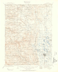
USGS Historical Topographic Map Collection · Public domain · the record · placed by its coordinates
Report this item
Hidden as soon as you tell us, everywhere it appears, before anyone reviews it.
Public domain, U.S. Geological Survey. The sheet shows the ground as the survey found it then, which is why a trail or road you know may be missing. Every sheet over this point, 1907 to 1980: USGS topoView.
In print since 1877
1877 Geologic Map of Colorado (Hayden), high-resolution scan · F. V. Hayden; scan by the Colorado Geological Survey · 1877
Geological and geographical atlas of Colorado and portions of adjacent territory · F. V. Hayden, U.S. Geological and Geographical Survey of the Territories · 1877
Free to read: public domain or government work. About Fort Collins as a whole, not this wall. More in the reading room.
From the archives
Photographs of this area held by the Library of Congress, oldest first. Every one carries the Library's own "no known restrictions on publication"; anything else is left out.


Library of Congress, Prints & Photographs Division · Public domain · the record · found by place name, not yet checked
Report this item
Hidden as soon as you tell us, everywhere it appears, before anyone reviews it.
Library of Congress, Prints & Photographs Division · Public domain · the record · found by place name, not yet checked
Report this item
Hidden as soon as you tell us, everywhere it appears, before anyone reviews it.
Library of Congress, Prints & Photographs Division · Public domain · the record · found by place name, not yet checked
Report this item
Hidden as soon as you tell us, everywhere it appears, before anyone reviews it.
Library of Congress, Prints & Photographs Division · Public domain · the record · found by place name, not yet checked
Report this item
Hidden as soon as you tell us, everywhere it appears, before anyone reviews it.
Library of Congress, Prints & Photographs Division · Public domain · the record · indexed to this place by the archive
Report this item
Hidden as soon as you tell us, everywhere it appears, before anyone reviews it.
Library of Congress, Prints & Photographs Division · Public domain · the record · indexed to this place by the archive
Report this item
Hidden as soon as you tell us, everywhere it appears, before anyone reviews it.
Library of Congress, Prints & Photographs Division · Public domain · the record · indexed to this place by the archive
Report this item
Hidden as soon as you tell us, everywhere it appears, before anyone reviews it.
Library of Congress, Prints & Photographs Division · Public domain · the record · indexed to this place by the archive
Report this item
Hidden as soon as you tell us, everywhere it appears, before anyone reviews it.
Library of Congress, Prints & Photographs Division · Public domain · the record · indexed to this place by the archive
Report this item
Hidden as soon as you tell us, everywhere it appears, before anyone reviews it.
Library of Congress, Prints & Photographs Division · Public domain · the record · indexed to this place by the archive
Report this item
Hidden as soon as you tell us, everywhere it appears, before anyone reviews it.
3 more at the Library of Congress.
Routes
Breakers
- 1 Destination' Planet Claire 5.8
- 2 Wonga, Wonga, Wonga 5.10
- 3 Armed Response 5.12b
- 4 Frightline 5.10a
- 5 The Medusa 5.10b
Deliverance Boulder
- 1 Hypercling V9
- 2 Pisces V8-
- 3 Frenchy Special V5-6
- 4 Frenchy Deliverance V6
- 5 Deliverance V10
Doghouse Boulder, The
- 1 Triple Dog Dare V6
Granite Sea
- 1 Turquoise Tubers 5.6
- 2 Ankles Away 5.10b
- 3 I Yam I Yam 5.8+
- 4 Rip Tide 5.8
- 5 Easy Sailing 5.6
Greyrock Summit Trail 946
- 1 Unknown Roofcrack Boulder 5.6
Northwest Slabs
- 1 Turbo Pup 5.10b
- 2 Squid Skid 5.8
- 3 Yellow Dihedral 5.8
- 4 Ribeye Flake 5.8+
- 5 Cows are People Too 5.9
- 6 Doctor Cow 5.11c
- 7 Cows in Space 5.10b
- 8 Stiffler's Mom 5.7+
- 9 Sky Crack 5.7
- 10 Paint it Sad 5.8
- 11 Bolted Arete 5.6
Ripple, The
- 1 Crack-a-Goo-Goo 5.8
South Slabs, The
- 1 Trojan Romance 5.11c
- 2 Dirty Love 5.10
- 3 Slab Happy 5.7
- 4 Wigs on Fire 5.10b
- 5 Blackstreak 5.11d
- 6 Wildstreak 5.10d
- 7 Grey Rat Rocksicle 5.8
- 8 Shadow Dance 5.7
- 9 Funkativity 5.7
- 10 Sugar Mountain 5.5
- 11 Fun Flake 5.6
- 12 Good Girls Don't 5.7+
- 13 Two Minds Meet 5.7
- 14 Aunt Edna's Costume Jewelry 5.7
- 15 Between Nothingness and Eternity 5.12a
- 16 Bad Boys Bolt 5.11
- 17 Black Market 5.11
- 18 Birdland 5.9
- 19 Jazzman (a.k.a. Turdland) 5.10a
- 20 Beer for Breakfast 5.9
Southeast Face
- 1 Alvin 5.6
- 2 Theodore 5.6
- 3 Simon 5.8
- 4 Mr. Gone 5.10-
- 5 Jetstream Deluxe 5.9
- 6 Rites of Passage 5.8
- 7 Greatest Route 5.8
- 8 Forward Never Straight (a.k.a. Shade of Grey) 5.9
- 9 Barfy's Favorite 5.7
- 10 Judy's Jaunt 5.7
- 11 Misty Mountain Hop 5.8
- 12 Central Chimney 5.5
- 13 Happy Wife, Happy Life 5.8-
- 14 Dancing Ladies 5.7
- 15 Inner Mountain Flame 5.11c
- 16 Black Dog 5.9
- 17 Keep the River Free 5.10a
- 18 Le Petit Francais 5.6
Elsewhere at this crag
- Go Spuds Go 5.12a/b
- Hang 12 5.10-
- The Gardener Did It 5.6
- Jamminy Crackit 5.11d
- Not the Greatest Route (But Still Fun). 5.7
- Raich's South Side Route Easy 5th
Also within 3 km
- The Crumbling Castle2,324 m · 1 route · 5,722 ft
- Pine Vu2,699 m · 4 routes and 21 boulder problems · 5,760 ft
Straight line between the two crags' map points, each of which can be some way from its rock. For when this wall is full, or the sun has found it.
Photos from climbers
No photos here yet. If you're at the crag, yours would be the first.
Taken at the crag by climbers and published as they sent them. Each one's own location had to be within 0.5 km of this crag before we accepted it. See something that shouldn't be here? Use Report this photo under it and it's hidden at once. Anything else, write to us.
Conditions reported
Nothing reported recently.
Report what you see
Reports are dated and fade on their own: wet rock after 3 days, a bad bolt after a year. No names, no text.
Access & safety
The map point for this crag is on land managed by Roosevelt National Forest (federal). It lies inside inventoried roadless area, national forest.
Land manager from USGS PAD-US (public domain), read 2026-09-29. It is the manager of the crag's map point, which can be a long way from the wall. What you may do on the rock is the manager's to say, not ours.
Rules for all Arapaho and Roosevelt National Forests land
- Fees
- No entrance fee for the forest. Some locations require a reservation, pass, permit or day-use fee.
- Overnight
- Camping more than 14 days in a 30-day period, or more than 30 days in a 365-day period, is prohibited across the forests and the Pawnee National Grassland. Dispersed camping is within 300 feet of most Forest Service roads, on National Forest land; the MVUM shows which.
Read on Arapaho and Roosevelt National Forests's own pages, checked 2026-09-29 by John Crawford. What they require, in full, or their own climbing page. These apply to the manager's whole holding; anything specific to this crag is above.
Nearby, from OpenStreetMap
- Campsite
- Unnamed, 2,130 m away (map)
Distances are a straight line from this crag's map point, which can itself be hundreds of metres off; a road may be much longer. Mapped by OpenStreetMap contributors (ODbL), so a toilet missing here may simply be unmapped. Parking here is what OSM has drawn nearby, not a guidebook's directions.
Keep Deep Cut Guide free
No ads, no paywall, no account. You can chip in directly to help keep it running.