The Quarry Wall
25 routes and 17 boulder problems · basalt · 6,226 ft
What's here
5.7 to 5.13, with no single grade dominating.
V0 to V5, with no single grade dominating.
Counted from the 42 climbs here that carry a grade. Shown only where there are at least 5 of them — below that the shape is noise.
How well located
Position on wall known 25 Crag only 17
No route here has its own point yet. The map pin is the crag. At the wall? Survey it: 30 seconds per route.
The order of the climbs along this wall is known from the open catalogue, so a few surveys go a long way: standing at Koolaid, Depression, The Mummy (3 climbs, about 90 seconds) would place up to 22 more climbs between them. Survey the wall →
“Up to” because the estimate between two surveyed routes is only used when they turn out to be close enough together on the ground.
The guidebook for this area
Golden Climbing Guide - Kevin Capps, Jason Haas - 2020 every crag it covers
From the publisherBookshop.org
Bookshop.org links are affiliate links: if you buy through one we earn a commission, at no extra cost to you. Bookshop.org gives its profits to independent bookshops.
The book has the topos, the descriptions and the local knowledge this page can't. Buying it helps support the people who know the crag best.
Rock, from the geologic map
Potassic basalt (shoshonite) lava flows. Paleocene, about 66 to 56 million years old.
Dark-gray, porphyritic flow rock containing small pheonocrysts of augite, plagioclase, magnetite, and olivine in a fine-grained matrix. Called mafic latite by Van Horn (1976), although only upper flows are latitic; basal flow is a trachytitic basalt. Formerly mapped as three flows on North Table Mountain and two flows on South Table Mountain (Van Horn, 1976); four total flows now recognized (Drewes, 2004). Clinkery bases and vesicular tops are visible, except on upper flow where top is eroded. Locally forms prominent cliffs. Cavities at some localities contain a variety of zeolite minerals (Ellemeier, 1947). Flows most likely erupted from Ralston Buttes area, about 5 km north of Golden. Interlayered with and considered here as members of Denver Formation. 40Ar/39Ar age of upper flow is 63.9±1.2 Ma (Obradovich, 2002). Flows are as thick as 30 m where they filled channels
This is the map unit under this crag's map point, read from the 1:100,000 sheet (Kellogg and others, 2008, USGS Geologic Investigations Series 3000). The point can be a few hundred metres from the rock, a cliff often stands on the line between two units, and at that scale a line on the map is about 100 m wide on the ground, so the wall itself may be the neighbouring unit. The rock named at the top of this page comes from the public geology of this area; this card is the map's answer. Every crag on this unit: Potassic basalt (shoshonite) lava flows. Geology data: Macrostrat (CC BY 4.0), serving USGS and Colorado Geological Survey maps.
On the map since 1899
The USGS has mapped this ground since 1899. 28 historical sheets cover this crag's map point; the oldest is below.
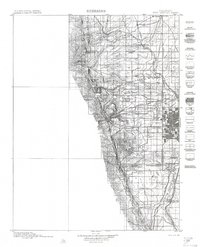
USGS Historical Topographic Map Collection · Public domain · the record · placed by its coordinates
Report this item
Hidden as soon as you tell us, everywhere it appears, before anyone reviews it.
Public domain, U.S. Geological Survey. The sheet shows the ground as the survey found it then, which is why a trail or road you know may be missing. Every sheet over this point, 1899 to 1983: USGS topoView.
In print since 1877
1877 Geologic Map of Colorado (Hayden), high-resolution scan · F. V. Hayden; scan by the Colorado Geological Survey · 1877
Geological and geographical atlas of Colorado and portions of adjacent territory · F. V. Hayden, U.S. Geological and Geographical Survey of the Territories · 1877
Trail and Timberline, volume 2 (1918) · Colorado Mountain Club · 1918
Free to read: public domain or government work. About Golden as a whole, not this wall. More in the reading room.
From the archives
Photographs of this area held by the Library of Congress, oldest first. Every one carries the Library's own "no known restrictions on publication"; anything else is left out.


Library of Congress, Prints & Photographs Division · Public domain · the record · found by place name, not yet checked
Report this item
Hidden as soon as you tell us, everywhere it appears, before anyone reviews it.
Library of Congress, Prints & Photographs Division · Public domain · the record · indexed to this place by the archive
Report this item
Hidden as soon as you tell us, everywhere it appears, before anyone reviews it.
Library of Congress, Prints & Photographs Division · Public domain · the record · indexed to this place by the archive
Report this item
Hidden as soon as you tell us, everywhere it appears, before anyone reviews it.
Photographs near this crag
Taken within 1.5 km of this crag's map point and published under a licence that lets us show them, from Wikimedia Commons. The coordinates say where the camera was, not what it was pointed at, so some of these will be the creek or the trail rather than the rock.


Wikimedia Commons · CC BY · the record · placed by its coordinates
Report this item
Hidden as soon as you tell us, everywhere it appears, before anyone reviews it.
Wikimedia Commons · CC BY · the record · placed by its coordinates
Report this item
Hidden as soon as you tell us, everywhere it appears, before anyone reviews it.
Wikimedia Commons · CC BY · the record · placed by its coordinates
Report this item
Hidden as soon as you tell us, everywhere it appears, before anyone reviews it.
Wikimedia Commons · CC BY · the record · placed by its coordinates
Report this item
Hidden as soon as you tell us, everywhere it appears, before anyone reviews it.
Wikimedia Commons · CC BY · the record · placed by its coordinates
Report this item
Hidden as soon as you tell us, everywhere it appears, before anyone reviews it.
Wikimedia Commons · CC BY · the record · placed by its coordinates
Report this item
Hidden as soon as you tell us, everywhere it appears, before anyone reviews it.
Wikimedia Commons · CC BY · the record · placed by its coordinates
Report this item
Hidden as soon as you tell us, everywhere it appears, before anyone reviews it.
Wikimedia Commons · CC BY-SA · the record · placed by its coordinates
Report this item
Hidden as soon as you tell us, everywhere it appears, before anyone reviews it.
Wikimedia Commons · CC BY-SA · the record · placed by its coordinates
Report this item
Hidden as soon as you tell us, everywhere it appears, before anyone reviews it.
Wikimedia Commons · CC BY-SA · the record · placed by its coordinates
Report this item
Hidden as soon as you tell us, everywhere it appears, before anyone reviews it.
Wikimedia Commons · CC BY · the record · placed by its coordinates
Report this item
Hidden as soon as you tell us, everywhere it appears, before anyone reviews it.
Wikimedia Commons · CC BY · the record · placed by its coordinates
Report this item
Hidden as soon as you tell us, everywhere it appears, before anyone reviews it.
2 more on Commons.
Routes
- 1 Koolaid 5.10
- 2 Crap Crags 5.8
- 3 Shark Jaw 5.7+
- 4 Sharkcicle 5.10b/c
- 5 Frank's Tame Years 5.11a
- 6 Frank's Wild Years 5.11
- 7 One Night 5.13c
- 8 Banquet 5.12b
- 9 Silver Bullet 5.11+
- 10 Bone Collector aka Bone Crusher 5.12
- 11 Kleptocracy 5.13-
- 12 Elephantiasis 5.13
- 13 Depression 5.10a/b
- 14 Recession 2016 5.12a
- 15 Recession Arete 5.11d
- 16 Eastern Heart 5.12a
- 17 Tough Love 5.12-
- 18 Marry Me, Becky 5.10b
- 19 Stimulus 5.12+
- 20 The Gnome 5.12
- 21 The Short Tour 5.10b
- 22 The Bowels 5.8
- 23 Offwidth Bulge 5.9+
- 24 Warm Up Crack 5.8
- 25 The Mummy 5.8
- Ace is High V4
- Afternoon Delight V2
- Alto V2
- Ankle Wrecker V2
- Blubber V0
- Comer Culo V2
- Finger Wrecker V2
- Moby Dick V6-
- Ode to the Lowball V4
- Pocket Rocket V4
- Scotland 'Wales' V4
- Something to Do V0
- South Arête V0
- Southwest Face V0
- The Big Phallic V4
- The Whale V2
- Yearling V1
Also within 3 km
- The East Quarry237 m · 53 routes and 3 boulder problems · 6,203 ft
- Child Free Zone (aka Parkway Crags)719 m · 26 routes and 1 boulder problem · 6,376 ft
- Brown Cloud Rocks860 m · 53 routes · 6,311 ft
- Overhang Area899 m · 40 routes · 6,341 ft
- Table Top Area948 m · 27 routes · 6,328 ft
- The Trad Lands992 m · 22 routes and 2 boulder problems · 6,324 ft
Straight line between the two crags' map points, each of which can be some way from its rock. For when this wall is full, or the sun has found it.
Photos from climbers
No photos here yet. If you're at the crag, yours would be the first.
Taken at the crag by climbers and published as they sent them. Each one's own location had to be within 0.5 km of this crag before we accepted it. See something that shouldn't be here? Use Report this photo under it and it's hidden at once. Anything else, write to us.
Conditions reported
Nothing reported recently.
Report what you see
Reports are dated and fade on their own: wet rock after 3 days, a bad bolt after a year. No names, no text.
Access & safety
The map point for this crag is on land managed by Jefferson County Open Space (local government), in North Table Mountain Park. It lies inside local park.
Land manager from USGS PAD-US (public domain), read 2026-09-29. It is the manager of the crag's map point, which can be a long way from the wall. What you may do on the rock is the manager's to say, not ours.
Rules for all Jefferson County Parks & Open Space land
- Climbing permit
- Installing fixed hardware on a new route requires a permit: a Fixed Hardware Application, vetted by the Fixed Hardware Review Committee before the Climbing Committee decides.
- Hours
- Unlawful to be on Open Space land from one hour after sunset to one hour before sunrise, unless posted otherwise.
- Rules
- JCPOS does not install, maintain or inspect hardware related to rock climbing. Climbing ethics differ by park -- Clear Creek Canyon, the Cathedral Spires and the South Platte each have their own published guidelines.
- Overnight
- Camping by advance permit only, obtained online at least 24 hours ahead -- not at the park, headquarters or by phone. Only White Ranch and Reynolds Parks, tent-only.
- Dogs
- Dogs must be on a leash ten feet or less in length and under physical control.
Read on Jefferson County Parks & Open Space's own pages, checked 2026-09-29 by John Crawford. What they require, in full, or their own climbing page. These apply to the manager's whole holding; anything specific to this crag is above.
Approach trail, from Jefferson County
North Table Loop in North Table Mountain Park passes 54 m from this crag's map point. The county rates it most difficult. Pets: yes.
A segment the county flags as climber access, drawn on the Take me there map. Where it leaves the trail for the base of the wall is the guidebook's to say, not ours.
Nearby, from OpenStreetMap
- Toilets
- 878 m away (map)
- Mapped parking
- 519 m away (map)
- Campsite
- Clear Creek RV Park, 2,968 m away (map)
Distances are a straight line from this crag's map point, which can itself be hundreds of metres off; a road may be much longer. Mapped by OpenStreetMap contributors (ODbL), so a toilet missing here may simply be unmapped. Parking here is what OSM has drawn nearby, not a guidebook's directions.
Keep Deep Cut Guide free
No ads, no paywall, no account. You can chip in directly to help keep it running.