Mt. Evans Bouldering
166 boulder problems · granodiorite (Mount Evans batholith) · 10,927 ft
What's here
V0 to V14, with no single grade dominating.
Counted from the 166 climbs here that carry a grade. Shown only where there are at least 5 of them — below that the shape is noise.
How well located
Base placed (one source) 2 Position on wall known 3 Crag only 161
The guidebook for this area
Mount Evans Bouldering - Jamie Emerson - 2022 ed. every crag it covers
The book has the topos, the descriptions and the local knowledge this page can't. Buying it helps support the people who know the crag best.
Rock, from the geologic map
Talus deposits. Quaternary, younger than 781,000 years.
Angular pebbles to large boulders deposited chiefly by rock and snow avalanche, rockfall, rock slide, and debris flow at base of cliffs and steep slopes where debris forms aprons, cones, and fan-shaped deposits. Locally includes debris flow and rubbly scree deposits. In cirques, locally includes tills of the Satanta Peak and Triple Lakes advances of Benedict (1985), about 12–10 ka (Davis, 1988), and tills of Holocene age near cirque headwalls (Benson and others, 2007). Much of the talus in glaciated valleys and cirques postdates the retreat of Pinedale ice. Some of the talus derived from the Fountain Formation (Phf) south of Boulder may be of middle Pleistocene age. Estimated thickness 3–15 m
This is the map unit under this crag's map point, read from the 1:100,000 sheet (Kellogg and others, 2008, USGS Geologic Investigations Series 3000). The point can be a few hundred metres from the rock, a cliff often stands on the line between two units, and at that scale a line on the map is about 100 m wide on the ground, so the wall itself may be the neighbouring unit. The rock named at the top of this page comes from the public geology of this area; this card is the map's answer. Every crag on this unit: Talus deposits. Geology data: Macrostrat (CC BY 4.0), serving USGS and Colorado Geological Survey maps.
On the map since 1903
The USGS has mapped this ground since 1903. 28 historical sheets cover this crag's map point; the oldest is below.
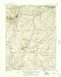
USGS Historical Topographic Map Collection · Public domain · the record · placed by its coordinates
Report this item
Hidden as soon as you tell us, everywhere it appears, before anyone reviews it.
Public domain, U.S. Geological Survey. The sheet shows the ground as the survey found it then, which is why a trail or road you know may be missing. Every sheet over this point, 1903 to 1983: USGS topoView.
In print since 1877
1877 Geologic Map of Colorado (Hayden), high-resolution scan · F. V. Hayden; scan by the Colorado Geological Survey · 1877
Geological and geographical atlas of Colorado and portions of adjacent territory · F. V. Hayden, U.S. Geological and Geographical Survey of the Territories · 1877
Mountaineering in Colorado: the peaks about Estes Park · Frederick H. Chapin · 1889
Trail and Timberline, volume 2 (1918) · Colorado Mountain Club · 1918
Mountaineering in the Rocky Mountain National Park · Roger W. Toll, U.S. National Park Service · 1919
Free to read: public domain or government work. About Alpine Rock as a whole, not this wall. More in the reading room.
From the archives
Photographs of this area held by the Library of Congress, oldest first. Every one carries the Library's own "no known restrictions on publication"; anything else is left out.

Library of Congress, Prints & Photographs Division · Public domain · the record · found by place name, not yet checked
Report this item
Hidden as soon as you tell us, everywhere it appears, before anyone reviews it.
Photographs near this crag
Taken within 1.5 km of this crag's map point and published under a licence that lets us show them, from Wikimedia Commons. The coordinates say where the camera was, not what it was pointed at, so some of these will be the creek or the trail rather than the rock.


Wikimedia Commons · CC BY-SA · the record · placed by its coordinates
Report this item
Hidden as soon as you tell us, everywhere it appears, before anyone reviews it.
Wikimedia Commons · CC BY-SA · the record · placed by its coordinates
Report this item
Hidden as soon as you tell us, everywhere it appears, before anyone reviews it.
Wikimedia Commons · CC BY-SA · the record · placed by its coordinates
Report this item
Hidden as soon as you tell us, everywhere it appears, before anyone reviews it.
Routes
Area B
- 1 Sunseeker V12
Hell's Hole
- 1 Black Corner V6
- 2 Golden V5
- 3 Abyss V7
Roadside Boulder
- 1 1 V1
Elsewhere at this crag
- 8 Equals D V8
- A Different Ben's Arete V6
- All Dogs Go To Evans V10
- And So It Goes V6
- Arete V9
- Banksy V9
- Behind the Eight Ball V8
- Ben's Arete V5
- Ben's Highball V4
- Ben's Roof V9
- Bierstadt V9+
- Bierstadt Corridor Arete V1
- Bierstadt Loh V9-10
- Big Perm V5
- Big Worm V14
- Black Streak V1
- Black Tornado V5
- Blackie V11
- Breeze Block V5
- Broken Arrow Dyno V6-7
- Broken Arrow Left V3
- Broken Arrow Right (FKA Anorexic Gymnast) V4+
- Cantalope Earmuffs V3
- Canvas V2
- Caressing Lovely Lumps V0
- Carl Spackler's Thumb (Name Unknown) V1
- Chalk on Rock V7
- Chalk on Rock Left V3
- Champagne Left V4
- Champagne Right V5
- Cherry Top Rip (mame unknown AKA Grey Face Moderate) V5
- Child Stars V12
- Chocolate Croissant V7
- Chrome V12
- Clan of the Cave Bears V13
- Clear Blue Skies V12
- Country Roads V5
- Cross Fire sit V5
- Crossfire V4
- Crystal Grip Pump V2
- Crystal Seam V2-3
- Dark Crystal V3
- Death Trout V13-
- Digging for Diamonds V4
- Dilithium Crystal V3
- Dismantling the Enemy V12
- Downtrail Face V6
- Dream Snatcher V8
- Eleventh Hour V5
- Emancipation Right V3-4
- Evil Backwards V13
- Fer Ire V5
- French Kiss V5
- Frosted Flakes V4
- Gateway V5-6
- Gateway Arete V3
- Gateway Face V5+
- Ground Control V11-12
- Guillotine V10-
- Heads or Tails V11
- Hollow Deception V8-9
- Honey Badger V11
- Jasper V2-3
- Jenny Craig V7-8
- Jiggle V8-9
- Jimmy’s Sweet Thang V11
- Kansas City Shuffle V1
- King Critter V10-11
- King Critter Sit V12-
- Kryptonite V8
- Lama V1
- Last of the Ohitians V1
- Laying In Wait V8
- Left of Bierstadt Arete V2
- Little Something for the Effort (Name Unknown) V2
- Love in an Elevator V5-6
- Ludders Pinch Low V7-8
- Ludders Pinch SDS V8-9
- Ludders' Pinch V7
- Maker's Mark V5
- Maker's Mark Low V8
- Mental Pollution V10
- Mental Pollution Low AKA Mental Masturbation V12
- Milk Is For Babies V4
- Mindsets A Threat V9
- Mirror Mask V10-
- Miss Kiwi V4
- Molli V1-2
- Mote in God’s Eye V13
- Nemesis V1-2
- No More Greener Grasses V12
- Now Nudda V11
- Ode to the Modern Man V14
- Ohitians Arete V3
- PK Warm-up V2
- Pat's Arete V7
- Peasants Into Leaders V7
- Phobos V11
- Pinch Me Squeeze Me V6
- Pinch Me Squeeze Me (Stand) V0
- Pink Fink V7
- Powder Keg V7
- Prehistoric Bird V6
- Public Execution V9-10
- Puddle Jumper V2
- Purple is Not a Color V10-
- Ramskull V9
- Rawhide V7
- Rebellion V9
- Red Herring V7
- Red Rum V2
- Red Rum SDS V4
- Right Arete Warm-up V0
- Rule #11 - Neck of My Skin V2
- Sacred Stones V2-3
- Seurat V8
- Shot Tower V5
- Silverback V10
- Snow White V7-8
- Steep Grades, Sharp Curves V5
- Summer Solstice V7
- Super Gui V11
- Tangerine Man V8
- Tattooed Teardrops V11
- The Alpenfrau V8
- The Brown Seam V4
- The Champagne Room V6
- The Dali Sit Down Start V9-
- The Dali Stand Start V6
- The Dali Warmup V1
- The Diving Board V1
- The Exfoliator V12
- The Gallery V8
- The Hammer V8
- The Horn Arete V3-4
- The Ladder V2
- The Last Drag V4
- The Quill V7
- The Rapier V7
- The Sober Stoner V7
- Thing Across From Bierstadt V3
- Think Mauve V5-6
- This Could Be Alright V4
- Tickfest V7
- Timeline V1
- Tomahawk V10
- Topher's Problem V1
- Touchdown Jesus V2
- Traverse V4
- Unknown V5 V5
- Useless Tools V7
- V1 V1
- V4 Left of Maker's Mark V4
- Vanilla Chip V0
- Vaporizer V7
- Warm Up V1
- World Famous Pow Wow V9
- Zorro V5-6
- Zorro Arete V6-7
- Zorro Warmup V1
- [Redacted] V1-2
Also within 3 km
- Possibility Area286 m · 12 routes · 11,606 ft
- Rock Hard Tower865 m · 2 routes · 11,952 ft
- Lincoln Lake Slabs2,114 m · 34 routes · 12,129 ft
- The Alpine Lite Cliffs2,395 m · 18 routes · 12,376 ft
Straight line between the two crags' map points, each of which can be some way from its rock. For when this wall is full, or the sun has found it.
Photos from climbers
No photos here yet. If you're at the crag, yours would be the first.
Taken at the crag by climbers and published as they sent them. Each one's own location had to be within 0.5 km of this crag before we accepted it. See something that shouldn't be here? Use Report this photo under it and it's hidden at once. Anything else, write to us.
Conditions reported
Nothing reported recently.
Report what you see
Reports are dated and fade on their own: wet rock after 3 days, a bad bolt after a year. No names, no text.
Access & safety
The map point for this crag is on land managed by Arapaho National Forest (federal). It lies inside wilderness area, national forest.
Land manager from USGS PAD-US (public domain), read 2026-09-29. It is the manager of the crag's map point, which can be a long way from the wall. What you may do on the rock is the manager's to say, not ours.
Rules for all Arapaho and Roosevelt National Forests land
- Fees
- No entrance fee for the forest. Some locations require a reservation, pass, permit or day-use fee.
- Overnight
- Camping more than 14 days in a 30-day period, or more than 30 days in a 365-day period, is prohibited across the forests and the Pawnee National Grassland. Dispersed camping is within 300 feet of most Forest Service roads, on National Forest land; the MVUM shows which.
Read on Arapaho and Roosevelt National Forests's own pages, checked 2026-09-29 by John Crawford. What they require, in full, or their own climbing page. These apply to the manager's whole holding; anything specific to this crag is above.
Keep Deep Cut Guide free
No ads, no paywall, no account. You can chip in directly to help keep it running.