Devil's Canyon
57 routes · clastic (Kayenta Formation, with sandstone, shale) · 5,480 ft
What's here
5.4 to 5.11, mostly around 5.10.
Counted from the 57 climbs here that carry a grade. Shown only where there are at least 5 of them — below that the shape is noise.
How well located
Base placed (one source) 1 Position on wall known 51 Crag only 5
The order of the climbs along this wall is known from the open catalogue, so a few surveys go a long way: standing at Kimbo Slice, "Thug" Rose Namajunas (2 climbs, about 60 seconds on UFC Wall) would place up to 11 more climbs between them. Survey the wall →
“Up to” because the estimate between two surveyed routes is only used when they turn out to be close enough together on the ground.
Rock, from the geologic map
Kayenta Formation — clastic; sandstone; shale; siltstone. Early Jurassic, about 200 to 189 million years old.
Irregularly interbedded red, buff, and gray fine- to coarse-grained sandstone and lavender shale and siltstone. Thin beds of limestone-pebble and shale-pellet conglomerate locally present. Thickness 0 to 200 ft.
This is the map unit under this crag's map point, read from the 1:100,000 sheet (Day and others, 1999, U.S. Geological Survey Open-File Report 99-0427). The point can be a few hundred metres from the rock, a cliff often stands on the line between two units, and at that scale a line on the map is about 100 m wide on the ground, so the wall itself may be the neighbouring unit. Every crag on this unit: Kayenta Formation. Geology data: Macrostrat (CC BY 4.0), serving USGS and Colorado Geological Survey maps.
On the map since 1956
The USGS has mapped this ground since 1956. 14 historical sheets cover this crag's map point; the oldest is below.
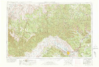
USGS Historical Topographic Map Collection · Public domain · the record · placed by its coordinates
Report this item
Hidden as soon as you tell us, everywhere it appears, before anyone reviews it.
Public domain, U.S. Geological Survey. The sheet shows the ground as the survey found it then, which is why a trail or road you know may be missing. Every sheet over this point, 1956 to 1981: USGS topoView.
In print since 1877
1877 Geologic Map of Colorado (Hayden), high-resolution scan · F. V. Hayden; scan by the Colorado Geological Survey · 1877
Geological and geographical atlas of Colorado and portions of adjacent territory · F. V. Hayden, U.S. Geological and Geographical Survey of the Territories · 1877
Free to read: public domain or government work. About Grand Junction Area as a whole, not this wall. More in the reading room.
Routes
COVID Castle
- 1 Devil's Delight 5.8
- 2 Stimulus Check 5.11
- 3 Quarantine Cave 5.10
- 4 Vaccine Card 5.10-
- 5 Unvaccinated Travel 5.11
- 6 Moderna 5.11-
- 7 Stay at Home Order 5.11
- 8 Social D Chimney 5.10
D3 West Side Trail
- 1 Ale House 5.11+
D6 Loop
- 1 Unknown 5.8
- 2 Caribbean Queen 5.9
- 3 Turdle 5.10+
Devil's Gate Tower
- 1 Death of Panduva 5.11
- 2 Genesha 5.9+
- 3 Virgin Sacrifice 5.10
- 4 Budda's Belly 5.10
- 5 North Face 5.11
- 6 Hanuman 5.7+
- 7 Panduva 5.10
Mystery Wall
- 1 "Mystery Line" 5.10+
No Mans Land
- 1 Mark IV 5.9+
- 2 Brodie 5.10a
- 3 Over The Top 5.9+
- 4 Trench Foot 5.9
Phantom Spire
- 1 Kurukshetra 5.9
- 2 Vyasa 5.10+
- 3 Kit Carson Crack 5.10
Sedit Slabs
- 1 Naamah 5.8+
- 2 Mantus 5.9
- 3 Escape From Hell (1980) 5.10+
- 4 Tenebrion 5.9
Slabs, The
- 1 Chhipakalee Mandir 5.11-
- 2 The Hole Way 5.6
- 3 Slab 1a 5.9-
- 4 Beta Max 5.10a/b
- 5 Night Crawler 5.10+
- 6 Budget Corner 5.5
- 7 Morning Ride 5.10c/d
- 8 White Spice 5.7+
- 9 Pip's Gully 5.4
UFC Wall
- 1 Kimbo Slice 5.8+
- 2 Christos Anesti 5.10
- 3 Chuck Liddel 5.9+
- 4 Peanut Butter Falcon 5.11
- 5 Glass Joe 5.8
- 6 Testostikleeze 5.10+
- 7 Weili Zhang 5.9+
- 8 Ken Shamrock 5.10
- 9 Conor McGregor 5.8+
- 10 Demetrious "Mighty Mouse" Johnson 5.11-
- 11 Anderson "The Spider" Silva 5.11
- 12 Spider Start 5.9
- 13 "Thug" Rose Namajunas 5.11
Elsewhere at this crag
- Pitchfork Tower - From the Depths of Hell 5.8
- Devil's Disciple I 5.10
- Devil's Disciple II 5.10+
- Failed Exorcism Arch - The Power of Christ Compels You 5.9
Also within 3 km
- Slab Boulder1,979 m · 5 boulder problems · 4,891 ft · McInnis Canyon Bouldering
- Kodel's Canyon2,210 m · 2 routes · 4,824 ft
- Ahab Tower2,628 m · 1 route · 5,793 ft · Colorado National Monument
- Fruita Canyon2,628 m · 11 routes · 5,793 ft · Colorado National Monument
- No Thoroughfare Canyon2,628 m · 15 routes · 5,793 ft · Colorado National Monument
- Other areas2,628 m · 4 routes · 5,793 ft · Colorado National Monument
Straight line between the two crags' map points, each of which can be some way from its rock. For when this wall is full, or the sun has found it.
Photos from climbers
No photos here yet. If you're at the crag, yours would be the first.
Taken at the crag by climbers and published as they sent them. Each one's own location had to be within 0.5 km of this crag before we accepted it. See something that shouldn't be here? Use Report this photo under it and it's hidden at once. Anything else, write to us.
Conditions reported
Nothing reported recently.
Report what you see
Reports are dated and fade on their own: wet rock after 3 days, a bad bolt after a year. No names, no text.
Access & safety
The map point for this crag is on land managed by Bureau of Land Management (federal), in Grand Junction Field Office. It lies inside wilderness area, national conservation area.
Land manager from USGS PAD-US (public domain), read 2026-09-29. It is the manager of the crag's map point, which can be a long way from the wall. What you may do on the rock is the manager's to say, not ours.
Rules for all Bureau of Land Management land
- Fees
- Developed campgrounds are fee sites: at Shelf Road, Sand Gulch is $20 a night for an individual site and $40 for a group site, with no drinking water, hook-ups or trash service. Where a fee area is posted, you must register and pay within 30 minutes of entering it.
- Overnight
- Camping more than 14 days in any 30-day period at any one location is prohibited, including in a campground, and afterwards you must move at least 30 air miles. Personal property may not be left unattended anywhere on public land for more than 48 hours.
Read on Bureau of Land Management's own pages, checked 2026-09-29 by John Crawford. What they require, in full, or their own climbing page. These apply to the manager's whole holding; anything specific to this crag is above.
Nearby, from OpenStreetMap
- Campsite
- Saddlehorn Campground (Loop A and Loop B), 2,749 m away (map)
Distances are a straight line from this crag's map point, which can itself be hundreds of metres off; a road may be much longer. Mapped by OpenStreetMap contributors (ODbL), so a toilet missing here may simply be unmapped. Parking here is what OSM has drawn nearby, not a guidebook's directions.
Keep Deep Cut Guide free
No ads, no paywall, no account. You can chip in directly to help keep it running.