Arthur's Rock
31 routes and 69 boulder problems · Porphyroblastic Biotite Schist · 6,677 ft
What's here
5.5 to 5.13, mostly around 5.11.
VB to V12, mostly around V2.
Counted from the 100 climbs here that carry a grade. Shown only where there are at least 5 of them — below that the shape is noise.
How well located
Base placed (one source) 4 Position on wall known 96
The order of the climbs along this wall is known from the open catalogue, so a few surveys go a long way: standing at Corridor Project, Kiddy Pool, Sunrise (3 climbs, about 90 seconds on South Face of Arthur's Rock) would place up to 17 more climbs between them. Survey the wall →
“Up to” because the estimate between two surveyed routes is only used when they turn out to be close enough together on the ground.
Rock, from the geologic map
Porphyroblastic Biotite Schist. about 4,000 to 541 million years old.
Characterized by abundant porphyroblasts of coarse biotite
This is the map unit under this crag's map point, read from the 1:100,000 sheet (Colton, Roger B., 1976, U.S. Geological Survey Geologic Investigations Series I-855-G). The point can be a few hundred metres from the rock, a cliff often stands on the line between two units, and at that scale a line on the map is about 100 m wide on the ground, so the wall itself may be the neighbouring unit. Every crag on this unit: Porphyroblastic Biotite Schist. Geology data: Macrostrat (CC BY 4.0), serving USGS and Colorado Geological Survey maps.
On the map since 1906
The USGS has mapped this ground since 1906. 31 historical sheets cover this crag's map point; the oldest is below.
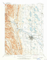
USGS Historical Topographic Map Collection · Public domain · the record · placed by its coordinates
Report this item
Hidden as soon as you tell us, everywhere it appears, before anyone reviews it.
Public domain, U.S. Geological Survey. The sheet shows the ground as the survey found it then, which is why a trail or road you know may be missing. Every sheet over this point, 1906 to 1980: USGS topoView.
In print since 1877
1877 Geologic Map of Colorado (Hayden), high-resolution scan · F. V. Hayden; scan by the Colorado Geological Survey · 1877
Geological and geographical atlas of Colorado and portions of adjacent territory · F. V. Hayden, U.S. Geological and Geographical Survey of the Territories · 1877
Free to read: public domain or government work. About Fort Collins as a whole, not this wall. More in the reading room.
From the archives
Photographs of this area held by the Library of Congress, oldest first. Every one carries the Library's own "no known restrictions on publication"; anything else is left out.


Library of Congress, Prints & Photographs Division · Public domain · the record · found by place name, not yet checked
Report this item
Hidden as soon as you tell us, everywhere it appears, before anyone reviews it.
Library of Congress, Prints & Photographs Division · Public domain · the record · found by place name, not yet checked
Report this item
Hidden as soon as you tell us, everywhere it appears, before anyone reviews it.
Library of Congress, Prints & Photographs Division · Public domain · the record · found by place name, not yet checked
Report this item
Hidden as soon as you tell us, everywhere it appears, before anyone reviews it.
Library of Congress, Prints & Photographs Division · Public domain · the record · found by place name, not yet checked
Report this item
Hidden as soon as you tell us, everywhere it appears, before anyone reviews it.
Library of Congress, Prints & Photographs Division · Public domain · the record · indexed to this place by the archive
Report this item
Hidden as soon as you tell us, everywhere it appears, before anyone reviews it.
Library of Congress, Prints & Photographs Division · Public domain · the record · indexed to this place by the archive
Report this item
Hidden as soon as you tell us, everywhere it appears, before anyone reviews it.
Library of Congress, Prints & Photographs Division · Public domain · the record · indexed to this place by the archive
Report this item
Hidden as soon as you tell us, everywhere it appears, before anyone reviews it.
Library of Congress, Prints & Photographs Division · Public domain · the record · indexed to this place by the archive
Report this item
Hidden as soon as you tell us, everywhere it appears, before anyone reviews it.
Library of Congress, Prints & Photographs Division · Public domain · the record · indexed to this place by the archive
Report this item
Hidden as soon as you tell us, everywhere it appears, before anyone reviews it.
Library of Congress, Prints & Photographs Division · Public domain · the record · indexed to this place by the archive
Report this item
Hidden as soon as you tell us, everywhere it appears, before anyone reviews it.
3 more at the Library of Congress.
Photographs near this crag
Taken within 1.5 km of this crag's map point and published under a licence that lets us show them, from Wikimedia Commons. The coordinates say where the camera was, not what it was pointed at, so some of these will be the creek or the trail rather than the rock.


Wikimedia Commons · CC BY-SA · the record · placed by its coordinates
Report this item
Hidden as soon as you tell us, everywhere it appears, before anyone reviews it.
Wikimedia Commons · CC0 · the record · placed by its coordinates
Report this item
Hidden as soon as you tell us, everywhere it appears, before anyone reviews it.
Routes
Beast Boulder
- 1 Stoic Wonder V4
- 2 The Beast House V9
Big Reach Boulder
- 1 Big Reach Arete V7
Childbirth (Area at Arthur's Rock)
- 1 Gremlin Arete V0-1
- 2 Child Birth V8
- 3 Tears of a Clown 5.12b
Crystal Pinch Boulder
- 1 Crystal Pinch V2
Dingus Boulder
- 1 Traverse V2
- 2 Mangino Dyno V2
Drunken Master Boulder
- 1 Fingerlock Campus Mantel V3
- 2 Ode to Failure V8
- 3 Gravities Rainbow 5.12b
- 4 Last Resort V5
- 5 Drunken Master V2
- 6 Added Planet V10
- 7 Brick Pinch V11
- 8 Triton V11-12
Fog That Surrounds Boulder, The
- 1 North Face Arête V2
- 2 Tall Crack V0
- 3 North Face V0+
- 4 Scoo V0
- 5 North Face Crack V0
- 6 Fog Arête V1
- 7 The Fog That Surrounds V7
- 8 Silence V5
- 9 Vida V5
Godzilla Boulder
- 1 Mainstreet V5
- 2 Four Dollar Arete V11
- 3 Godzilla V7
- 4 Sir Arthur's Lunge V4
Hank's Roof
- 1 Hank’s Cave Problem V8
Lizard Boulder
- 1 Drew’s Toe Knuckles V2
- 2 Lizard Tamer V7
Marble Boulder
- 1 Sit Start Roof V2
- 2 Corner Crack V2
Mole People Boulder
- 1 Highball Crack V2
- 2 Mole People V6
Overlook (Arthur's Rock), The
- 1 Lagunita 5.10a/b
- 2 Mossy Moe 5.10-
- 3 'Old School Route' 5.7
- 4 Black Dog 5.8
- 5 Crystal Pinch 5.11
- 6 Green Sky 5.11
- 7 The Giggle Maker 5.11+
- 8 Overview Effect 5.10a
- 9 Overpopulation 5.10
Parking Lot Wall (Arthur's Rock)
- 1 Fran's Slopey Mantel V2
- 2 Easy Flake V1
- 3 Corner Crack V0
- 4 Easy Edges V1
- 5 Voodoo Lady V5
Sister Boulder
- 1 Blokky Traverse V1
- 2 Blokky Behind V1-
- 3 Left Face - Left Side V0
- 4 Sister Boulder - Left Face V-easy
Snake and the Skewer
- 1 Shotput V7-8
- 2 Block Pinch V4
- 3 Snake and the Skewer V7
- 4 Everett Overhang V5
- 5 Onsight V4
- 6 Southeast Arete V1
- 7 Handcrack V0
South Face of Arthur's Rock
- 1 Corridor Project 5.13+
- 2 Blackish Blobs 5.8
- 3 Excellent Adventure 5.11+
- 4 The Great Corner 5.9
- 5 The Great Variant 5.10a
- 6 Rocksie Rocks 5.12c
- 7 Owl Roof 5.12c
- 8 Doom Corner 5.12b
- 9 Big, Bad Book 5.11b
- 10 Goldeneye 5.11c/d
- 11 Water Fountain 5.11a
- 12 Mono Matt 5.11+
- 13 Kiddy Pool 5.8
- 14 Front Gate 5.7
- 15 Edge Of Time 5.11c
- 16 Intestinal Fortitude 5.11b
- 17 Right of Passage 5.9
- 18 Sunset (submitted as Mole Rat Crack) 5.6
- 19 Sunday Morning Coming Down 5.7
- 20 Sunrise 5.5
Syringe Boulder
- 1 The Enchanting Wizard of Rhythm V8
- 2 Frenchy and the Burglar V9-
- 3 Overdose V12
- 4 The Syringe V6
- 5 Floater V7-
- 6 Moby's Traverse V3-4
- 7 Moby's Razor V7
Vulture Boulder
- 1 Hummingbird V2
- 2 Janitor Shift V7
Warm-Up Boulder
- 1 The Vice V10
- 2 Le Crimp V9-
- 3 Hank's Pinchers V5
- 4 Clutch (aka Double Clutch) V7
- 5 Sherman Pinch Problem V2
- 6 Warmup Layback V1
- 7 Pinchy Warmup V3
- 8 Shady Arete V3
Elsewhere at this crag
- Zeus V5
Also within 3 km
- Nature Trail Boulders883 m · 5 boulder problems · 5,841 ft
- Mill Creek Wall1,143 m · 6 boulder problems · 5,785 ft
- Orchard Cove1,399 m · 6 boulder problems · 5,574 ft
- Eltuck Bay1,803 m · 16 boulder problems · 5,504 ft
- The Land of the Overhangs2,323 m · 7 boulder problems · 5,398 ft · Horsetooth Reservoir
- Party Cove2,323 m · 1 boulder problem · 5,398 ft · Horsetooth Reservoir
Straight line between the two crags' map points, each of which can be some way from its rock. For when this wall is full, or the sun has found it.
Photos from climbers
No photos here yet. If you're at the crag, yours would be the first.
Taken at the crag by climbers and published as they sent them. Each one's own location had to be within 0.5 km of this crag before we accepted it. See something that shouldn't be here? Use Report this photo under it and it's hidden at once. Anything else, write to us.
Conditions reported
Nothing reported recently.
Report what you see
Reports are dated and fade on their own: wet rock after 3 days, a bad bolt after a year. No names, no text.
Access & safety
The map point for this crag is on land managed by Colorado Parks & Wildlife (state), in Lory State Park. It lies inside state park.
Land manager from USGS PAD-US (public domain), read 2026-09-29. It is the manager of the crag's map point, which can be a long way from the wall. What you may do on the rock is the manager's to say, not ours.
Rules for all Colorado Parks & Wildlife land
- Fees
- Every Colorado state park requires an entrance pass for motor vehicles. A daily vehicle pass is $4 to $17 depending on the park; an individual pass covers entry on foot or bike.
- Reservations
- Eldorado Canyon runs timed-entry vehicle reservations on summer weekends and holidays; see the park's own page. Other parks do not require one to enter.
- Permits
- A daily pass is valid until noon on the day after purchase. The annual Keep Colorado Wild pass is $29 and is bought with a vehicle registration.
Read on Colorado Parks & Wildlife's own pages, checked 2026-09-29 by John Crawford. What they require, in full, or their own climbing page. These apply to the manager's whole holding; anything specific to this crag is above.
Nearby, from OpenStreetMap
- Toilets
- 1,103 m away (map)
- Campsite
- Backcountry Site 1, 455 m away (map)
Distances are a straight line from this crag's map point, which can itself be hundreds of metres off; a road may be much longer. Mapped by OpenStreetMap contributors (ODbL), so a toilet missing here may simply be unmapped. Parking here is what OSM has drawn nearby, not a guidebook's directions.
Keep Deep Cut Guide free
No ads, no paywall, no account. You can chip in directly to help keep it running.