Haus Rock
27 routes and 1 boulder problem · Till of Pinedale age · 9,819 ft
What's here
5.6 to 5.14, with no single grade dominating.
Counted from the 27 climbs here that carry a grade. Shown only where there are at least 5 of them — below that the shape is noise.
How well located
Position on wall known 27 Crag only 1
No route here has its own point yet. The map pin is the crag. At the wall? Survey it: 30 seconds per route.
The order of the climbs along this wall is known from the open catalogue, so a few surveys go a long way: standing at Top Soil, They Call Me Shorty, Torqued Blow, Chainsaw (4 climbs, about 120 seconds) would place up to 23 more climbs between them. Survey the wall →
“Up to” because the estimate between two surveyed routes is only used when they turn out to be close enough together on the ground.
Rock, from the geologic map
Till of Pinedale age. Late Pleistocene, younger than 126,000 years.
Mostly nonsorted and nonstratified, subangular to subrounded boulders to granules in a silty sand matrix. Material less than 2 mm in diameter is estimated to be 20–40 percent of unit. This material consists chiefly of poorly sorted sand and ≤20 percent silt and ≤5 percent clay. Unit commonly forms large prominent, sharp-crested lateral and end moraines that are very bouldery and have distinct constructional morphology. Deposits in some areas have well-expressed knob-and-kettle topography. Surface soils have A/Cox profiles on moraines with narrow crests and A/Bw/Cox and A/Btj/Cox profiles on moraines with broad crests. Surface and near-surface O and E soil horizons are locally present. Cambic (Bw) and weak argillic (Btj) horizons are thin (10–40 cm) and commonly contain 1–5 percent more clay than the underlying till (<2 mm size fraction). Most of the biotite-rich granitic and gneissic clasts within the soil are unweathered, and disintegrated clasts are rare. Unit locally includes deposits of stratified drift, mass-movement and glacial deposits, undivided (Qmg), tills of the Satanta Peak and Triple Lakes advances of Benedict (1985), about 12–10 ka (Davis, 1988), till of Bull Lake age (Qtb), colluvium (Qc) and other mass-movement deposits, and valley-floor alluvium (Qva); locally may include till of pre-Bull Lake age. Radiocarbon (14C) and cosmogenic-exposure ages indicate that till of unit Qtp is about 30–12 ka (Nelson and others, 1979; Madole, 1986; Schildgen and Dethier, 2000; Benson and others, 2004, 2005). Subsurface deposits and locally some surface deposits of unit Qtp may be older than 30 ka, because uranium-series ages of travertine in the northern Yellowstone area suggest an early advance of Pinedale ice about 47–34 ka (Sturchio and others, 1994). Estimated thickness 1.5–30 m
This is the map unit under this crag's map point, read from the 1:100,000 sheet (Kellogg and others, 2008, USGS Geologic Investigations Series 3000). The point can be a few hundred metres from the rock, a cliff often stands on the line between two units, and at that scale a line on the map is about 100 m wide on the ground, so the wall itself may be the neighbouring unit. Every crag on this unit: Till of Pinedale age. Geology data: Macrostrat (CC BY 4.0), serving USGS and Colorado Geological Survey maps.
On the map since 1924
The USGS has mapped this ground since 1924. 33 historical sheets cover this crag's map point; the oldest is below.
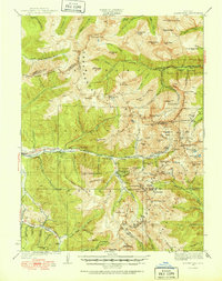
USGS Historical Topographic Map Collection · Public domain · the record · placed by its coordinates
Report this item
Hidden as soon as you tell us, everywhere it appears, before anyone reviews it.
Public domain, U.S. Geological Survey. The sheet shows the ground as the survey found it then, which is why a trail or road you know may be missing. Every sheet over this point, 1924 to 1983: USGS topoView.
Routes
- 1 Top Soil 5.10a
- 2 Side Plate 5.10a
- 3 Napoleon’s Syndrome (submitted as Five Nine) 5.8+
- 4 Susie Seka's Short, Yet So Seductive, Little, Flakey Arete 5.8
- 5 Not Lichen This 5.9+
- 6 Lichen This 5.9
- 7 Not So Hostile Krainzover 5.8+
- 8 Hostile Krainzover 5.10a
- 9 Feet Do Not Fail Me Now 5.8
- 10 The Spine 5.11a
- 11 Road Rash (submitted as Flakin' Out) 5.10b
- 12 Dirty Love 5.8
- 13 They Call Me Shorty 5.7
- 14 Little Squirt 5.6
- 15 Little Haus 5.10c
- 16 Throwin' The Drool Again 5.11a
- 17 Half and Half 5.9
- 18 Dink 5.11a
- 19 Macho Picasso 5.13b
- 20 Abstract Plain 5.14
- 21 Crystal Ball 5.12b
- 22 Proppa Toppa 5.13b
- 23 Burning Down the Haus 5.13d
- 24 The Ol' Ball and Chain 5.12d
- 25 Torqued Blow 5.13b
- 26 Sky Pilot 5.12c
- 27 Chainsaw 5.12+
- Dance the Magic Dance V4
Also within 3 km
- Hummingbird Boulder #3116 m · 1 route · 9,893 ft · Hummingbird Boulders
- Choss 30 aka 30 Rock aka Pimpin' Ain't Easy125 m · 2 boulder problems · 9,813 ft · Hummingbird Boulders
- Seam Boulder125 m · 5 boulder problems · 9,813 ft · Hummingbird Boulders
- Hero Boulder136 m · 4 boulder problems · 9,743 ft · Hummingbird Boulders
- Trail Boulder142 m · 4 boulder problems · 9,712 ft · Hummingbird Boulders
- Main Boulder, Hummingbird Boulders159 m · 6 routes and 4 boulder problems · 9,813 ft · Hummingbird Boulders
Straight line between the two crags' map points, each of which can be some way from its rock. For when this wall is full, or the sun has found it.
Photos from climbers
No photos here yet. If you're at the crag, yours would be the first.
Taken at the crag by climbers and published as they sent them. Each one's own location had to be within 0.5 km of this crag before we accepted it. See something that shouldn't be here? Use Report this photo under it and it's hidden at once. Anything else, write to us.
Conditions reported
Nothing reported recently.
Report what you see
Reports are dated and fade on their own: wet rock after 3 days, a bad bolt after a year. No names, no text.
Access & safety
The map point for this crag is on land managed by White River National Forest (federal). It lies inside inventoried roadless area, national forest.
Land manager from USGS PAD-US (public domain), read 2026-09-29. It is the manager of the crag's map point, which can be a long way from the wall. What you may do on the rock is the manager's to say, not ours.
Rules for all White River National Forest land
- Rules
- The forest strongly recommends dispersed campers pack out solid human waste using an approved disposable or self-contained system rather than burying it in a cathole.
- Overnight
- Camping more than 14 days in any continuous 30-day period is prohibited, counted from the first day of occupancy. Some places allow dispersed camping only at designated sites and some run a shorter 7-day limit in summer.
Read on White River National Forest's own pages, checked 2026-09-29 by John Crawford. What they require, in full, or their own climbing page. These apply to the manager's whole holding; anything specific to this crag is above.
Nearby, from OpenStreetMap
- Mapped parking
- 765 m away (map)
- Campsite
- Unnamed, 4,828 m away (map)
Distances are a straight line from this crag's map point, which can itself be hundreds of metres off; a road may be much longer. Mapped by OpenStreetMap contributors (ODbL), so a toilet missing here may simply be unmapped. Parking here is what OSM has drawn nearby, not a guidebook's directions.
Keep Deep Cut Guide free
No ads, no paywall, no account. You can chip in directly to help keep it running.