Land's End Area
95 routes · Basalt · 9,678 ft
What's here
5.0 to 5.12, mostly around 5.10.
Counted from the 95 climbs here that carry a grade. Shown only where there are at least 5 of them — below that the shape is noise.
How well located
Position on wall known 95
No route here has its own point yet. The map pin is the crag. At the wall? Survey it: 30 seconds per route.
The order of the climbs along this wall is known from the open catalogue, so a few surveys go a long way: standing at Bioturbation, Jungle Gym, Ft Mac Gravy Train, Night Watchman (4 climbs, about 120 seconds on Paleosol Wall) would place up to 26 more climbs between them. Survey the wall →
“Up to” because the estimate between two surveyed routes is only used when they turn out to be close enough together on the ground.
Rock, from the geologic map
Basalt — extrusive; mafic; basalt flows. Cenozoic, about 66 to 2.6 million years old.
Scoriaceous and vesicular lava capping Grand Mesa and Mount Callahan.
This is the map unit under this crag's map point, read from the 1:100,000 sheet (Day and others, 1999, U.S. Geological Survey Open-File Report 99-0427). The point can be a few hundred metres from the rock, a cliff often stands on the line between two units, and at that scale a line on the map is about 100 m wide on the ground, so the wall itself may be the neighbouring unit. Every crag on this unit: Basalt. Geology data: Macrostrat (CC BY 4.0), serving USGS and Colorado Geological Survey maps.
On the map since 1956
The USGS has mapped this ground since 1956. 14 historical sheets cover this crag's map point; the oldest is below.
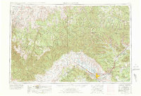
USGS Historical Topographic Map Collection · Public domain · the record · placed by its coordinates
Report this item
Hidden as soon as you tell us, everywhere it appears, before anyone reviews it.
Public domain, U.S. Geological Survey. The sheet shows the ground as the survey found it then, which is why a trail or road you know may be missing. Every sheet over this point, 1956 to 1981: USGS topoView.
In print since 1877
1877 Geologic Map of Colorado (Hayden), high-resolution scan · F. V. Hayden; scan by the Colorado Geological Survey · 1877
Geological and geographical atlas of Colorado and portions of adjacent territory · F. V. Hayden, U.S. Geological and Geographical Survey of the Territories · 1877
Free to read: public domain or government work. About Grand Junction Area as a whole, not this wall. More in the reading room.
Routes
Beyond Civilization Wall
- 1 New Minds 5.11-
- 2 Another Story 5.11
- 3 3rd Dimension 5.8
- 4 New Vision 5.10+
- 5 Web of Life 5.9-
- 6 Tribal Wisdom 5.10
- 7 Rapa Nui 5.8
- 8 Tracks 5.9
- 9 Sign of Abundance 5.8+
Dr. C’s Classroom
- 1 The Edge of Magic 5.10-
- 2 Pride and Prejudice and Zombies 5.9
- 3 Open Your Heart 5.8
- 4 Lost In The Company of Others 5.9
- 5 All Of This Is Temporary 5.8+
- 6 A Teachable Moment 5.7+
- 7 Charlene’s Dreams 5.9
- 8 The Professor 5.10+
- 9 Mentor 5.8+
- 10 The Scottish Castle 5.8+
- 11 Science and Literacy 5.9
- 12 Dr. C 5.11
- 13 China Rabbit 5.8
Kaleidoscope Wall
- 1 Purple Haze 5.10-
- 2 Dragons in the Desert 5.11-
- 3 Fantasia 5.11
- 4 Black Canary 5.10
- 5 Candy Striper 5.10
- 6 Flying Purple People Eater 5.11-
- 7 The Glass Menagerie 5.11-
- 8 Murder Train 5.11-
- 9 No Escape 5.10+
- 10 Dope On a Rope 5.10+
- 11 The Pika Strikes Back 5.9
- 12 Blue Lightning 5.10
- 13 The Mess 5.8+
- 14 Down the Rabbit Hole 5.10
- 15 Lucy in the Sky With Diamonds 5.10+
- 16 Shattered Reality 5.9
- 17 Queen of Hearts 5.10-
- 18 House of Cards 5.10
- 19 Cheshire Cat 5.10
- 20 Hank's Death Star 5.8
Kannah Creek Wall
- 1 Pigs We Get 5.8
- 2 What Pigs Deserve 5.9
- 3 Halos 5.10+
- 4 [Redacted] 5.11
- 5 Trail of Honey 5.11b
- 6 Fountain of Decay 5.10-
- 7 Descend From Grace 5.9
Land's End Wall
- 1 Totally Metal 5.12
- 2 Unknown TR 5.10 5.10
- 3 Cocaine!! 5.10
- 4 Dr. Rockzo 5.9
- 5 Death Metal Camel 5.11
- 6 So Brutal 5.10-
- 7 Dethklok 5.10-
Misspent Youth Wall
- 1 Zod the Immortal 5.10-
- 2 Binge 5.11a
- 3 Purge 5.10+
- 4 Rollercoaster of Love 5.11-
- 5 Soul Reaver 5.12-
- 6 Somewhat Damaged 5.11-
- 7 Poo Shoes 5.8
- 8 The Magnificent Nardo Polo 5.9
- 9 Teenage Angst 5.9
Paleosol Wall
- 1 Bioturbation 5.11-
- 2 Topographic Reversal 5.10
- 3 Paleosol 5.11
- 4 Roof Pendant 5.12
- 5 Open Project 5.0
- 6 Paleoflow 5.9-
- 7 German on 2nd 5.8+
- 8 Brown Chicken Brown Cow 5.8+
- 9 Hooose 5.7
- 10 Day Old Mackerel 5.10a/b
- 11 Xenolith 5.10+
- 12 Flat Rock Flight 5.9
- 13 Jungle Gym 5.10a/b
- 14 Mafic 5.10+
- 15 Ultramafic 5.11a
- 16 My Favorite Human 5.11a
- 17 Paleomagnetism 5.11
- 18 Punctuated Equilibrium 5.10b/c
- 19 Technicon Man 5.10d
- 20 Pull the Trigger 5.8+
- 21 Aggressive Posturing 5.9-
- 22 Diagenesis 5.8
- 23 Mass Wasting 5.10a
- 24 KYBHT! 5.10b
- 25 Ft Mac Gravy Train 5.10a
- 26 Get Crazy With the Cheese Wiz 5.9
- 27 Babies Have Rabies 5.8+
- 28 Vesicle Joyride 5.10b
- 29 Mass Extinction 5.10a
- 30 Night Watchman 5.10b
Photos from climbers
No photos here yet. If you're at the crag, yours would be the first.
Taken at the crag by climbers and published as they sent them. Each one's own location had to be within 0.5 km of this crag before we accepted it. See something that shouldn't be here? Use Report this photo under it and it's hidden at once. Anything else, write to us.
Conditions reported
Nothing reported recently.
Report what you see
Reports are dated and fade on their own: wet rock after 3 days, a bad bolt after a year. No names, no text.
Access & safety
The map point for this crag is on land managed by Grand Mesa National Forest (federal). It lies inside national forest.
Land manager from USGS PAD-US (public domain), read 2026-09-29. It is the manager of the crag's map point, which can be a long way from the wall. What you may do on the rock is the manager's to say, not ours.
Nobody has yet read Grand Mesa National Forest's own rules for this crag and written them down here, so treat the above as where you are, not as what you may do.
Nearby, from OpenStreetMap
- Toilets
- 441 m away (map)
- Mapped parking
- 438 m away (map)
Distances are a straight line from this crag's map point, which can itself be hundreds of metres off; a road may be much longer. Mapped by OpenStreetMap contributors (ODbL), so a toilet missing here may simply be unmapped. Parking here is what OSM has drawn nearby, not a guidebook's directions.
Keep Deep Cut Guide free
No ads, no paywall, no account. You can chip in directly to help keep it running.