Flatirons Central
204 routes and 66 boulder problems · sandstone (Fountain Formation) · 6,347 ft
What's here
5.0 to 5.13, mostly around 5.11.
V0 to V13, mostly around V3.
Counted from the 261 climbs here that carry a grade. Shown only where there are at least 5 of them — below that the shape is noise.
How well located
Base placed (one source) 3 Position on wall known 159 Crag only 108
The order of the climbs along this wall is known from the open catalogue, so a few surveys go a long way: standing at Egg Roll Traverse, V9"ish" Arete, Hydrahedral (3 climbs, about 90 seconds on Bear Canyon Bouldering) would place up to 15 more climbs between them. Survey the wall →
“Up to” because the estimate between two surveyed routes is only used when they turn out to be close enough together on the ground.
The guidebook for this area
Climbing Boulder's Flatirons - Jason Haas - 2nd ed. every crag it covers
The book has the topos, the descriptions and the local knowledge this page can't. Buying it helps support the people who know the crag best.
Rock, from the geologic map
Fountain Formation. Paleozoic, about 320 to 295 million years old.
Reddish-brown arkosic conglomerate and pebbly sandstone containing thin layers of dark reddish-brown shales. Forms red spines and monuments at Red Rocks and Roxborough Parks and flatirons west and southwest of Boulder. Thickness 512 to 610 m.
This is the map unit under this crag's map point, read from the 1:100,000 sheet (Trimble and others, 2003, U.S. Geological Survey Geologic Investigations Series I-856-H). The point can be a few hundred metres from the rock, a cliff often stands on the line between two units, and at that scale a line on the map is about 100 m wide on the ground, so the wall itself may be the neighbouring unit. The rock named at the top of this page comes from the public geology of this area; this card is the map's answer. Every crag on this unit: Fountain Formation. Geology data: Macrostrat (CC BY 4.0), serving USGS and Colorado Geological Survey maps.
On the map since 1899
The USGS has mapped this ground since 1899. 31 historical sheets cover this crag's map point; the oldest is below.
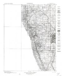
USGS Historical Topographic Map Collection · Public domain · the record · placed by its coordinates
Report this item
Hidden as soon as you tell us, everywhere it appears, before anyone reviews it.
Public domain, U.S. Geological Survey. The sheet shows the ground as the survey found it then, which is why a trail or road you know may be missing. Every sheet over this point, 1899 to 1983: USGS topoView.
In print since 1877
1877 Geologic Map of Colorado (Hayden), high-resolution scan · F. V. Hayden; scan by the Colorado Geological Survey · 1877
Geological and geographical atlas of Colorado and portions of adjacent territory · F. V. Hayden, U.S. Geological and Geographical Survey of the Territories · 1877
Trail and Timberline, volume 2 (1918) · Colorado Mountain Club · 1918
Free to read: public domain or government work. About Boulder as a whole, not this wall. More in the reading room.
From the archives
Photographs of this area held by the Library of Congress, oldest first. Every one carries the Library's own "no known restrictions on publication"; anything else is left out.


Library of Congress, Prints & Photographs Division · Public domain · the record · indexed to this place by the archive
Report this item
Hidden as soon as you tell us, everywhere it appears, before anyone reviews it.
Library of Congress, Prints & Photographs Division · Public domain · the record · indexed to this place by the archive
Report this item
Hidden as soon as you tell us, everywhere it appears, before anyone reviews it.
Library of Congress, Prints & Photographs Division · Public domain · the record · indexed to this place by the archive
Report this item
Hidden as soon as you tell us, everywhere it appears, before anyone reviews it.
Library of Congress, Prints & Photographs Division · Public domain · the record · indexed to this place by the archive
Report this item
Hidden as soon as you tell us, everywhere it appears, before anyone reviews it.
Library of Congress, Prints & Photographs Division · Public domain · the record · indexed to this place by the archive
Report this item
Hidden as soon as you tell us, everywhere it appears, before anyone reviews it.
Library of Congress, Prints & Photographs Division · Public domain · the record · indexed to this place by the archive
Report this item
Hidden as soon as you tell us, everywhere it appears, before anyone reviews it.
Library of Congress, Prints & Photographs Division · Public domain · the record · indexed to this place by the archive
Report this item
Hidden as soon as you tell us, everywhere it appears, before anyone reviews it.
Library of Congress, Prints & Photographs Division · Public domain · the record · found by place name, not yet checked
Report this item
Hidden as soon as you tell us, everywhere it appears, before anyone reviews it.
Library of Congress, Prints & Photographs Division · Public domain · the record · indexed to this place by the archive
Report this item
Hidden as soon as you tell us, everywhere it appears, before anyone reviews it.
Library of Congress, Prints & Photographs Division · Public domain · the record · indexed to this place by the archive
Report this item
Hidden as soon as you tell us, everywhere it appears, before anyone reviews it.
4 more at the Library of Congress.
Photographs near this crag
Taken within 1.5 km of this crag's map point and published under a licence that lets us show them, from Wikimedia Commons. The coordinates say where the camera was, not what it was pointed at, so some of these will be the creek or the trail rather than the rock.


Wikimedia Commons · CC BY · the record · placed by its coordinates
Report this item
Hidden as soon as you tell us, everywhere it appears, before anyone reviews it.
Wikimedia Commons · CC BY · the record · placed by its coordinates
Report this item
Hidden as soon as you tell us, everywhere it appears, before anyone reviews it.
Wikimedia Commons · CC BY-SA · the record · placed by its coordinates
Report this item
Hidden as soon as you tell us, everywhere it appears, before anyone reviews it.
Wikimedia Commons · CC BY · the record · placed by its coordinates
Report this item
Hidden as soon as you tell us, everywhere it appears, before anyone reviews it.
Wikimedia Commons · CC BY-SA · the record · placed by its coordinates
Report this item
Hidden as soon as you tell us, everywhere it appears, before anyone reviews it.
Wikimedia Commons · CC BY-SA · the record · placed by its coordinates
Report this item
Hidden as soon as you tell us, everywhere it appears, before anyone reviews it.
Wikimedia Commons · CC BY · the record · placed by its coordinates
Report this item
Hidden as soon as you tell us, everywhere it appears, before anyone reviews it.
Wikimedia Commons · CC BY · the record · placed by its coordinates
Report this item
Hidden as soon as you tell us, everywhere it appears, before anyone reviews it.
Wikimedia Commons · CC BY-SA · the record · placed by its coordinates
Report this item
Hidden as soon as you tell us, everywhere it appears, before anyone reviews it.
Wikimedia Commons · CC BY-SA · the record · placed by its coordinates
Report this item
Hidden as soon as you tell us, everywhere it appears, before anyone reviews it.
Wikimedia Commons · CC BY · the record · placed by its coordinates
Report this item
Hidden as soon as you tell us, everywhere it appears, before anyone reviews it.
Wikimedia Commons · CC BY · the record · placed by its coordinates
Report this item
Hidden as soon as you tell us, everywhere it appears, before anyone reviews it.
8 more on Commons.
Routes
Bear Canyon Bouldering
- 1 Egg Roll Traverse V3
- 2 Broccoli Beef V4
- 3 Swee Sowa Pork V2-3
- 4 Amalgamation V9-
- 5 Wedgie V6
- 6 Party Trick V5
- 7 [Redacted] V8
- 8 Landing Strip V8
- 9 Brazilian V8-9
- 10 Face the Whale V2-3
- 11 Survival of the Fitness V7
- 12 Bear Trap V7
- 13 V9"ish" Arete V9
- 14 Flake Roof V3
- 15 Tears Overhang V5
- 16 Chossasaur V5
- 17 Biohazard V5
- 18 Hydrahedral V6
Box, The
- 1 Sample the Dog 5.12+
- 2 Hand Crack 5.9
- 3 Aunt Jennifer's Tigers 5.10d
- 4 Fact of a Door Frame 5.11b/c
- 5 The Boxer 5.12b
- 6 Box of Rain 5.11c
- 7 Stone Love 5.10d
- 8 Cornucopia 5.13a
- 9 More-nucopia 5.13a
- 10 Discipline 5.12b
- 11 Side Line 5.7+
- 12 South Ramp Easy 5th
Der Freischutz
- 1 Lucy and Devi Go Mousing 5.11a
- 2 Street Hassle 5.12c
- 3 Frankenstein 5.11
- 4 Bidoigt 5.10a
- 5 Reality 5.11c
- 6 Drugs 5.11b
- 7 Rock and Roll 5.10d
- 8 Fat Elvis 5.9
- 9 Porcelain God 5.8
Der Zerkle
- 1 West Face [Der Zerkle] 5.0
- 2 Bar None 5.9-
- 3 Feeling Lucky 5.10a
- 4 Der Fuhrer 5.8
- 5 What If You're Not? 5.7
- 6 Two Clucks From Saigon 5.7
- 7 Wing Ding 5.9+
- 8 Ribspuren 5.8
- 9 Absolution (submitted as Hot if You're Not aka The Brown Eye Wall) 5.11b
- 10 Final Address 5.8
- 11 Hot if You're Not aka The Brown Eye Wall (submitted as Absolution) 5.12a
- 12 April Fools 5.11c
- 13 Sunny Side Two 4th
- 14 Sunny Side One 5.5
- 15 Touch Monkey 5.11b
- 16 Knot Carrot 5.11a
- 17 East Face Left Side 5.6
- 18 East Face Right/Der Zerkle 5.7
Dino Boulders
- 1 Dino’s Dyno V12
- 2 One Punch Human V4
Dinosaur Rock
- 1 Pink Man's Burden 5.11d
- 2 Dinosaur Tracks 5.3
- 3 [Redacted] 5.4
- 4 East Face/Dinosaur Rock 5.4
- 5 East Face Right/Dinosaur Rock 5.5
- 6 Pretty in Pinkler 5.11d
- 7 The Shaft 5.12b
- 8 Patience Face 5.12a
- 9 Milk Bone 5.13a
- 10 Ultrasaurus 5.13a
- 11 Jurassic Park 5.13
- 12 West Face [Dinosaur Rock] 5.0
- 13 Dinosaur Jr. 5.10-
- 14 Tracks are for Kids 5.10b
- 15 Big Bob Cranks 5.10b
- 16 Triceratops Tracks 5.10b
Dobkin Rock
- 1 V1 Crack V1
Dwarf
- 1 Eat Cat Too 5.11b
Elevated Boulder
- 1 Edging Edgio SDS V12
- 2 Edging Edgio V8
- 3 Slapshot V13
- 4 Elevated V8
- 5 Spring Loaded V7
Finger Flatiron
- 1 East Face/Finger Flatiron 5.4
- 2 East Face Right/Finger Flatiron 5.7
- 3 Patience 5.12b
- 4 Northwest Corner 5.8+
- 5 Right Crack 5.8
- 6 Nude Figures in a Hollow Fruit 5.10b
- 7 Polydoigt 5.9+
- 8 Thicker 5.5
- 9 Monodoigt 5.11c
- 10 Thinner 5.11a
- 11 Dropline 5.10-
- 12 No "Tufa" Ones Here? 5.11c/d
- 13 South Side of the Sky 5.11+
- 14 Mere Wall 5.8
Front Porch
- 1 East Face South Side/Front Porch 5.2
- 2 East Face Center 5.0
- 3 Tiptoe Slab 5.3
- 4 Northeast Ridge 4th
Gazebo
- 1 East Face of the Gazebo 4th
Hand, The
- 1 Quest for Balance 5.11b
- 2 The Handy Warm Up 5.10-
- 3 New Saigon 5.11b/c
- 4 Cardboard Cowboy 5.11c
- 5 Father on Fire 5.10d
- 6 The Perfect Kiss (P1 of Rock Atrocity) 5.11d
- 7 Rock Atrocity 5.13+
- 8 Battle Cat 5.13a
- 9 Lackin' Slacks (aka The Full Monty) 5.11a
- 10 Power Bulge 5.12c
- 11 Back in Slacks 5.11c
- 12 Back in Yaks 5.9
- 13 East Face/Hand 5.4
Land of the Lost
- 1 DaNile V4-5
- 2 Two Dead Birds V7
- 3 Caillou on Crack V3-4
- 4 Muffin Time V2-3
- 5 Squirrely McSquirrelface V6
- 6 Yee Dino V1
- 7 Three Shots V8-9
- 8 Oro V3
- 9 Ankylosaurus V0
- 10 Brontosaurus V3
Last Flatironette
- 1 East Face 5.0
- 2 Consolation Prize 5.9+
Lost Porch
- 1 East Face Center 5.3
Low Ball Zone
- 1 Rennak's Delight V8
- 2 Mini-Victory V6
Mallory Flatironette
- 1 East Face/Mallory Flatironnette aka Shark Fin 4th
North Ridge (of Dinosaur Mountain)., The
- 1 The North Ridge 5.4
- 2 The North Buttress 5.10+
- 3 Idly I De-Ice 5.9
- 4 Blank Sheets 5.7
- 5 Audiophile 5.7+
- 6 Get Down On It 5.7
- 7 The Beat Down 5.8
Pocket Place
- 1 Pockets Away V3
- 2 Sit Crack V0
- 3 Layaway Pockets V1
Red Devil
- 1 Hell Freezes Over 5.12a
- 2 South Face 5.4
- 3 Paradise Lost 5.9-
- 4 Super-spreader 5.10b
- 5 So Easy, Even A Caveman Can Do It 5.7
- 6 Friend of the Devil 5.10+
- 7 Hell in a Bucket 5.10d
- 8 Berserker 5.6
- 9 East Face Right/Red Devil 5.6
Shark's Fin
- 1 South Side 5.6
- 2 Direct Northeast Face 5.7
- 3 North Side 5.3
South Ridge
- 1 Back to Basics 5.7
- 2 Throw Back 5.8-
- 3 Thrown Out Back 5.6
- 4 Megasaurus 5.10d
- 5 Liquid Crystal 5.11c
- 6 Just Another Pitch 5.8+
- 7 Old School 5.10
- 8 Mellow 5.7
South Summit of Green Mountain
- 1 Summit Route (Directissimma) 5.5
- 2 East Face (3rd Tower) 5.5
Trailside Boulder
- 1 The Common Front Range Flying Squirrel V4
Unicorn
- 1 South East Ridge/Unicorn 5.2
- 2 East Overhang 5.7
Elsewhere at this crag
- East Face/Back Porch 5.6
- Fi Fun 5.3
- East Face/Achean Pronouncement 5.7
- Free Shot 5.1
- Yellow Christ 5.12b
- South Ridge 5.0
- Quadratic Equation 5.6
- Primal Rib 5.5
- Hatch 5.6
- Southeast Ridge 5.0
- Rehatch 5.5
- Fumbledeedum 4th
- Thought Control 5.9+
- East Face / Der Freischutz 5.0
- East Face/Overture 5.0
- Happy Ending 5.10c
- South Ridge 5.3
- East Face/Dreadnaught 5.2
- Five Year Plan aka Space Time Inversion 5.13b
- Sneak Preview 5.11c
- South Ridge / Overture 5.2
- East Face South Side 5.6
- East Face of the West Gazebo Easy 5th
- East Face/Dum 5.2
- Hot Spit 5.11c
- East Face Right/Fum 5.6
- Flake 5.10c
- NW Corner / Square Rock 5.8
- The Fiend 5.13c
- Crack 5.11c
- Mountaineer's Route 5.4
- Coming Attractions 5.10d
- East Face/Fee 5.5
- South Ridge/Dum 5.5
- Binary Surd 5.6
- Electric Fountain Crack 5.8
- Cloud Walker 5.10c
- Dwarfs Are People Too 5.10a
- Extraterrestrial 5.6
- Girls Day Out aka Right Side 5.11a
- North Face 5.6
- South Ramps 5.5
- Super Power 5.11c/d
- Cold Sweat 5.11b
- East Face 4th
- Exploratory Surgery 5.6
- Hi Fi 5.8
- Lichen the Look of This 5.6
- North East Gully 5.4
- North Summit 5.2
- Northeast Corner 5.4
- Rescratch 5.8+
- Southern Exposure 5.7
- Third Eye 5.10b
- Third Time's a Charm 5.11c
- Yam Crack 5.9-
- Dangling Fury 5.11c
- Dark Obsession 5.9
- Lingum Direct 5.9
- Measure for Measure? 5.10b
- MoFo 5.6
- New Beginnings 5.10d
- North Face Flake 5.10a
- Northeast Arete 5.7
- Northwest Corner (Gazebo West) 5.5
- Sidewalk Stroll 5.11a
- Solid State 5.8
- Southeast Arete 5.8+
- The Dreadnaught 5.10c
- The Horn 5.13+
- Tunnel Route 5.5
- Yoni 5.6
- Android Power Pack 5.12c/d
- Black Christmas 5.13
- Candy Corn V2
- Chesticles V5
- Dihedral [Bulge Boulder] V1
- East Face/Babyhorn 4th
- Garden Party V1
- Gemini V3
- Green Streak V3
- Hanging Garden V5
- Heel or No Deal V3-
- Just Right 5.6
- Kändy Körn V6
- Left Side 5.10
- Love and Peace V3
- Merest Excrescences V5
- Murffy Slab-a-thon V2
- NE Face 5.6
- Outer Dark V7
- Pumpkin Seeds V4-
- Sage V3-4
- Shadow's Path V2+
- South Face 5.7
- Sunshine Traverse V2
- The Bristol Slab V4
- The Hernia Exam V4
- The Zoller Bulge V7+
- Tree House V1
- Warm-up V1
- Warmup Slab V0+
- West Arete 5.6
- West Face Right 5.6
- West Face [Babyhorn] 5.9
Also within 3 km
- Flatirons South1,201 m · 350 routes and 75 boulder problems · 7,408 ft
- The Sacred Cliffs1,672 m · 27 routes and 7 boulder problems · 8,094 ft
- Flatirons North1,798 m · 364 routes and 207 boulder problems · 7,158 ft
- Flatirons1,843 m · 1 route · 6,565 ft
- Sobo2,295 m · 10 routes · 8,527 ft · Eldorado Canyon State Park
- Diamond Head2,882 m · 14 routes · 7,896 ft · Eldorado Canyon State Park
Straight line between the two crags' map points, each of which can be some way from its rock. For when this wall is full, or the sun has found it.
Photos from climbers
No photos here yet. If you're at the crag, yours would be the first.
Taken at the crag by climbers and published as they sent them. Each one's own location had to be within 0.5 km of this crag before we accepted it. See something that shouldn't be here? Use Report this photo under it and it's hidden at once. Anything else, write to us.
Conditions reported
Nothing reported recently.
Report what you see
Reports are dated and fade on their own: wet rock after 3 days, a bad bolt after a year. No names, no text.
Access & safety
The map point for this crag is on land managed by City of Boulder Open Space and Mountain Parks (local government), in Us Patent - Green Mtn..
Land manager from USGS PAD-US (public domain), read 2026-09-29. It is the manager of the crag's map point, which can be a long way from the wall. What you may do on the rock is the manager's to say, not ours.
Rules for all City of Boulder Open Space and Mountain Parks land
- Fees
- Parking fees apply at certain trailheads for vehicles not registered in Boulder County.
- Permits
- Off-trail permits are required to reach some climbing areas inside Habitat Conservation Areas.
- Climbing permit
- It is illegal to place fixed protection without a permit. Replacement and new bolted routes go through the Flatirons Climbing Council application, decided by OSMP.
- Rules
- Climbing gear -- ropes, webbing, slings, quickdraws -- may not be left unattended. Grooming, tree cutting, rock gluing and chipping are prohibited. Drones are prohibited. Seasonal raptor closures run 15 December to 31 July depending on species.
- Overnight
- Camping is prohibited on Open Space and Mountain Parks, as are tents, nets and other structures. The exception is Buckingham Campground at Fourth of July Trailhead.
- Dogs
- All dogs must be leashed unless the dog and its guardian are registered in the Voice & Sight Tag Program, and off-leash dogs must display the city's V&S tag and rabies tags.
Read on City of Boulder Open Space and Mountain Parks's own pages, checked 2026-09-29 by John Crawford. What they require, in full, or their own climbing page. These apply to the manager's whole holding; anything specific to this crag is above.
Nearby, from OpenStreetMap
- Campsite
- Camp Patiya, 4,491 m away (map)
Distances are a straight line from this crag's map point, which can itself be hundreds of metres off; a road may be much longer. Mapped by OpenStreetMap contributors (ODbL), so a toilet missing here may simply be unmapped. Parking here is what OSM has drawn nearby, not a guidebook's directions.
Keep Deep Cut Guide free
No ads, no paywall, no account. You can chip in directly to help keep it running.