Mickey Mouse Wall
37 routes · Precambrian crystalline (quartzite, near Boulder Creek Granodiorite) · 7,317 ft
What's here
5.7 to 5.13, mostly around 5.11.
Counted from the 37 climbs here that carry a grade. Shown only where there are at least 5 of them — below that the shape is noise.
How well located
Position on wall known 37
No route here has its own point yet. The map pin is the crag. At the wall? Survey it: 30 seconds per route.
The order of the climbs along this wall is known from the open catalogue, so a few surveys go a long way: standing at Unnamed Dihedral, Vergin' on Perversion, Red Dihedral, Oblique Streak (4 climbs, about 120 seconds) would place up to 33 more climbs between them. Survey the wall →
“Up to” because the estimate between two surveyed routes is only used when they turn out to be close enough together on the ground.
Rock, from the geologic map
Fountain Formation. Paleozoic, about 323 to 273 million years old.
Maroon and red, arkosic, thick-bedded, coarse-grained to pebbly, cross-bedded fluvial sandstone and conglomerate containing thin layers of dark-maroon, hard (siliceous), micaceous siltstone and silty, fine-grained sandstone. Coarser beds commonly fill shallow channels. Sandstone locally bleached light tan to white. Clasts are well rounded to subrounded, as long as 25 cm, and composed mostly of Proterozoic rocks. Scott (1972) reported rare lower Paleozoic clasts in lower part of formation in Morrison 7.5-minute quadrangle. Thickness in quadrangle about 600 m; in Eldorado Springs quadrangle a measured section is 305 m thick (Wells, 1967). Mapped only in Denver Basin
This is the map unit under this crag's map point, read from the 1:100,000 sheet (Kellogg and others, 2008, USGS Geologic Investigations Series 3000). The point can be a few hundred metres from the rock, a cliff often stands on the line between two units, and at that scale a line on the map is about 100 m wide on the ground, so the wall itself may be the neighbouring unit. The rock named at the top of this page comes from the public geology of this area; this card is the map's answer. Every crag on this unit: Fountain Formation. Geology data: Macrostrat (CC BY 4.0), serving USGS and Colorado Geological Survey maps.
On the map since 1899
The USGS has mapped this ground since 1899. 31 historical sheets cover this crag's map point; the oldest is below.
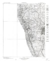
USGS Historical Topographic Map Collection · Public domain · the record · placed by its coordinates
Report this item
Hidden as soon as you tell us, everywhere it appears, before anyone reviews it.
Public domain, U.S. Geological Survey. The sheet shows the ground as the survey found it then, which is why a trail or road you know may be missing. Every sheet over this point, 1899 to 1983: USGS topoView.
In print since 1877
1877 Geologic Map of Colorado (Hayden), high-resolution scan · F. V. Hayden; scan by the Colorado Geological Survey · 1877
Geological and geographical atlas of Colorado and portions of adjacent territory · F. V. Hayden, U.S. Geological and Geographical Survey of the Territories · 1877
Trail and Timberline, volume 2 (1918) · Colorado Mountain Club · 1918
Free to read: public domain or government work. About Boulder as a whole, not this wall. More in the reading room.
From the archives
Photographs of this area held by the Library of Congress, oldest first. Every one carries the Library's own "no known restrictions on publication"; anything else is left out.


Library of Congress, Prints & Photographs Division · Public domain · the record · indexed to this place by the archive
Report this item
Hidden as soon as you tell us, everywhere it appears, before anyone reviews it.
Library of Congress, Prints & Photographs Division · Public domain · the record · indexed to this place by the archive
Report this item
Hidden as soon as you tell us, everywhere it appears, before anyone reviews it.
Library of Congress, Prints & Photographs Division · Public domain · the record · indexed to this place by the archive
Report this item
Hidden as soon as you tell us, everywhere it appears, before anyone reviews it.
Library of Congress, Prints & Photographs Division · Public domain · the record · indexed to this place by the archive
Report this item
Hidden as soon as you tell us, everywhere it appears, before anyone reviews it.
Library of Congress, Prints & Photographs Division · Public domain · the record · indexed to this place by the archive
Report this item
Hidden as soon as you tell us, everywhere it appears, before anyone reviews it.
Library of Congress, Prints & Photographs Division · Public domain · the record · indexed to this place by the archive
Report this item
Hidden as soon as you tell us, everywhere it appears, before anyone reviews it.
Library of Congress, Prints & Photographs Division · Public domain · the record · indexed to this place by the archive
Report this item
Hidden as soon as you tell us, everywhere it appears, before anyone reviews it.
Library of Congress, Prints & Photographs Division · Public domain · the record · found by place name, not yet checked
Report this item
Hidden as soon as you tell us, everywhere it appears, before anyone reviews it.
Library of Congress, Prints & Photographs Division · Public domain · the record · indexed to this place by the archive
Report this item
Hidden as soon as you tell us, everywhere it appears, before anyone reviews it.
Library of Congress, Prints & Photographs Division · Public domain · the record · indexed to this place by the archive
Report this item
Hidden as soon as you tell us, everywhere it appears, before anyone reviews it.
2 more at the Library of Congress.
Photographs near this crag
Taken within 1.5 km of this crag's map point and published under a licence that lets us show them, from Wikimedia Commons. The coordinates say where the camera was, not what it was pointed at, so some of these will be the creek or the trail rather than the rock.


Wikimedia Commons · CC BY · the record · placed by its coordinates
Report this item
Hidden as soon as you tell us, everywhere it appears, before anyone reviews it.
Wikimedia Commons · CC BY-SA · the record · placed by its coordinates
Report this item
Hidden as soon as you tell us, everywhere it appears, before anyone reviews it.
Wikimedia Commons · CC BY-SA · the record · placed by its coordinates
Report this item
Hidden as soon as you tell us, everywhere it appears, before anyone reviews it.
Wikimedia Commons · CC BY-SA · the record · placed by its coordinates
Report this item
Hidden as soon as you tell us, everywhere it appears, before anyone reviews it.
Wikimedia Commons · CC BY-SA · the record · placed by its coordinates
Report this item
Hidden as soon as you tell us, everywhere it appears, before anyone reviews it.
Wikimedia Commons · CC BY-SA · the record · placed by its coordinates
Report this item
Hidden as soon as you tell us, everywhere it appears, before anyone reviews it.
Wikimedia Commons · CC BY-SA · the record · placed by its coordinates
Report this item
Hidden as soon as you tell us, everywhere it appears, before anyone reviews it.
Routes
- 1 Unnamed Dihedral 5.9
- 2 Eagle's Bier 5.8
- 3 Lifestream 5.11a
- 4 Zen Effects 5.12b
- 5 Beagle's Ear 5.11a
- 6 Hamburger Helper 5.11-
- 7 Fake Right, Go Left 5.10b/c
- 8 Don't Panic, It's Organic 5.10c
- 9 Parallel Journey 5.9+
- 10 Zambezi 5.12-
- 11 Vulcans Don't Lie 5.10a
- 12 Perversion 5.9
- 13 Vergin' on Perversion 5.11c
- 14 Sidewinder 5.11+
- 15 Captain Beyond 5.10+
- 16 Astral Traveller 5.12d
- 17 Dark Matter 5.8+
- 18 Culp's Fault 5.8
- 19 The Three Mousketeers 5.11c
- 20 Mighty Mouse 5.12a/b
- 21 Simian's Way 5.11a
- 22 Green Dihedral 5.7+
- 23 Boxcar Willie 5.11a
- 24 The Red Arete (aka Myra) 5.13c/d
- 25 Red Dihedral 5.12d
- 26 Stigmata 5.13a
- 27 Fluffy Bunny 5.11-
- 28 Krystal Klyr 5.10d
- 29 Perilous Journey 5.11b
- 30 Asahi 5.10
- 31 The Offset 5.9+
- 32 Skink's Lip 5.10
- 33 Monks in the Gym 5.11b
- 34 Shiva's Dance 5.7
- 35 Flakes 5.10a
- 36 Mausoleum 5.11+
- 37 Oblique Streak 5.9
Also within 3 km
- The Industrial Wall353 m · 16 routes · 7,108 ft
- Behemoth406 m · 2 routes · 7,558 ft
- East Ridge406 m · 6 routes · 7,558 ft
- Warm Up Rock406 m · 2 routes · 6,838 ft
- Secret Crag (aka Ridge 6)789 m · 13 routes · 7,378 ft
- Ridge 4916 m · 19 routes · 7,275 ft
Straight line between the two crags' map points, each of which can be some way from its rock. For when this wall is full, or the sun has found it.
Photos from climbers
No photos here yet. If you're at the crag, yours would be the first.
Taken at the crag by climbers and published as they sent them. Each one's own location had to be within 0.5 km of this crag before we accepted it. See something that shouldn't be here? Use Report this photo under it and it's hidden at once. Anything else, write to us.
Conditions reported
Nothing reported recently.
Report what you see
Reports are dated and fade on their own: wet rock after 3 days, a bad bolt after a year. No names, no text.
Access & safety
The map point for this crag is on land managed by City of Boulder Open Space and Mountain Parks (local government), in Eldorado Mountain (Conda Quarry).
Land manager from USGS PAD-US (public domain), read 2026-09-29. It is the manager of the crag's map point, which can be a long way from the wall. What you may do on the rock is the manager's to say, not ours.
Rules for all City of Boulder Open Space and Mountain Parks land
- Fees
- Parking fees apply at certain trailheads for vehicles not registered in Boulder County.
- Permits
- Off-trail permits are required to reach some climbing areas inside Habitat Conservation Areas.
- Climbing permit
- It is illegal to place fixed protection without a permit. Replacement and new bolted routes go through the Flatirons Climbing Council application, decided by OSMP.
- Rules
- Climbing gear -- ropes, webbing, slings, quickdraws -- may not be left unattended. Grooming, tree cutting, rock gluing and chipping are prohibited. Drones are prohibited. Seasonal raptor closures run 15 December to 31 July depending on species.
- Overnight
- Camping is prohibited on Open Space and Mountain Parks, as are tents, nets and other structures. The exception is Buckingham Campground at Fourth of July Trailhead.
- Dogs
- All dogs must be leashed unless the dog and its guardian are registered in the Voice & Sight Tag Program, and off-leash dogs must display the city's V&S tag and rabies tags.
Read on City of Boulder Open Space and Mountain Parks's own pages, checked 2026-09-29 by John Crawford. What they require, in full, or their own climbing page. These apply to the manager's whole holding; anything specific to this crag is above.
Nearby, from OpenStreetMap
- Toilets
- 1,414 m away (map)
Distances are a straight line from this crag's map point, which can itself be hundreds of metres off; a road may be much longer. Mapped by OpenStreetMap contributors (ODbL), so a toilet missing here may simply be unmapped. Parking here is what OSM has drawn nearby, not a guidebook's directions.
Keep Deep Cut Guide free
No ads, no paywall, no account. You can chip in directly to help keep it running.