Castlewood Canyon SP
359 routes and 186 boulder problems · conglomerate (Castle Rock Conglomerate) · 6,511 ft
What's here
5.3 to 5.15, mostly around 5.10.
VB to V10, with no single grade dominating.
Counted from the 544 climbs here that carry a grade. Shown only where there are at least 5 of them — below that the shape is noise.
How well located
Base placed (one source) 12 Position on wall known 464 Crag only 69
The order of the climbs along this wall is known from the open catalogue, so a few surveys go a long way: standing at Hot Tuna, Rat's Nest, Carmel Corner Layback, Banana Shake, Gorilla Milk (5 climbs, about 150 seconds on Grocery Store Walls, The) would place up to 41 more climbs between them. Survey the wall →
“Up to” because the estimate between two surveyed routes is only used when they turn out to be close enough together on the ground.
The guidebook for this area
Colorado Bouldering: Front Range - Phillip Benningfield, Matt Samet - 2020 every crag it covers
From the publisherBookshop.org
Bookshop.org links are affiliate links: if you buy through one we earn a commission, at no extra cost to you. Bookshop.org gives its profits to independent bookshops.
The book has the topos, the descriptions and the local knowledge this page can't. Buying it helps support the people who know the crag best.
Rock, from the geologic map
Upper part of Dawson Arkose (Dawson Arkose) — arkose, conglomerate, shale. Paleocene, about 66 to 57 million years old.
Arkosic sandstone, conglomerate, and shale. Includes Green Mountain Conglomerate south of Golden
This is the map unit under this crag's map point, read from the 1:500,000 sheet (Horton and others, 2017, U.S. Geological Survey Data Series 1052). The point can be a few hundred metres from the rock, a cliff often stands on the line between two units, and at that scale a line on the map is about 500 m wide on the ground, so the wall itself may be the neighbouring unit. The rock named at the top of this page comes from the public geology of this area; this card is the map's answer. Every crag on this unit: Upper part of Dawson Arkose. Geology data: Macrostrat (CC BY 4.0), serving USGS and Colorado Geological Survey maps.
On the map since 1894
The USGS has mapped this ground since 1894. 28 historical sheets cover this crag's map point; the oldest is below.
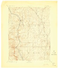
USGS Historical Topographic Map Collection · Public domain · the record · placed by its coordinates
Report this item
Hidden as soon as you tell us, everywhere it appears, before anyone reviews it.
Public domain, U.S. Geological Survey. The sheet shows the ground as the survey found it then, which is why a trail or road you know may be missing. Every sheet over this point, 1894 to 1983: USGS topoView.
Photographs near this crag
Taken within 1.5 km of this crag's map point and published under a licence that lets us show them, from Wikimedia Commons. The coordinates say where the camera was, not what it was pointed at, so some of these will be the creek or the trail rather than the rock.


Wikimedia Commons · CC BY-SA · the record · placed by its coordinates
Report this item
Hidden as soon as you tell us, everywhere it appears, before anyone reviews it.
Wikimedia Commons · CC BY-SA · the record · placed by its coordinates
Report this item
Hidden as soon as you tell us, everywhere it appears, before anyone reviews it.
Routes
Allied Wall
- 1 Cumulative Distribution Fracture 5.10a
- 2 Johnson's Crack 5.3
- 3 Coalition 5.10a
- 4 Left Crack 5.11a
- 5 Right Crack 5.10
Anvil Tower
- 1 Unknown (5.9+) 5.9+
- 2 Unknown (5.10b) 5.10b
- 3 Unknown (5.9-) 5.9-
Balancing Boulder
- 1 Holey Ground V1-
Bat's Crazy! Boulder
- 1 Be Safe Mr. Sloth V2+
Berthoud Cave area
- 1 Giving Berthoud Extension V8+
- 2 Giving Berthoud V8
- 3 Berthoud Canal V5
- 4 Berthoud Canal Low V9
- 5 Unknown (hard) V10+
Big Blue Boulder
- 1 Slink to the Left V0+
- 2 Swoosh, There It Is! V1-
Big, Gigantic Boulder
- 1 Graham Cracker V0
- 2 Separation Anxiety V4
- 3 Mr. Tree V1
- 4 Big, Gigantic Traverse V0-
Broken Ankle Boulder
- 1 Balls and Chains V5
- 2 Boobie Direct V6-
Buddha Cave area
- 1 Warm-up Corner V0
- 2 The Buddha V4
- 3 Ned’s Corner V5
- 4 Rounded Prow V3
- 5 Sometimes Wet V2
- 6 Phillip's Problem V5
- 7 Butt Crystal V3
Buoux Block
- 1 Name Unknown 5.12b
C-Section
- 1 Black Brow 5.11-
- 2 [Redacted] 5.10c/d
- 3 Patrick Hedgeclipper 5.11c
- 4 The Sky is Falling 5.7
- 5 Sweaty Betty 5.8
- 6 Dystocia 5.9-
- 7 Entry Level 5.9-
- 8 Heavy Duty Judy 5.10c
- 9 Radiation Fear 5.11a
- 10 First Dibs 5.10b
- 11 Wishbone Crack 5.10d
- 12 Korbomite Maneuver 5.12a
- 13 Pebble Beach 5.11d
- 14 Peckerwood 5.10d
COVID-19 Boulder
- 1 Social Distancing V1
- 2 Viral V0+
Cat's Den, The
- 1 Exit Stage Right V1-
- 2 5.7 Corner V0
- 3 Tiger Claw V5
- 4 Kitty Fingers V3+
- 5 Tiger Toss V3-4
Cave Wall
- 1 Snowdens Intro 5.8+
- 2 Chimney 5.6
- 3 The Good Bad and Dirty 5.10d
Checkerboard Boulder
- 1 Checkerboard Square V4
- 2 Hollywood Squares V8
- 3 Patina Arete V5
Coat of Arms Corner and The Rat Cracks
- 1 Crack Up 5.7
- 2 Danger Mouse 5.9+
- 3 Crack Sweat 5.9
- 4 Getting Rid of Your Rats 5.9
- 5 Rabbid Rat Crack 5.9
Corporate View Block
- 1 Joes' So Low 5.5
- 2 Mammon's Mantra V0
Corporate Walls, The
- 1 Explosion at the Ballbearing Factory 5.11a/b
- 2 O.S.H.A. Inspection 5.11b
- 3 Unincorporated Comglomerate 5.11+
Corridor Wall
- 1 Dyno V1
Denver Nuggets Arena
- 1 Pistol Pete V2-3
- 2 Spud Web V3
Distance Boulder
- 1 Distance Southwest Arete V0
Dungeon, The
- 1 Diagadoigt 5.10a
- 2 Helm Hammerhand 5.9+
- 3 High Boltage 5.10a
- 4 Poor Mr. Bat 5.10a
- 5 The Rack 5.10d
- 6 Whackbusher 5.6
- 7 Blondes' Way 5.6
- 8 Green Varlot 5.10d
- 9 Norman Rockshoes 5.9+
- 10 The Iron Maiden 5.10a
- 11 The 5.11d
- 12 Argenine Dary Party 5.12a
- 13 Heather the Leather Nun 5.10+
- 14 Wild America 5.12c
- 15 Wild Kingdom 5.12d
- 16 Call of the Wild 5.11c
- 17 Where The Wild Things Are 5.11d
- 18 Lichen the Old County 5.10d
- 19 Stocking Stuffer 5.9+
Easter Egg, The
- 1 The Hunt V5+
- 2 Cracked V3
- 3 Dipped V1
Falls Trail Boulders
- 1 At Least There’s a Landing V0+
- 2 Wish There Was a Landing V1-
- 3 Moray Eel V0-1
- 4 Oof V1-2
Falls Wall
- 1 Swinging Sirloin 5.11c
- 2 Out of Arms Reach 5.10b
- 3 Arborist Arms 5.11a
- 4 Invaders from the North 5.11b
- 5 Bitch 5.10
- 6 Steam Rock Fever 5.8
- 7 Unknown 5.8
- 8 Unknown TR 5.10b
- 9 The Fat Raisen Sings 5.11b
- 10 Not Long For This World 5.10c
- 11 Internal Affairs 5.11b
- 12 It's Flakey 5.7
- 13 Chimney Sweep 5.5
- 14 Raison d'Être 5.10d
- 15 Rim Job 5.12d
- 16 Bones 5.13c
- 17 Lactic Tactics 5.10d
- 18 Club Cafe 5.10+
- 19 The Headless Corpse of Roger Henry Floth 5.11d
- 20 High Road to Antwerp 5.10d
- 21 Wall of Gore 5.11a
Five and Dime Boulders
- 1 Day Old Roller Dog V4
- 2 Slurpee V2
Five and Dime Wall
- 1 Why Ask Why? 5.11a/b
- 2 Skin Flint 5.10c/d
- 3 Quarantine Corner 5.8
- 4 Corona Crack 5.8+
Fountain Lip Boulder
- 1 Cave Direct V6+
- 2 Unknown- Slab Route V0
- 3 Rocket Ship V1+
Fountainebleau Boulder
- 1 Traverse V4
- 2 Exit Stage Left (submitted as East Face, Left Side) V2
- 3 Exit Stage Right V2+
- 4 Up Staged V2
- 5 Center Stage V2
- 6 Back Stage V0
- 7 Wounded Knee V0+
Gargoyle Wall, The
- 1 Missing Lynx 5.10+
- 2 Sweet Cheater 5.12a/b
- 3 Carnival 5.12c
- 4 Just Another Sucking Chest Wound 5.12a/b
- 5 Kibbles and Bits 5.9
- 6 Purina Dog Chow 5.11d
- 7 Earthbound Misfit 5.11a/b
- 8 Stoneground Corngrit 5.10
- 9 Ranger Chicks 5.10a
- 10 Fun Run & Other Oxymorons 5.11a
Gathering (Snowstorm Boulder), The
- 1 Creekside Crimps V3
- 2 Lady Luck V0
- 3 Isotropical V4
Grocery Store Wall Bouldering
- 1 Suckerpunch V2
- 2 Raise Your Rifles V1
- 3 Cobbler's Delight V3-4
- 4 Pocket Full Of Hate V6
- 5 Bulge Direct V6
- 6 Bulge Standard V4
- 7 Gorilla Milk Direct 5.9
Grocery Store Walls, The
- 1 Hot Tuna 5.11a
- 2 Hamburger Helper 5.10
- 3 Hamburger 5.10
- 4 Cactus Flower 5.10
- 5 Shake and Bake 5.11
- 6 Pushing Buttons 5.10d
- 7 Petrified Turd 5.8
- 8 Hot Fudge 5.8+
- 9 Donut Hole 5.11a
- 10 Hot Fudge (variation) 5.10b
- 11 Peaches and Scream 5.6
- 12 Zucchini 5.4
- 13 Rat's Nest 5.8+
- 14 Tortilla Flats 5.9+
- 15 Pretzel Logic 5.11b
- 16 You Name It 5.12a
- 17 Licorice Stick 5.9
- 18 Gatoraide 5.12+
- 19 Bozo No No 5.11a
- 20 Rain Dance Crack 5.10a/b
- 21 Rain Dance 5.9+
- 22 Frosted Flake 5.10a
- 23 Caramel Corner 5.5
- 24 Carmel Popcorn 5.7+
- 25 Carmel Corner Layback 5.5
- 26 Blood Pudding 5.9+
- 27 The Cornucopia 5.15d
- 28 Penny Horse Ride 5.9
- 29 Meat Market 5.10b
- 30 Bubbo Goes Solo 5.8
- 31 Bubbo's Crack 5.8+
- 32 5.10 5.10+
- 33 The Scoop 5.11a
- 34 Teething Biscuit 5.10a
- 35 Banana Chimney 5.4
- 36 Banana Peel 5.9+
- 37 Banana Shake 5.9
- 38 Banana Flip 5.6
- 39 Short Ribs (submitted as Fruit Bat) 5.7
- 40 Rainbow Bread 5.9+
- 41 Pecan Pie 5.8
- 42 Pie In The Sky 5.10c/d
- 43 Franktown Brewery 5.6
- 44 Strawberry Jam 5.5
- 45 Gorilla Milk Direct 5.9
- 46 Gorilla Milk 5.7+
Grotto, The
- 1 Dirty Dirt Diggler 5.10
- 2 Summon an Elemental 5.10c
- 3 Billiam 5.7
- 4 Grotto Chimney 5.5
- 5 Grotto Wall 5.11b/c
- 6 Bumbles Bounce 5.11c
- 7 Race the Storm 5.4
Gully Boulder
- 1 Pink Cigarette V6
- 2 Stripsearch V4
- 3 Phlegmatics V4
- 4 Techno Allah V3
- 5 Disco Volante V6
Hobble Cobble Boulder
- 1 Hobble Cobble Direct V6
- 2 Hobble Cobble V7
Honeycomb Spire
- 1 Serpentine Crack 5.6
- 2 Choss Me The Moss 5.7+
- 3 Hippopromis 5.10a
- 4 Rhinocerock 5.10c
- 5 Rosebud 5.12a
- 6 Brain Drain 5.9
- 7 Unreliable Skinhead 5.10a
- 8 Honey Crack 5.6
- 9 Holy Lamb 5.10a
- 10 Collage 5.11
- 11 Deathwidth 5.9-
- 12 Mosaic 5.10a
Juggernaut Area, The
- 1 Pipe Dreams 5.11a
- 2 Pebbles and Bam Bam 5.9+
- 3 Exit the Womb 5.11b
- 4 Seem to Seam 5.12a
- 5 Bat Face 5.10a
- 6 Super Conductor 5.11a
- 7 Slab Happy 5.10a
Little Brown Jug Wall
- 1 Little Brown Jug Haul V0
- 2 Little Brown Jug Wall V1
Mama Jama Boulder
- 1 Foxy, Classy, Sexy, Sassy V3
- 2 Birthday Flake V4
- 3 Monopolize V3
Morning Sun Wall
- 1 Beast Master 5.11+
- 2 Five Seven Crack 5.7
- 3 Diagonal Crack 5.6
- 4 Magician's Apprentice 5.10d
- 5 Lowly Morning V0
- 6 Marijuana 5.10+
- 7 Renaissance 5.11a
- 8 Pointillist 5.10d
- 9 The Millard Filmore Memorial 5.10b
- 10 Mystical Potato Head Groove Thing 5.12a
- 11 Rising Sun 5.10d
- 12 Albatross 5.9+
- 13 Morning Glory 5.10d
- 14 Gun Control 5.11a
- 15 The Howitzer 5.9
Morning Wood Boulder
- 1 Gumby Pocket V1
Neanderthal Wall
- 1 The Mosh 5.8
- 2 Outer Mongolia 5.10
- 3 Hanson's Folly 5.7
- 4 Oh Face 5.8
- 5 The Story So Far 5.7
- 6 Primal Jam 5.11c
- 7 The Way Out 5.7+
- 8 The Rotunda 5.10
- 9 Pebble Pinching Pagoda 5.10b/c
- 10 Cheater Five 5.11a
- 11 Fat Fingered And Overhung 5.9+
- 12 Jackalopes and Preachers 5.7
- 13 Ada Jam 5.5
- 14 Are You Experienced? 5.6
- 15 Hackfleisch 5.9
- 16 Madness of Folly 5.12a
- 17 Pack the Walls 5.7
- 18 The Fingers Have It 5.7
- 19 Candyland 5.10a
- 20 Stratego 5.12a
- 21 Chicken Wing Crack 5.9
- 22 The Squeeze 5.11a
- 23 Cro-Mag Crack 5.10d
- 24 Wall of Webs 5.10b
- 25 Up the Red 5.10d
- 26 Bad Ass Pi Man 5.6
Nine Lives Boulder
- 1 Double Dick Dyno V6
- 2 Nine Lives Arete V4
No Approach Boulder
- 1 2-pock V0
- 2 Splits V1
- 3 No Approach Boulder Problem V3-4
Pebble Beach Boulder
- 1 Zipper V-easy
Plate Rock aka South Sentry Boulder
- 1 Plate Highball V2
- 2 South Face Left V4
Playground, The
- 1 Fine, Feral Friends 5.11a
- 2 Black Slide 5.11a/b
- 3 Playing Hookie 5.10c
- 4 Problem Child 5.10
- 5 Darys' Crack 5.8
- 6 Emerald Epitaph 5.10b
- 7 Pulling the Flake 5.10a
- 8 High Flyer 5.9+
- 9 Tag aka Push Start 5.11a
- 10 Crack the Whip 5.12a
- 11 Chinook 5.10b/c
- 12 Crack of the Past 5.10a
- 13 Professor Plum With The Candlestick In The Conservatory 5.12
- 14 Silmarillion 5.11b
- 15 No Wimp Situation 5.11-
Porky's Wall
- 1 Alien Tuna 5.10a
- 2 Hand Pain Jam 5.9
Project X Wall
- 1 Skunk Budtress 5.10a
- 2 Lothar 5.9+
- 3 Anticlimacticrack 5.10
- 4 Rest in Pieces 5.10b
- 5 Nuclear Blue 5.11a
- 6 Project X 5.12b
- 7 Radiation Control Area 5.12
- 8 Stemasaurus 5.12a/b
Punani Boulder
- 1 Punani V7
- 2 Gerbil in a Chute V3-4
- 3 The Mangler V5
- 4 Craterface V6
- 5 Mole Monkey Work V6-
- 6 Troll V6
Punani Slab
- 1 Unknown Slab V5
Realm of the Venusian Love Goddess
- 1 The Grip of an Android 5.9
- 2 Realm of the Venusian Love Goddess 5.11a
- 3 Oof Roof 5.10d
- 4 Scills 5.7
- 5 March of the Druids 5.9
- 6 Crake Flack 5.7
- 7 Magic Mountain 5.8
- 8 The Impossible Crack 5.7
- 9 Fifteen Feet O' Slack 5.7
- 10 Spank the Other Cheek 5.11a
- 11 the n00bs Goiter 5.9+
- 12 Deviated Septum 5.10d
- 13 Goiter Boi 5.9+
- 14 Another Pointless Excursion of Mediocrity 5.11
River Bottom Boulder
- 1 River Bottom Traverse V1-
River's Edge
- 1 Thistles & Bumble Bees V0+
Salamander Boulder
- 1 Herpetology V4-5
- 2 Reptilia V6
- 3 Textured Arete V1
- 4 Textured Arete SDS V6
Scary Monsters
- 1 Right V3
- 2 Scary Monsters V5
Sea World a.k.a. Hanson's Wall
- 1 Tradewinds 5.11a/b
- 2 Horse Latitudes 5.11b/c
- 3 Doldrums 5.12b
- 4 It's a Nor'easter Outa Thar Sou'west 5.12a
- 5 Sea Breeze 5.11c
- 6 Subterfuge 5.11d
- 7 Catch as Catch Can 5.11b
Shakespearean Theatre & Revolution Buttress, The
- 1 Much Ado About Bolting 5.11d
- 2 King Fear 5.12a
- 3 The Taming of The Shoe 5.12a
- 4 Shakespur 5.11a
- 5 The Two Hangdogs of Verona 5.11d
- 6 Lives of Quiet Desperation 5.8
- 7 Butterfly McQueens' Birthday 5.9+
- 8 Jamuary 5.9+
- 9 The Revolution 5.10d
- 10 In a Pickle 5.11b
- 11 Mind Meld 5.11a/b
- 12 It's Greek to Me 5.10a
Sherwood Forest
- 1 Hand Over Fist 5.10
- 2 I Love You 5.10a
- 3 The Fully Clothed Edge 5.10a
- 4 Stabs of Joy 5.11a
- 5 Hot Jambalaya V1
Slab, The
- 1 Dihedarête V2
- 2 Lichen Dark V2
- 3 Pascal's Wager V3
- 4 Birds Have Nests V3
South Boulder
- 1 Cheap Grace V1
- 2 Middle V3
South Canyon Point
- 1 Equinox 5.10
- 2 Spring and Fall 5.10
- 3 Autumnal Wall 5.10-
- 4 Conspicuous Consumption 5.8
- 5 Thickly Settled 5.8
- 6 The Ladder 5.6
- 7 Coroner's Crack 5.10a
- 8 Swamped 5.7+
- 9 Jerry's Kids 5.11a
- 10 April Fool 5.9
- 11 Ian 5.9
- 12 Cooking with Crash 5.8
- 13 Pilgrimage to Cythera 5.11+
- 14 Dihedarete 5.8
- 15 Clive 5.8+
- 16 Temur (Tamer) Khan 5.6
- 17 Genghis Khan 5.11a/b
- 18 Kublai Khan 5.10d
- 19 Wrath of Khan 5.9
- 20 Johler Coaster 5.9+
- 21 Elf Jism Dihedral 5.11a
- 22 ReTaliation 5.9
Standalone Boulder
- 1 Tipless V1-2
- 2 I Stand Alone V3
- 3 Sangre De Los Manos V2
Terminal Area, The
- 1 Kiosk of Dharma 5.9
- 2 Hormonal Imbalance 5.11b
- 3 Chimney 5.4
- 4 Taggart Transcontinental 5.8
- 5 Amtrak 5.8
Tim's Boulder aka Powerline Boulder
- 1 Tiger Woods V7
- 2 Flakes Of Wrath V3
Titanic Boulder
- 1 Ass Monkey V3
- 2 Pit Monkey V6
- 3 Kate Winslet V5
Vulture Walls
- 1 Vulture Culture 5.7+
- 2 Regulation 9 aka Left of Scandinavian Dreams 5.11b
- 3 Scandanavian Dreams 5.11b
- 4 Vulture Club 5.8-
- 5 Too Easy 5.6
- 6 The Reaper 5.10
- 7 Pay Attention 5.11a
- 8 Pay Homage 5.12a/b
- 9 Blanket of Secrecy 5.12b
- 10 Unknown Flake 5.8
- 11 Lightning Strikes 5.10a/b
- 12 That Hideous Strength 5.11a
- 13 The Four Loves 5.10b
- 14 Fahrenheit 451 5.11b
- 15 Octoroon 5.11a
- 16 Naga 5.7+
- 17 Jolokia 5.8-
Warm-Up Wall
- 1 Warm-up Wall Warm-up V0
- 2 Unknown V4 V4
Wendell Spire
- 1 The Beak 5.11c
- 2 Peter Rubble 5.10d
- 3 Song from the Wood 5.12b
- 4 The Pocket 5.12a
- 5 Seamless aka Knappweed Infestation 5.12b/c
- 6 The Black Streak 5.13b
- 7 The Sub 5.12d
- 8 The Travesty 5.12d
- 9 Nob Job 5.10d
- 10 Cheesedick Soiree 5.12a
- 11 The Ruse 5.11c
- 12 Bob's Nob 5.11d
- 13 Cobble Wobble 5.11a
- 14 Icerigger 5.10d
- 15 Noodlers' Nightmare 5.5
- 16 Triskaidekaphobia 5.12a
- 17 Bag of Tricks aka Flake 5.10a
- 18 Prarie Dog 5.10c/d
- 19 Sidewinder 5.11b
- 20 Textured Landscape 5.12b
- 21 Pit Viper 5.11
- 22 Castlewood Capers 5.11b
- 23 Unknown Chimney 5.4
- 24 Svengali 5.11a
- 25 Phalloid Void 5.10c
- 26 Sun Cave Direct 5.11d
- 27 Sun Cave Right 5.12a
- 28 Nose Job 5.11+
- 29 Horizontal Bop 5.11d
World's Slopiest Boulder, The
- 1 NW Corner V1-
- 2 South Face V4-
Zoids, The
- 1 Sedated Racoon 5.10a
- 2 Petting Zoo 5.10a
- 3 Fall is in the Air 5.8
- 4 Fat Finger Frenzy 5.11b
- 5 Peeled and Deveined 5.12b
- 6 New Shoes 5.11b
- 7 Young Wretches 5.10a
- 8 Face Full o' Bush 5.8
- 9 Lick Crack 5.8
- 10 Poloroid 5.10a
- 11 Bonzoid Corner 5.8
- 12 Caucasoid Corner 5.9
- 13 Caucasoid Wall 5.12a
- 14 Caucasoid Crack 5.10c
- 15 Warren Piece 5.11
- 16 Antithesis 5.11d
Elsewhere at this crag
- Gun Control 5.11a
- BC Winger 5.8
- The Slot 5.11d
- A River Runs Through It V4-5
- Avalanche V6
- Between the Tears V4
- Bloody Fingers R Us V2
- Break the Chains V6
- Corporate Chimney 5.4
- Crudely Painted Arete V8+
- Crudely Painted Not So Funny Folk Art V8+
- Deeds of Darkness V0
- Diamond Back In The Rough V0
- Dingus V2
- Distance Overhang V3-4
- Distance Overhang Sit Start V6-7
- Dr. Love's Rock V3
- Dry Ice V3
- Dry Spell V9-10
- Eo's Song V7
- Flu Shot V4
- Fountain Lip Traverse V3+
- From Concentrate V9
- Gold Digger V2
- Hoagie in Heaven aka The Crystal Cling V8-9
- Intense Incense V4
- J-smooth V-easy
- Just Enough V1+
- Kintsugi V2
- Large V1
- Left Route V3
- Levitate V3
- Little Devil 5.15d
- Mig 28 V3
- Minor in Possession V4
- Monkey Shots V7
- Mono-opoly V4
- Nappy Rooted V1-2
- North Sentry Crack V2-3
- Northeast Arete V0
- Overhang Right V0+
- Pax V0
- Pee Piddle Lee on the Dee Diddle Lee V2
- Phallic Rock V1-2
- Pleasure By Ambush V6
- Pop Rocks V4
- Power Up V3
- Prowerful Arete V1
- Right To Left Traverse V1-2
- Skinny V1+
- Slab Master V4
- Slicko Mode V0-
- Snow Shoes V4
- South Face V1
- South Face Right V2
- Spaceman Spiff V?
- Super Chunk V9
- Super Mario V5+
- Surfer's Paradise V1
- Teepee V4
- The Ham V5-
- Treehugger V6
- Trough Arete V5
- Under The Fun V0-1
- Unknown V2+
- Unknown (5.8+) 5.8+
- Wacky Waving Inflatable Flailing Armed Tube Man V2+
- Warmup Traverse V1
- West Face V2
- West Face Crack V1
- What's This? V0-
Photos from climbers
No photos here yet. If you're at the crag, yours would be the first.
Taken at the crag by climbers and published as they sent them. Each one's own location had to be within 0.5 km of this crag before we accepted it. See something that shouldn't be here? Use Report this photo under it and it's hidden at once. Anything else, write to us.
Conditions reported
Nothing reported recently.
Report what you see
Reports are dated and fade on their own: wet rock after 3 days, a bad bolt after a year. No names, no text.
Access & safety
The map point for this crag is on land managed by Colorado Parks & Wildlife (state), in Castlewood Canyon State Park. It lies inside state park.
The boundary is close. Land managed by Douglas Land Conservancy or Colorado State Parks comes within 250 m of this point, and the point is not the rock — the wall itself may be on the other side of the line. Check which before you rely on either one's rules.
Land manager from USGS PAD-US (public domain), read 2026-09-29. It is the manager of the crag's map point, which can be a long way from the wall. What you may do on the rock is the manager's to say, not ours.
Rules for all Colorado Parks & Wildlife land
- Fees
- Every Colorado state park requires an entrance pass for motor vehicles. A daily vehicle pass is $4 to $17 depending on the park; an individual pass covers entry on foot or bike.
- Reservations
- Eldorado Canyon runs timed-entry vehicle reservations on summer weekends and holidays; see the park's own page. Other parks do not require one to enter.
- Permits
- A daily pass is valid until noon on the day after purchase. The annual Keep Colorado Wild pass is $29 and is bought with a vehicle registration.
Read on Colorado Parks & Wildlife's own pages, checked 2026-09-29 by John Crawford. What they require, in full, or their own climbing page. These apply to the manager's whole holding; anything specific to this crag is above.
Nearby, from OpenStreetMap
- Toilets
- 722 m away (map)
- Mapped parking
- 177 m away (map)
Distances are a straight line from this crag's map point, which can itself be hundreds of metres off; a road may be much longer. Mapped by OpenStreetMap contributors (ODbL), so a toilet missing here may simply be unmapped. Parking here is what OSM has drawn nearby, not a guidebook's directions.
Keep Deep Cut Guide free
No ads, no paywall, no account. You can chip in directly to help keep it running.