The Sport Park
102 routes and 1 boulder problem · granodiorite (Boulder Creek Granodiorite) · 7,922 ft
What's here
5.5 to 5.12, mostly around 5.11.
Counted from the 102 climbs here that carry a grade. Shown only where there are at least 5 of them — below that the shape is noise.
How well located
Position on wall known 102 Crag only 1
No route here has its own point yet. The map pin is the crag. At the wall? Survey it: 30 seconds per route.
The order of the climbs along this wall is known from the open catalogue, so a few surveys go a long way: standing at Hee Haw, Pump Truck, The Belfry (3 climbs, about 90 seconds on Upper Wall) would place up to 17 more climbs between them. Survey the wall →
“Up to” because the estimate between two surveyed routes is only used when they turn out to be close enough together on the ground.
The guidebook for this area
Boulder Canyon Rock Climbs - Topher Donahue - 4th ed. - 2024 every crag it covers
From the publisherBookshop.org
Bookshop.org links are affiliate links: if you buy through one we earn a commission, at no extra cost to you. Bookshop.org gives its profits to independent bookshops.
The book has the topos, the descriptions and the local knowledge this page can't. Buying it helps support the people who know the crag best.
Rock, from the geologic map
Boulder Creek granodiorite. Paleoproterozoic, about 2,500 to 1,600 million years old.
Gray, coarse-grained, equigranular to porphyritic, massive to weakly foliated biotite±hornblende±muscovite monzogranite, granodiorite, and tonalite. Forms large intrusive body (Boulder Creek batholith) west of Boulder (Gable, 1980). Typically weathers into grayish-tan rounded outcrops. Mean U-Pb zircon date from numerous analyses is 1,716±3 Ma (W.R. Premo and K.S. Kellogg, unpub. data, 2007), which supports earlier U-Pb zircon dates of 1,725 Ma (Stern and others, 1971) and 1,721±15 Ma (Premo and Fanning, 2000)
This is the map unit under this crag's map point, read from the 1:100,000 sheet (Kellogg and others, 2008, USGS Geologic Investigations Series 3000). The point can be a few hundred metres from the rock, a cliff often stands on the line between two units, and at that scale a line on the map is about 100 m wide on the ground, so the wall itself may be the neighbouring unit. The rock named at the top of this page comes from the public geology of this area; this card is the map's answer. Every crag on this unit: Boulder Creek granodiorite. Geology data: Macrostrat (CC BY 4.0), serving USGS and Colorado Geological Survey maps.
On the map since 1899
The USGS has mapped this ground since 1899. 25 historical sheets cover this crag's map point; the oldest is below.
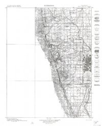
USGS Historical Topographic Map Collection · Public domain · the record · placed by its coordinates
Report this item
Hidden as soon as you tell us, everywhere it appears, before anyone reviews it.
Public domain, U.S. Geological Survey. The sheet shows the ground as the survey found it then, which is why a trail or road you know may be missing. Every sheet over this point, 1899 to 1983: USGS topoView.
In print since 1877
1877 Geologic Map of Colorado (Hayden), high-resolution scan · F. V. Hayden; scan by the Colorado Geological Survey · 1877
Geological and geographical atlas of Colorado and portions of adjacent territory · F. V. Hayden, U.S. Geological and Geographical Survey of the Territories · 1877
Trail and Timberline, volume 2 (1918) · Colorado Mountain Club · 1918
Free to read: public domain or government work. About Boulder as a whole, not this wall. More in the reading room.
From the archives
Photographs of this area held by the Library of Congress, oldest first. Every one carries the Library's own "no known restrictions on publication"; anything else is left out.


Library of Congress, Prints & Photographs Division · Public domain · the record · indexed to this place by the archive
Report this item
Hidden as soon as you tell us, everywhere it appears, before anyone reviews it.
Library of Congress, Prints & Photographs Division · Public domain · the record · indexed to this place by the archive
Report this item
Hidden as soon as you tell us, everywhere it appears, before anyone reviews it.
Library of Congress, Prints & Photographs Division · Public domain · the record · indexed to this place by the archive
Report this item
Hidden as soon as you tell us, everywhere it appears, before anyone reviews it.
Library of Congress, Prints & Photographs Division · Public domain · the record · indexed to this place by the archive
Report this item
Hidden as soon as you tell us, everywhere it appears, before anyone reviews it.
Library of Congress, Prints & Photographs Division · Public domain · the record · indexed to this place by the archive
Report this item
Hidden as soon as you tell us, everywhere it appears, before anyone reviews it.
Library of Congress, Prints & Photographs Division · Public domain · the record · indexed to this place by the archive
Report this item
Hidden as soon as you tell us, everywhere it appears, before anyone reviews it.
Library of Congress, Prints & Photographs Division · Public domain · the record · indexed to this place by the archive
Report this item
Hidden as soon as you tell us, everywhere it appears, before anyone reviews it.
Library of Congress, Prints & Photographs Division · Public domain · the record · indexed to this place by the archive
Report this item
Hidden as soon as you tell us, everywhere it appears, before anyone reviews it.
Library of Congress, Prints & Photographs Division · Public domain · the record · found by place name, not yet checked
Report this item
Hidden as soon as you tell us, everywhere it appears, before anyone reviews it.
Library of Congress, Prints & Photographs Division · Public domain · the record · indexed to this place by the archive
Report this item
Hidden as soon as you tell us, everywhere it appears, before anyone reviews it.
3 more at the Library of Congress.
Photographs near this crag
Taken within 1.5 km of this crag's map point and published under a licence that lets us show them, from Wikimedia Commons. The coordinates say where the camera was, not what it was pointed at, so some of these will be the creek or the trail rather than the rock.

Wikimedia Commons · CC BY-SA · the record · placed by its coordinates
Report this item
Hidden as soon as you tell us, everywhere it appears, before anyone reviews it.
Routes
Chicken Wall
- 1 Chicken Delight 5.10b
- 2 Rubber Chicken 5.10c
- 3 Winner Winner 5.8+
- 4 Chicken Lips 5.11b
- 5 Alfa Chick 5.11+
- 6 Chicken Hawk 5.9
- 7 Daddy Blocker 5.11a
- 8 Mommy Blocker 5.10a
- 9 Wessel in the Chicken Coop 5.9
Forbidden Fruit Crag
- 1 Percocet Arete 5.10
- 2 King Of The Highway 5.11b
- 3 High Test 5.12-
- 4 Forbidden Fruit 5.10
- 5 Knocking on Heaven's Door 5.11c
Overhung Wall
- 1 [Redacted] 5.12b
- 2 Warf Factor 5.12a
- 3 Warm Up 5.11
- 4 Invisible Touch 5.12b/c
- 5 Eternal Vigilance 5.12b
Owl Prow
- 1 Owl JuJu 5.11a
- 2 Owl On The Prowl 5.11b
- 3 Linking Logs 5.11c
- 4 Ground Zero 5.11c/d
Recovery Room
- 1 Stryker 5.10a
- 2 Jaws 5.11a/b
- 3 Blackout 5.12b
- 4 Coffee Pot Crack 5.10+
Sky Cafe, The
- 1 The Appetizer 5.10d
- 2 Dwarf's Dilemma 5.12c
- 3 Wind Song 5.11c/d
- 4 Rain Dance 5.10d
- 5 Fire And Rain 5.12b/c
- 6 Right-facing Dihedral 5.9
- 7 Room With A View 5.10b/c
- 8 One Way Ticket Into Exile 5.12b
- 9 Illegal Smile 5.12a
- 10 Bar Room Ranger Fight 5.11c
- 11 Ride the Wind 5.10d
South Face
- 1 Choss Temple Pilots 5.8
- 2 Killer Fish Taco 5.11a
- 3 The Fix 5.11a
- 4 South Crack 5.8
- 5 Chasing Sticks 5.9
- 6 Vitamin V 5.9
- 7 Wavy Gravy 5.10a
- 8 Dutch Oven 5.9
- 9 Monkey Bob 5.8
- 10 Hood Surfing In Socks 5.11c
- 11 Platinum Curl 5.11b
- 12 The Touch 5.8
- 13 Dirty Dave's Dumpster Dive 5.10a
- 14 Double Down 5.9+
- 15 Frictionary 5.7
Sport Park Slab
- 1 Walk in the Park 5.5
Stone Cafe, The
- 1 Stone Soup 5.9+
- 2 Thanks a Latte' 5.6
- 3 Rock Lobster 5.10a
- 4 Reach for the Sky... Cafe 5.10d
- 5 Yin Pin (aka Stonefish) 5.10d
- 6 Gruel Shoes 5.8
Upper Wall
- 1 Hee Haw 5.11-
- 2 Leave it to Beaver 5.11c/d
- 3 Beaver Fever 5.11d
- 4 Beaver Overload 5.12d
- 5 Mutant Overload 5.12c
- 6 Butt Luscious 5.11+
- 7 Go Dog Go 5.12b
- 8 Jolly Jug 5.12a/b
- 9 Hair Shirt 5.12
- 10 No Doze 5.12b
- 11 The Big Dipper 5.10d
- 12 Pump Dipper 5.11-
- 13 Pump Truck 5.12+
- 14 Salad Shooter 5.12d
- 15 Three Little Pigs 5.11a
- 16 Mother Goose 5.10b/c
- 17 Infa-Goose 5.10b/c
- 18 Infra-Red Riding Hood 5.10a
- 19 Ultra-Violet Parr 5.10b
- 20 The Belfry V10-11
Visor, The
- 1 Absolute Boulder Canyon 5.11-
- 2 Dyno Monkey 5.11c
- 3 Rubberneck 5.12-
- 4 Flying Rubber Monkey Canyon 5.12c
- 5 Flying Machines 5.11a
- 6 Bone Home 5.10+
- 7 Welcome Wagon 5.10
- 8 Hair of the Dog 5.10a
- 9 Geek in the Creek 5.8
West Face
- 1 Surprise, Surprise 5.8+
- 2 Northwest Passage 5.8
- 3 Wise Crack 5.8
- 4 Pocket Fisherman 5.11a/b
- 5 Curve of Binding Energy 5.12a/b
- 6 Space Goats 5.11c/d
- 7 Furious Howard Brown 5.12a/b
- 8 American Beauty 5.12b
- 9 Amber 5.11+
- 10 Mercy Drilling 5.12a
- 11 North Crack 5.8
- 12 Impeachara 5.12a/b
- 13 Shakedown Street 5.12c
- 14 The Other One 5.11a
Also within 3 km
- Across From Cenotaph aka Sea of Tranquility541 m · 3 routes · 8,191 ft
- Cenotaph Crag703 m · 13 routes · 7,974 ft
- Frisky Cliff839 m · 14 routes · 8,021 ft
- Castle Rock1,069 m · 62 routes and 21 boulder problems · 7,789 ft
- Broken Rock1,163 m · 14 routes · 7,785 ft
- The Overlook1,211 m · 16 routes and 3 boulder problems · 7,956 ft
Straight line between the two crags' map points, each of which can be some way from its rock. For when this wall is full, or the sun has found it.
Photos from climbers
No photos here yet. If you're at the crag, yours would be the first.
Taken at the crag by climbers and published as they sent them. Each one's own location had to be within 0.5 km of this crag before we accepted it. See something that shouldn't be here? Use Report this photo under it and it's hidden at once. Anything else, write to us.
Conditions reported
Nothing reported recently.
Report what you see
Reports are dated and fade on their own: wet rock after 3 days, a bad bolt after a year. No names, no text.
Access & safety
We don't know who manages this ground: PAD-US doesn't map this point as protected land, which most often means it is private. Find out whose it is before you go.
Nobody has yet read the land manager's own rules for this crag and written them down here, so treat the above as where you are, not as what you may do.
Nearby, from OpenStreetMap
- Toilets
- 1,300 m away (map)
Distances are a straight line from this crag's map point, which can itself be hundreds of metres off; a road may be much longer. Mapped by OpenStreetMap contributors (ODbL), so a toilet missing here may simply be unmapped. Parking here is what OSM has drawn nearby, not a guidebook's directions.
Keep Deep Cut Guide free
No ads, no paywall, no account. You can chip in directly to help keep it running.