*Arkansas Valley Bouldering South
33 boulder problems · granite · 7,679 ft
What's here
V0 to V10, mostly around V0.
Counted from the 33 climbs here that carry a grade. Shown only where there are at least 5 of them — below that the shape is noise.
How well located
Base placed (one source) 5 Position on wall known 23 Crag only 5
The order of the climbs along this wall is known from the open catalogue, so a few surveys go a long way: standing at The Junction, Slab Dyno Project (2 climbs, about 60 seconds on Hecla Junction North) would place up to 3 more climbs between them. Survey the wall →
“Up to” because the estimate between two surveyed routes is only used when they turn out to be close enough together on the ground.
Rock, from the geologic map
Topaz rhyolite flow of Nathrop Volcanics, including basal vitrophyre. Rupelian, about 34 to 28 million years old.
Light-gray, light pinkish-gray, and purplish-gray, strongly flow-layered alkaline rhyolite flow forming prominent outcrops, about 8 km south-southeast of Buena Vista at Ruby Mountain, Sugarloaf Mountain, and upper part of Bald Mountain (Keller and others, 2004). Layering is moderately to strongly folded. The rhyolite consists of small, sparse phenocrysts of smoky quartz, sanidine, plagioclase, and rare biotite in a dense microcrystalline groundmass; accessory minerals are apatite, zircon, magnetite, garnet, and topaz (Keller and others, 2004). Locally contains spherules as much as 10 cm in diameter, and lithophysae as much as 6 cm in diameter, particularly on Bald Mountain. Lithophysal cavities locally contain euhedral crystals of spessar- tine garnet and topaz, some of gem quality (Voynick, 1994). The basal vitrophyre is glassy, composed mostly of light-gray, brownish-gray, or black perlite with subordinate pitchstone. The perlite typically shows an “onion-skin” structure. One 40Ar/39Ar age on plagioclase on Bald Mountain is 29.25±0.12 Ma, and three 40Ar/39Ar ages on sanidine at Ruby Mountain are 30.47±0.08 29.25±0.21Ma, and 30.74±0.08 Ma (McIntosh and Chapin, 2004; ages corrected for revised standards of Kuiper and others, 2008), indicating early Oligocene age (McIntosh and Chapin, 2004). Similarity of age and composition (for example, presence of accessory topaz) with evolved Mount Antero leucogranites suite of Sawatch Range suggests genetic connection (Shannon, 1988). On Bald Mountain, the rhyolite is estimated to be about 150 m thick and was depos- ited within a paleovalley that also contains remnants of older Wall Mountain Tuff and Tallahassee Creek Conglomerate (Keller and others, 2004)
This is the map unit under this crag's map point, read from the 1:100,000 sheet (Kellogg and others, 2017, U.S. Geological Survey Scientific Investigations Map 3382). The point can be a few hundred metres from the rock, a cliff often stands on the line between two units, and at that scale a line on the map is about 100 m wide on the ground, so the wall itself may be the neighbouring unit. The rock named at the top of this page comes from the public geology of this area; this card is the map's answer. Every crag on this unit: Topaz rhyolite flow of Nathrop Volcanics, including basal vitrophyre. Geology data: Macrostrat (CC BY 4.0), serving USGS and Colorado Geological Survey maps.
On the map since 1955
The USGS has mapped this ground since 1955. 20 historical sheets cover this crag's map point; the oldest is below.
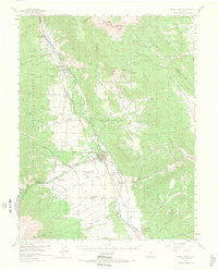
USGS Historical Topographic Map Collection · Public domain · the record · placed by its coordinates
Report this item
Hidden as soon as you tell us, everywhere it appears, before anyone reviews it.
Public domain, U.S. Geological Survey. The sheet shows the ground as the survey found it then, which is why a trail or road you know may be missing. Every sheet over this point, 1955 to 1994: USGS topoView.
From the archives
Photographs of this area held by the Library of Congress, oldest first. Every one carries the Library's own "no known restrictions on publication"; anything else is left out.


Library of Congress, Prints & Photographs Division · Public domain · the record · indexed to this place by the archive
Report this item
Hidden as soon as you tell us, everywhere it appears, before anyone reviews it.
Library of Congress, Prints & Photographs Division · Public domain · the record · indexed to this place by the archive
Report this item
Hidden as soon as you tell us, everywhere it appears, before anyone reviews it.
Library of Congress, Prints & Photographs Division · Public domain · the record · found by place name, not yet checked
Report this item
Hidden as soon as you tell us, everywhere it appears, before anyone reviews it.
Library of Congress, Prints & Photographs Division · Public domain · the record · found by place name, not yet checked
Report this item
Hidden as soon as you tell us, everywhere it appears, before anyone reviews it.
Library of Congress, Prints & Photographs Division · Public domain · the record · found by place name, not yet checked
Report this item
Hidden as soon as you tell us, everywhere it appears, before anyone reviews it.
Library of Congress, Prints & Photographs Division · Public domain · the record · found by place name, not yet checked
Report this item
Hidden as soon as you tell us, everywhere it appears, before anyone reviews it.
Library of Congress, Prints & Photographs Division · Public domain · the record · found by place name, not yet checked
Report this item
Hidden as soon as you tell us, everywhere it appears, before anyone reviews it.
Photographs near this crag
Taken within 1.5 km of this crag's map point and published under a licence that lets us show them, from Wikimedia Commons. The coordinates say where the camera was, not what it was pointed at, so some of these will be the creek or the trail rather than the rock.

Wikimedia Commons · CC BY · the record · placed by its coordinates
Report this item
Hidden as soon as you tell us, everywhere it appears, before anyone reviews it.
Routes
Aloe Vera Boulder
- 1 Bad Beta V0+
- 2 3rd Degree Burns V3-
- 3 Read a Guidebook V2-3
Buena Boulder, The
- 1 Light Sentence V3
- 2 Sunshine Superman? V1
- 3 Chained Heat V6
- 4 Light Sentence? V4
Butler Block
- 1 Servitude? V2
- 2 You Rang? V0
Hecla Junction
- 1 Rock Chalk V0-1
Hecla Junction North
- 1 The Junction V5
- 2 Step To Your Left V3
- 3 Richie's Arete V3+
- 4 Project V10+
- 5 Slab Dyno Project V8
Hecla Junction Talus
- 1 Wolf Jacket V7
- 2 Broken Lizard V7
- 3 Polished Arete V6
- 4 Warm-Up Arete V3
Maiden Block
- 1 Marrying Maiden? V2
- 2 V0 Face V0
Nathrop Cube
- 1 The Cling V0
- 2 The Verse V1
- 3 V0 V0
Raft Block
- 1 The Paddle V1
Sleeper Block
- 1 King Charles V4
Elsewhere at this crag
- Bucket Brigade V2
- Front and Center V1
- Nathrop Arete V2
- Pocketmaster V0
- Southern Sun V0
- The Blade V2+
- V0 Warm Up V0
Photos from climbers
No photos here yet. If you're at the crag, yours would be the first.
Taken at the crag by climbers and published as they sent them. Each one's own location had to be within 0.5 km of this crag before we accepted it. See something that shouldn't be here? Use Report this photo under it and it's hidden at once. Anything else, write to us.
Conditions reported
Nothing reported recently.
Report what you see
Reports are dated and fade on their own: wet rock after 3 days, a bad bolt after a year. No names, no text.
Access & safety
We don't know who manages this ground: PAD-US doesn't map this point as protected land, which most often means it is private. Find out whose it is before you go.
Nobody has yet read the land manager's own rules for this crag and written them down here, so treat the above as where you are, not as what you may do.
Nearby, from OpenStreetMap
- Toilets
- 500 m away (map)
- Mapped parking
- 609 m away (map)
- Campsite
- Ruby Mountain Campground, 591 m away (map)
Distances are a straight line from this crag's map point, which can itself be hundreds of metres off; a road may be much longer. Mapped by OpenStreetMap contributors (ODbL), so a toilet missing here may simply be unmapped. Parking here is what OSM has drawn nearby, not a guidebook's directions.
Keep Deep Cut Guide free
No ads, no paywall, no account. You can chip in directly to help keep it running.