*Arkansas Valley Bouldering North
50 boulder problems · granite · 10,048 ft
What's here
V0 to V7, mostly around V3.
Counted from the 50 climbs here that carry a grade. Shown only where there are at least 5 of them — below that the shape is noise.
How well located
Position on wall known 50
No route here has its own point yet. The map pin is the crag. At the wall? Survey it: 30 seconds per route.
The order of the climbs along this wall is known from the open catalogue, so a few surveys go a long way: standing at Austen's Left Problem, Another Chad Lowball, Awkward Right (3 climbs, about 90 seconds on Brood, The) would place up to 14 more climbs between them. Survey the wall →
“Up to” because the estimate between two surveyed routes is only used when they turn out to be close enough together on the ground.
Rock, from the geologic map
Till of Pinedale glaciation. Late Pleistocene, younger than 126,000 years.
Unit commonly forms large, very bouldery, sharp-crested lateral and end moraines that have distinct hummocky surface morphology. Deposits in some areas have well expressed knob-and-kettle topography. Some of the surface boulders of granitic and gneissic composition are as large as ≥4.5×5.5×7.0 m. Most of the biotite-rich granitic and gneissic clasts within the soil are unweathered or slightly weathered. Youngest mapped till of Pinedale glaciation within cirques or near valley heads locally may include till similar in age to that of the Satanta Peak advance of Benedict (1973b, 1985), dated at about 10–12 ka (Davis 1988). Soils formed in the top of the unit Qtp commonly have thin (≤25 cm) cambic B horizons that are poorly developed and have little or no clay accumulation. Some soils lack B horizons and have A/Cox or A/Bk profiles (Nelson and Shroba, 1998; Shroba and others, 2014). Depth of oxidation (base of Cox soil horizon) ranges from about 50 to 170 cm. Unoxidized till is gray, whereas soil B horizons commonly are light brown. Locally, as much as 15 percent of the biotite-rich pebbles and small cobbles within soils are partly or completely disintegrated (Shroba, 1977). Locally, multiple recessional moraines of Pinedale age were formed in glaciated valleys, including Cottonwood Creek and North Cottonwood Creek. 10Be cosmogenic surface-exposure dating (aver- age ages) of exposed boulders and pebbles on moraine crests on the south side of Pine Creek suggests two episodes of glacial advance: one at 22.0±1.4 ka and a later advance at 15.2±0.9 ka (Briner, 2009). Recently reported 10Be cosmogenic surface-exposure ages of exposed boulders on crests of outer and inner moraines composed of till of Pinedale age (units Qtpo and Qtpy of Shroba and others, 2014, respectively) on the southeast side of the Twin Lakes Reservoir (Schweinsberg, and others, 2016) are similar to those of a possible early advance at Pine Creek (Briner, 2009). Surface-exposure ages of boulders on the outer moraines on the southeast side of the Twin Lakes Reservoir range from 21.1±0.3 ka to 22.2±0.3 ka and average 21.6±0.3 ka. Ages of boulders on nearby inner moraines range from 21.1±0.3 ka to 22.2±0.3 ka and average 21.7±0.3 ka (Schweinsberg, and others, 2016). The surface-exposure ages reported for Pine Creek and near the Twin Lakes Reservoir are in accord with (1) radiocarbon and cosmogenic surface-exposure ages for till of Pinedale age in the Front Range region of north- central Colorado of about 31–12 ka (Nelson and others, 1979; Madole, 1986; Benson and others, 2004, 2005; Ward and others, 2007; Madole, 2010); (2) retreat of Pinedale glaciers in the Front Range and San Juan Mountains, Colorado between about 19 and 12 ka (10Be surface-exposure ages of Guido and others, 2007; Ward and others, 2007); (3) last glacial maximum in the Taylor River drainage, about 18 km west of map area, of about 21–16 ka (Brugger, 2007), and a “late advance” in the Taylor River drainage of about 14.5 ka (10Be and 36Cl cosmogenic ages of Brugger, 2007); (4) 10Be and 36Cl surface-exposure ages of 23–16 ka for deposits of Pinedale age in type area for till of Pinedale age in Wyoming (Chadwick and others, 1997); and (5) 10Be and 3He surface- exposure ages of about 18.8–13.5 ka for till of Pinedale age in the Yellowstone regions and Teton Range (Licciardi and Pierce, 2008). 10Be surface-exposure ages of glacier- abraded bedrock within the cirque at the head of Rock Creek, just south of Turquoise Lake, suggest that deglaciation of the northern Sawatch Range occurred by about 15–13 ka (Mason and others, 2011; Ruleman and others, 2013). Estimated thickness is as much as 40 m
This is the map unit under this crag's map point, read from the 1:100,000 sheet (Kellogg and others, 2017, U.S. Geological Survey Scientific Investigations Map 3382). The point can be a few hundred metres from the rock, a cliff often stands on the line between two units, and at that scale a line on the map is about 100 m wide on the ground, so the wall itself may be the neighbouring unit. The rock named at the top of this page comes from the public geology of this area; this card is the map's answer. Every crag on this unit: Till of Pinedale glaciation. Geology data: Macrostrat (CC BY 4.0), serving USGS and Colorado Geological Survey maps.
On the map since 1955
The USGS has mapped this ground since 1955. 16 historical sheets cover this crag's map point; the oldest is below.
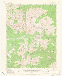
USGS Historical Topographic Map Collection · Public domain · the record · placed by its coordinates
Report this item
Hidden as soon as you tell us, everywhere it appears, before anyone reviews it.
Public domain, U.S. Geological Survey. The sheet shows the ground as the survey found it then, which is why a trail or road you know may be missing. Every sheet over this point, 1955 to 1994: USGS topoView.
From the archives
Photographs of this area held by the Library of Congress, oldest first. Every one carries the Library's own "no known restrictions on publication"; anything else is left out.


Library of Congress, Prints & Photographs Division · Public domain · the record · indexed to this place by the archive
Report this item
Hidden as soon as you tell us, everywhere it appears, before anyone reviews it.
Library of Congress, Prints & Photographs Division · Public domain · the record · indexed to this place by the archive
Report this item
Hidden as soon as you tell us, everywhere it appears, before anyone reviews it.
Library of Congress, Prints & Photographs Division · Public domain · the record · found by place name, not yet checked
Report this item
Hidden as soon as you tell us, everywhere it appears, before anyone reviews it.
Library of Congress, Prints & Photographs Division · Public domain · the record · found by place name, not yet checked
Report this item
Hidden as soon as you tell us, everywhere it appears, before anyone reviews it.
Library of Congress, Prints & Photographs Division · Public domain · the record · found by place name, not yet checked
Report this item
Hidden as soon as you tell us, everywhere it appears, before anyone reviews it.
Library of Congress, Prints & Photographs Division · Public domain · the record · found by place name, not yet checked
Report this item
Hidden as soon as you tell us, everywhere it appears, before anyone reviews it.
Library of Congress, Prints & Photographs Division · Public domain · the record · found by place name, not yet checked
Report this item
Hidden as soon as you tell us, everywhere it appears, before anyone reviews it.
Routes
Black Boulder, The
- 1 Blackheart V3+
- 2 Blackbeard V3+
- 3 Blackmail V1-2
- 4 Blackrain V3+
- 5 Blackjack V2-3
- 6 Blackbird V2-3
- 7 Blackeyed Peas V0-1
- 8 Blackberries V3
Brood, The
- 1 Austen's Left Problem V3+
- 2 Austen's Jump Start V4+
- 3 Austen's Right Arete V4
- 4 Nice Slab V3+
- 5 Fun Climb V3
- 6 Easier Fun Climb V2
- 7 Hard Bulge V4
- 8 Left of Classic V1
- 9 Center Classic V2
- 10 Classic Arete V3
- 11 Austen's Blunt Arete V5+
- 12 Chad's Lowball V3
- 13 Another Chad Lowball V2
- 14 Another Lowball V2
- 15 Awkward Left V2
- 16 Awkward Center V3+
- 17 Awkward Right V4
Fupa, The
- 1 Ninja Boots V2
- 2 Beaver Flop V2
- 3 Gunt V4+
- 4 Muffin Top V5+
- 5 Bearded Clam V3+
- 6 Snatch V2
- 7 Moose Knuckle V2+
- 8 Camel Toe V1-2
Heckendorf
- 1 The Heckendorf V7
- 2 2nd OG Problem V4+
- 3 OG Problem V4
- 4 3rd OG Problem V5+
- 5 Left Low Ball V3
- 6 Right Low Ball V3
- 7 Heel Hook Problem V5
- 8 Chris Dye's Problem V5
- 9 Small Arms Dealer V7
Tumor, The
- 1 Far Left Bulge V3
- 2 Scorpion Tail V2
- 3 Middle Slab V2
- 4 Right Slab V3
- 5 Benign Tumor V4
- 6 Ludders' Traverse V7
- 7 Malignant Tumor V4
- 8 Sarcoma V3
Photos from climbers
No photos here yet. If you're at the crag, yours would be the first.
Taken at the crag by climbers and published as they sent them. Each one's own location had to be within 0.5 km of this crag before we accepted it. See something that shouldn't be here? Use Report this photo under it and it's hidden at once. Anything else, write to us.
Conditions reported
Nothing reported recently.
Report what you see
Reports are dated and fade on their own: wet rock after 3 days, a bad bolt after a year. No names, no text.
Access & safety
The map point for this crag is on land managed by San Isabel National Forest (federal). It lies inside inventoried roadless area, national forest.
Land manager from USGS PAD-US (public domain), read 2026-09-29. It is the manager of the crag's map point, which can be a long way from the wall. What you may do on the rock is the manager's to say, not ours.
Rules for all Pike-San Isabel National Forests land
- Fees
- No entrance fee for the Pike-San Isabel National Forests or the Cimarron and Comanche National Grasslands. Fees apply at campgrounds and day-use areas operated by the forest's concessionaire, paid on site.
- Overnight
- On the Leadville, Salida and San Carlos districts of the San Isabel, camping at any location within the same 20-mile radius for more than 14 days in a continuous 30-day period is prohibited. No camping within 100 feet of water outside a developed or designated site.
Read on Pike-San Isabel National Forests's own pages, checked 2026-09-29 by John Crawford. What they require, in full, or their own climbing page. These apply to the manager's whole holding; anything specific to this crag is above.
Keep Deep Cut Guide free
No ads, no paywall, no account. You can chip in directly to help keep it running.